
| Memorials | : | 0 |
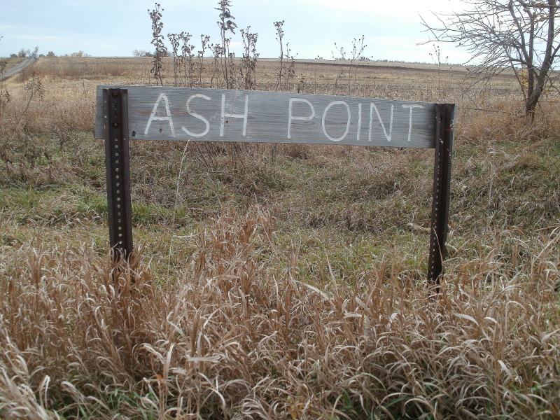
| Location | : | Baileyville, Nemaha County, USA |
| Coordinate | : | 39.8962380, -96.2051080 |
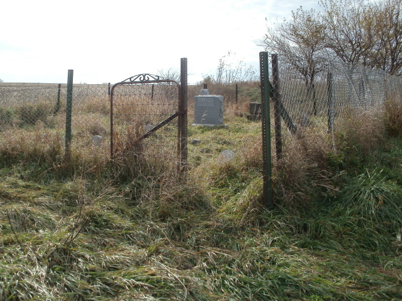
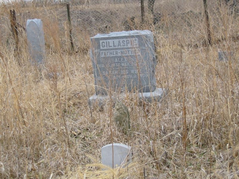
| Description | : | Ash Point seems to have been a private family cemetery, once the property left the family the new owner decided to remove the headstones from the land. On March 8, 2009 me and my family went to Nemaha County to find what we could. To our surprise someone had put the stones back to the best of there ability and put a fence around it. It just so happens that my brother John married a women from Nemaha County. She knows the guy who put back the headstones! God bless his efforts. |
frequently asked questions (FAQ):
-
Where is Ash Point Cemetery?
Ash Point Cemetery is located at Baileyville, Nemaha County ,Kansas ,USA.
-
Ash Point Cemetery cemetery's updated grave count on graveviews.com?
0 memorials
-
Where are the coordinates of the Ash Point Cemetery?
Latitude: 39.8962380
Longitude: -96.2051080
Nearby Cemetories:
1. Saint Michaels Cemetery
Axtell, Marshall County, USA
Coordinate: 39.8922005, -96.2577972
2. Rose Hill Cemetery
Axtell, Marshall County, USA
Coordinate: 39.8793983, -96.2667007
3. Sacred Heart Cemetery
Baileyville, Nemaha County, USA
Coordinate: 39.8485985, -96.1832962
4. Baileyville Cemetery
Baileyville, Nemaha County, USA
Coordinate: 39.8418900, -96.1976300
5. Brewer Cemetery
Baileyville, Nemaha County, USA
Coordinate: 39.9556900, -96.1736500
6. Shockleys Fairland Cemetery
Marshall County, USA
Coordinate: 39.9284500, -96.2866500
7. Saint Bridget Cemetery
Axtell, Marshall County, USA
Coordinate: 39.9572000, -96.2578000
8. Saint Marys Cemetery
Saint Benedict, Nemaha County, USA
Coordinate: 39.8866997, -96.0982971
9. Madden Cemetery
Axtell, Marshall County, USA
Coordinate: 39.9866800, -96.2490300
10. McCaffrey Cemetery
Nemaha County, USA
Coordinate: 39.9827100, -96.1474500
11. Mission Covenant Cemetery
Marshall County, USA
Coordinate: 39.8269005, -96.3153000
12. Seneca City Cemetery
Seneca, Nemaha County, USA
Coordinate: 39.8499603, -96.0712128
13. Saints Peter and Paul Cemetery
Seneca, Nemaha County, USA
Coordinate: 39.8488998, -96.0702972
14. Coal City Cemetery
Seneca, Nemaha County, USA
Coordinate: 39.9498500, -96.0689600
15. Scotch Valley Cemetery
Nemaha County, USA
Coordinate: 39.9578018, -96.0699997
16. Pleasant Ridge Cemetery
Du Bois, Pawnee County, USA
Coordinate: 40.0156000, -96.1494000
17. Saint Peters Evangelican Cemetery
Du Bois, Pawnee County, USA
Coordinate: 40.0010000, -96.1095000
18. Bloss Cemetery
Seneca, Nemaha County, USA
Coordinate: 39.9053900, -96.0318600
19. Johnson Creek Cemetery
Pawnee City, Pawnee County, USA
Coordinate: 40.0270000, -96.2465000
20. Dennis Cemetery
Nemaha County, USA
Coordinate: 39.8181400, -96.0585100
21. Pleasant Valley Cemetery
Pawnee County, USA
Coordinate: 40.0299988, -96.1554794
22. Salem Lutheran Cemetery
Axtell, Marshall County, USA
Coordinate: 39.7990200, -96.3352200
23. Holy Family Cemetery
Summerfield, Marshall County, USA
Coordinate: 39.9994011, -96.3414001
24. Summerfield Cemetery
Summerfield, Marshall County, USA
Coordinate: 40.0005989, -96.3422012