
| Memorials | : | 4 |
| Location | : | Seneca, Nemaha County, USA |
| Coordinate | : | 39.9498500, -96.0689600 |
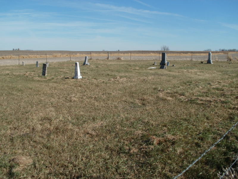
| Description | : | ORIGINALLY THIS WAS THE "METHODIST EPISCOPAL CHURCH", IN 1858 4 ACRES OF SARAH BROWN WOODS HICKS FARM WAS SOLD TO THE CHURCH FOR A LASTING PLACE FOR THE CEMETERY. THIS ABANDONED CEMETERY IS LOCATED EIGHT MILES NORTH OF SENECA, KS ON K63 AND ONE MILE WEST AND 3/4 MILE SOUTH. IT IS ABOUT 100 YARDS EAST IN A FIELD. MANY OF THE GRAVES ARE NOT MARKED, BROWN, BLUE, HESS, HICKS, CLAMPETT, JOHNSON AND KEY ARE SOME OF THEM. Find A Grave contributor Marc Trueb sent the following correction for this cemetery: Coal City Cemetery Sarah Brown was married to Andrew Anderson Woods and... Read More |
frequently asked questions (FAQ):
-
Where is Coal City Cemetery?
Coal City Cemetery is located at Seneca, Nemaha County ,Kansas ,USA.
-
Coal City Cemetery cemetery's updated grave count on graveviews.com?
4 memorials
-
Where are the coordinates of the Coal City Cemetery?
Latitude: 39.9498500
Longitude: -96.0689600
Nearby Cemetories:
1. Scotch Valley Cemetery
Nemaha County, USA
Coordinate: 39.9578018, -96.0699997
2. Friedens United Church of Christ Cemetery
Bern, Nemaha County, USA
Coordinate: 39.9929008, -96.0529480
3. German Lutheran Cemetery
Bern, Nemaha County, USA
Coordinate: 39.9794500, -96.0234300
4. Bloss Cemetery
Seneca, Nemaha County, USA
Coordinate: 39.9053900, -96.0318600
5. Saint John Lutheran Cemetery
Bern, Nemaha County, USA
Coordinate: 39.9538900, -95.9977700
6. Saint Peters Evangelican Cemetery
Du Bois, Pawnee County, USA
Coordinate: 40.0010000, -96.1095000
7. Cincinnati Cemetery
Du Bois, Pawnee County, USA
Coordinate: 40.0042000, -96.0274963
8. Saint Marys Cemetery
Saint Benedict, Nemaha County, USA
Coordinate: 39.8866997, -96.0982971
9. McCaffrey Cemetery
Nemaha County, USA
Coordinate: 39.9827100, -96.1474500
10. Bern Cemetery
Bern, Nemaha County, USA
Coordinate: 39.9637299, -95.9781494
11. DuBois Cemetery
Du Bois, Pawnee County, USA
Coordinate: 40.0231018, -96.0488968
12. Williams Cemetery
Bern, Nemaha County, USA
Coordinate: 39.9219017, -95.9741974
13. Brewer Cemetery
Baileyville, Nemaha County, USA
Coordinate: 39.9556900, -96.1736500
14. Prairie Star Pioneer Cemetery
Du Bois, Pawnee County, USA
Coordinate: 40.0293000, -96.1041000
15. Pleasant Ridge Cemetery
Du Bois, Pawnee County, USA
Coordinate: 40.0156000, -96.1494000
16. Four Mile Cemetery
Bern, Nemaha County, USA
Coordinate: 39.9857900, -95.9568900
17. Seneca City Cemetery
Seneca, Nemaha County, USA
Coordinate: 39.8499603, -96.0712128
18. Saints Peter and Paul Cemetery
Seneca, Nemaha County, USA
Coordinate: 39.8488998, -96.0702972
19. Pleasant Valley Cemetery
Pawnee County, USA
Coordinate: 40.0299988, -96.1554794
20. Evergreen Cemetery
Pawnee County, USA
Coordinate: 40.0485992, -96.1417007
21. Athens Cemetery
Richardson County, USA
Coordinate: 40.0449982, -95.9852982
22. Bern Apostolic Christian Church Cemetery
Bern, Nemaha County, USA
Coordinate: 39.9282888, -95.9203416
23. Ash Point Cemetery
Baileyville, Nemaha County, USA
Coordinate: 39.8962380, -96.2051080
24. Stoldt Cemetery
Sabetha, Nemaha County, USA
Coordinate: 39.9140500, -95.9155300