
| Memorials | : | 4 |
| Location | : | Manukau, Auckland Council, New Zealand |
| Coordinate | : | -36.9756920, 175.2599670 |
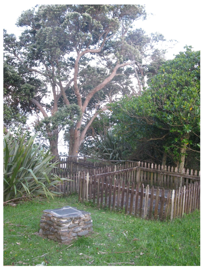
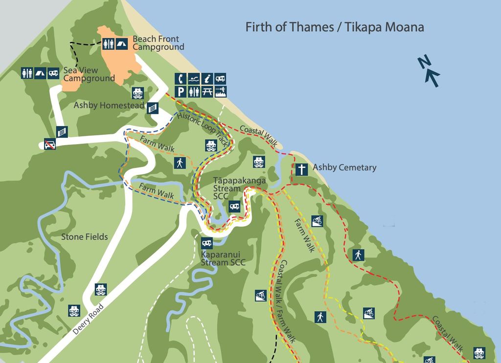
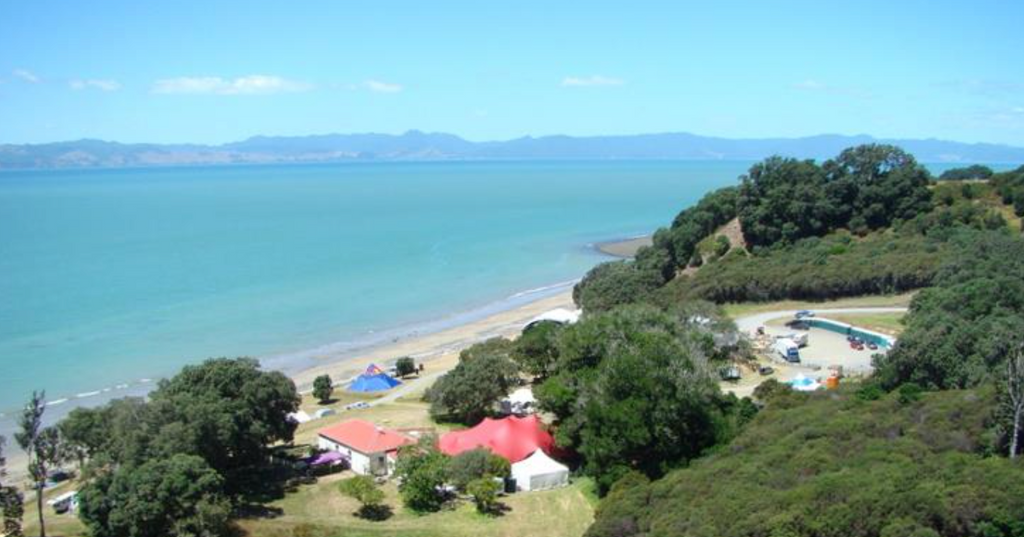
| Description | : | Ashby Family Cemetery located within the Tāpapakanga Regional Park. James ASHBY (1855-1944) was born 3 Sep 1855 in Marylebone, Middlesex, England. James purchased and farmed this land which is rich Maori history. A white sand, pohutukawa edged beach. James and his wife Rebecca arrived and built their homestead villa here in 1900 in kitset form, having been delivered by the Matakana steamer. After having 15 children they came to use the front room as a schoolroom and post office. It is still in good repair and forms part of the park. Tapapakanga still operates as a farm, with... Read More |
frequently asked questions (FAQ):
-
Where is Ashby Cemetery?
Ashby Cemetery is located at 145 Deerys Road, Ōrere Point Manukau, Auckland Council ,Auckland , 2585New Zealand.
-
Ashby Cemetery cemetery's updated grave count on graveviews.com?
4 memorials
-
Where are the coordinates of the Ashby Cemetery?
Latitude: -36.9756920
Longitude: 175.2599670
Nearby Cemetories:
1. Whakatiwai Urupā
Auckland Council, New Zealand
Coordinate: -37.0860660, 175.3014660
2. Chamberlin Family Cemetery
Auckland, Auckland Council, New Zealand
Coordinate: -36.8627607, 175.1870226
3. Rotoroa Island Cemetery
Auckland Council, New Zealand
Coordinate: -36.8131670, 175.2017830
4. Clevedon Cemetery All Souls Church
Clevedon, Auckland Council, New Zealand
Coordinate: -36.9862400, 175.0418100
5. St Andrews Presbyterian Cemetery
Clevedon, Auckland Council, New Zealand
Coordinate: -36.9921320, 175.0371370
6. Hunua Presbyterian Cemetery
Hunua, Auckland Council, New Zealand
Coordinate: -37.0792290, 175.0742700
7. Miranda Cemetery
Miranda, Hauraki District, New Zealand
Coordinate: -37.1798970, 175.2980610
8. Waikopua Cemetery
Whitford, Auckland Council, New Zealand
Coordinate: -36.9274400, 174.9998900
9. Waiomu Urupā
Thames-Coromandel District, New Zealand
Coordinate: -37.0267530, 175.5194780
10. St James Churchyard Ardmore
Auckland Council, New Zealand
Coordinate: -37.0364180, 174.9992160
11. Ararimu Cemetery
Ararimu, Auckland Council, New Zealand
Coordinate: -37.1321000, 175.0484200
12. Waiheke Lawn Cemetery
Auckland Council, New Zealand
Coordinate: -36.8015370, 175.0656180
13. Tararu Cemetery
Thames, Thames-Coromandel District, New Zealand
Coordinate: -37.1049590, 175.5189510
14. Ararimu Schoolhouse Cemetery
Ararimu, Auckland Council, New Zealand
Coordinate: -37.1448376, 175.0359288
15. Alfriston Cemetery
Auckland Council, New Zealand
Coordinate: -37.0133660, 174.9479400
16. Makomako Urupā
Waitakaruru, Hauraki District, New Zealand
Coordinate: -37.2329470, 175.3389910
17. Howick Cemetery
Howick, Auckland Council, New Zealand
Coordinate: -36.9040400, 174.9380500
18. Papakura Cemetery
Papakura, Auckland Council, New Zealand
Coordinate: -37.0698600, 174.9448300
19. All Saints Cemetery
Howick, Auckland Council, New Zealand
Coordinate: -36.8954260, 174.9337600
20. Papakura South Cemetery
Papakura, Auckland Council, New Zealand
Coordinate: -37.0877300, 174.9464700
21. Pratt's Road Catholic Cemetery
Ramarama, Auckland Council, New Zealand
Coordinate: -37.1425500, 174.9871300
22. Our Lady Star of the Sea Parish Cemetery
Howick, Auckland Council, New Zealand
Coordinate: -36.8932940, 174.9307940
23. Drury-Runciman War Memorial
Drury, Auckland Council, New Zealand
Coordinate: -37.1025480, 174.9528240
24. Drury Presbyterian Cemetery
Drury, Auckland Council, New Zealand
Coordinate: -37.0991270, 174.9497870