
| Memorials | : | 186 |
| Location | : | Howick, Auckland Council, New Zealand |
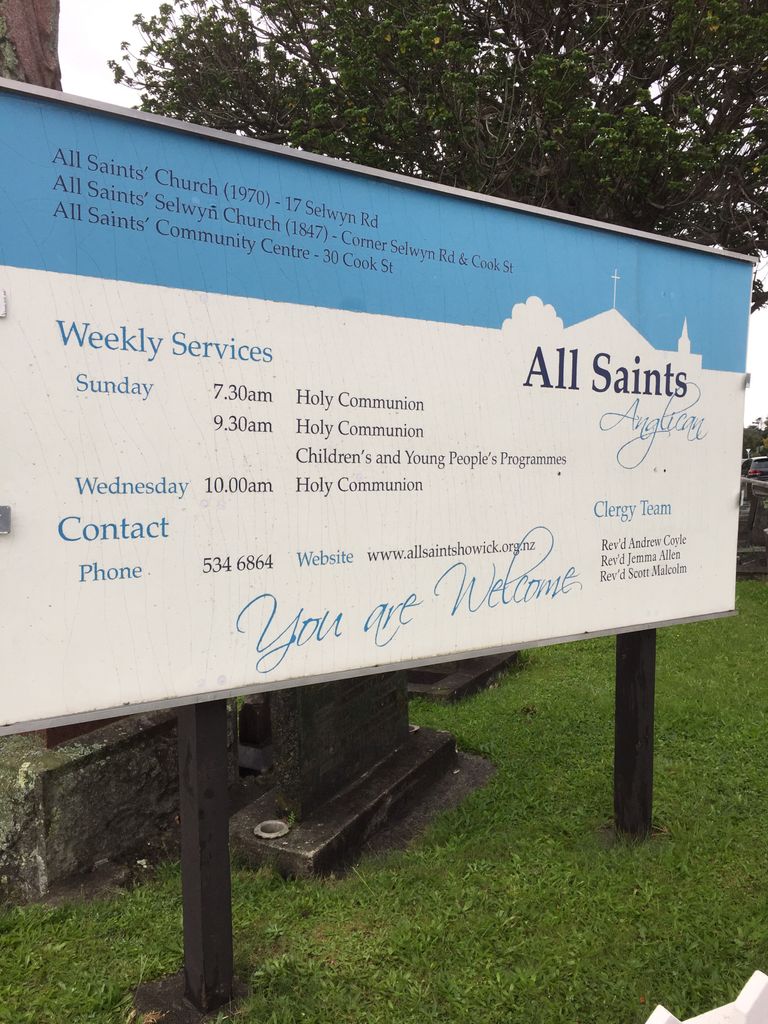
| Phone | : | 09-534 6864 |
| Website | : | www.allsaintshowick.org.nz/contact.php |
| Coordinate | : | -36.8954260, 174.9337600 |
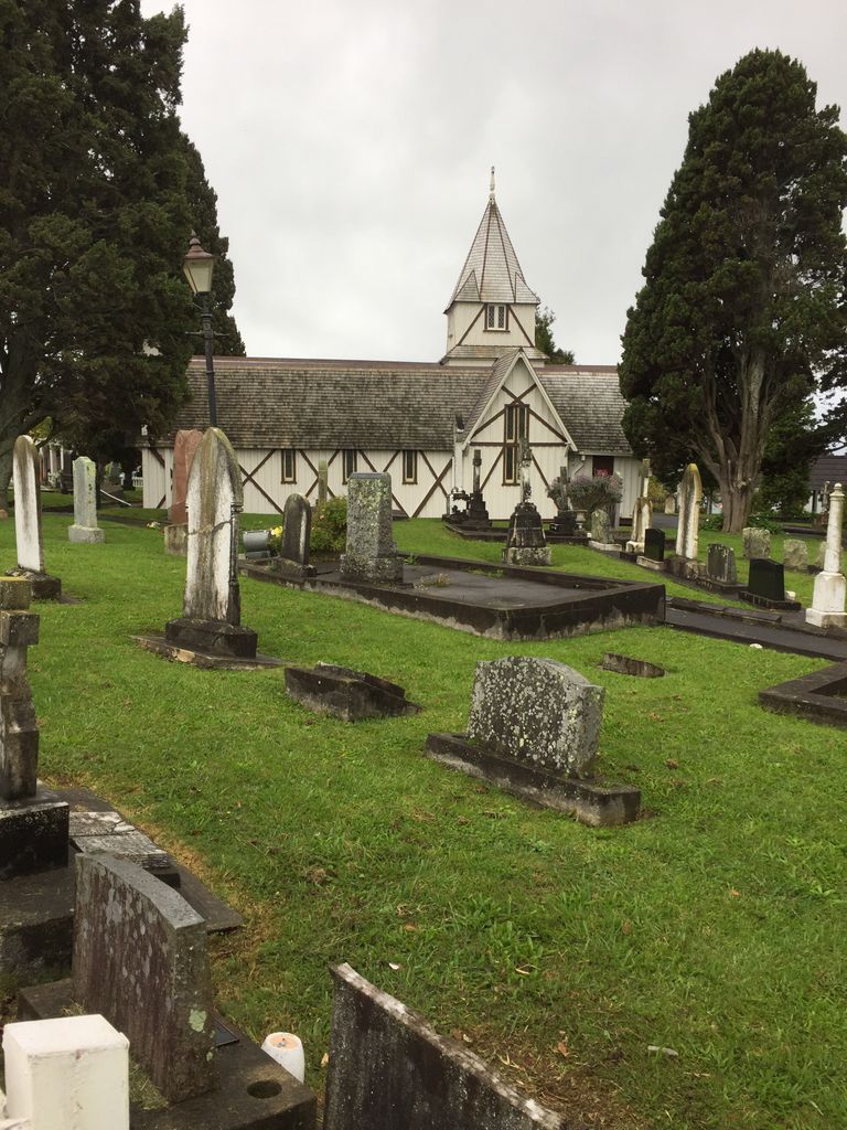
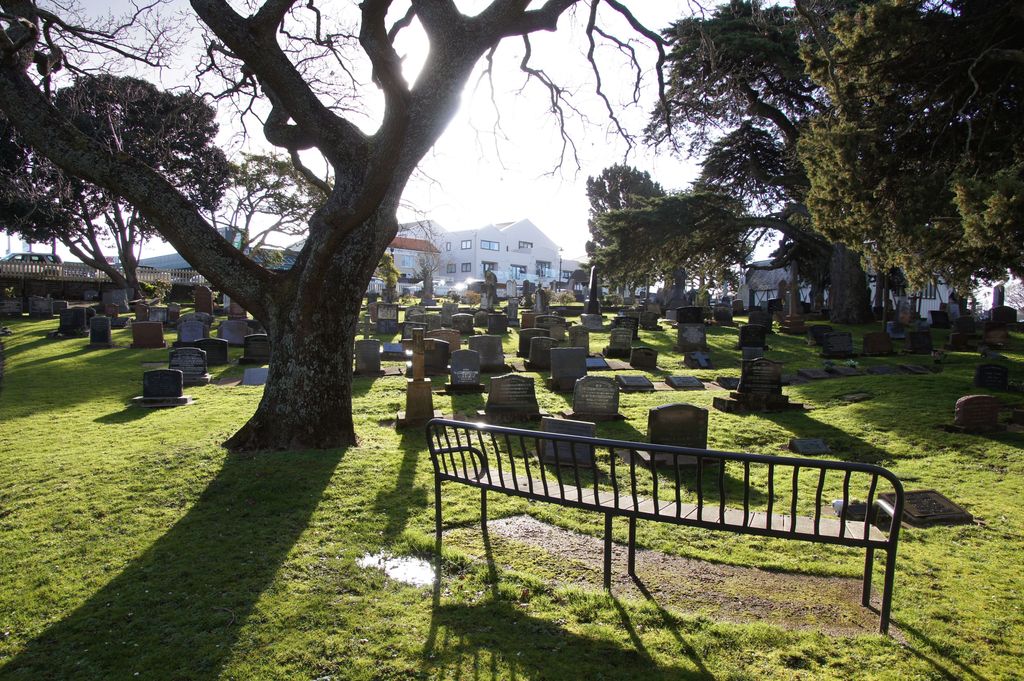
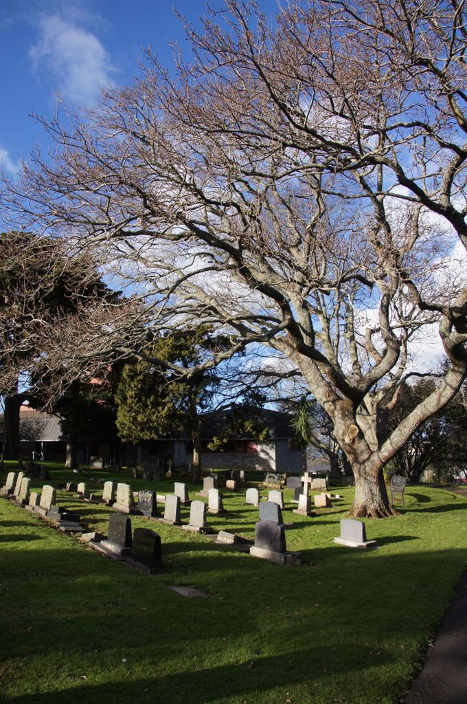
| Description | : | On the corner of Cook Street and Selwyn Road, Howick, Auckland. All Saints is one of the earliest churches in Auckland. Established in 1847, it has been a focal point in a community which has seen many changes through the years. The old All Saints (Selwyn) church was prefabricated at St John’s College, Meadowbank, and hauled by bullock wagon from Howick Beach. It is the icon of historic Howick, and continues to be lovingly maintained and frequently used for worship, weddings and funerals. |
frequently asked questions (FAQ):
-
Where is All Saints Cemetery?
All Saints Cemetery is located at 7 Selwyn Rd Howick, Auckland Council ,Auckland , 2014New Zealand.
-
All Saints Cemetery cemetery's updated grave count on graveviews.com?
185 memorials
-
Where are the coordinates of the All Saints Cemetery?
Latitude: -36.8954260
Longitude: 174.9337600
Nearby Cemetories:
1. Our Lady Star of the Sea Parish Cemetery
Howick, Auckland Council, New Zealand
Coordinate: -36.8932940, 174.9307940
2. Howick Cemetery
Howick, Auckland Council, New Zealand
Coordinate: -36.9040400, 174.9380500
3. St. Andrew Presbyterian Cemetery
Howick, Auckland Council, New Zealand
Coordinate: -36.8989900, 174.9201600
4. Howick Historical Village
Pakuranga, Auckland Council, New Zealand
Coordinate: -36.9067680, 174.9027080
5. Pakuranga Methodist Cemetery
Pakuranga, Auckland Council, New Zealand
Coordinate: -36.9054000, 174.8914900
6. Point England Presbyterian Cemetery
Point England, Auckland Council, New Zealand
Coordinate: -36.8823420, 174.8601550
7. St Matthias Churchyard
Panmure, Auckland Council, New Zealand
Coordinate: -36.9053300, 174.8577200
8. Waikopua Cemetery
Whitford, Auckland Council, New Zealand
Coordinate: -36.9274400, 174.9998900
9. St. Patrick's Roman Catholic Church Cemetery
Panmure, Auckland Council, New Zealand
Coordinate: -36.9029680, 174.8564960
10. Flat Bush Cemetery
East Tamaki, Auckland Council, New Zealand
Coordinate: -36.9563500, 174.9097100
11. St. John's Church Cemetery
East Tamaki, Auckland Council, New Zealand
Coordinate: -36.9522250, 174.8964540
12. St. Paul's Anglican Cemetery
East Tamaki, Auckland Council, New Zealand
Coordinate: -36.9615200, 174.9082000
13. St. Thomas Churchyard
Tamaki, Auckland Council, New Zealand
Coordinate: -36.8675590, 174.8460560
14. St. John’s College Graveyard
Saint Johns, Auckland Council, New Zealand
Coordinate: -36.8738169, 174.8416826
15. Holy Trinity Memorial Park
Ōtāhūhū, Auckland Council, New Zealand
Coordinate: -36.9374510, 174.8448580
16. St. Joseph and St. Joachim Catholic Cemetery
Ōtāhūhū, Auckland Council, New Zealand
Coordinate: -36.9436100, 174.8490100
17. Otahuhu Public Cemetery
Ōtāhūhū, Auckland Council, New Zealand
Coordinate: -36.9377500, 174.8432390
18. Purewa Cemetery
Meadowbank, Auckland Council, New Zealand
Coordinate: -36.8674300, 174.8297900
19. Nixon Memorial
Ōtāhūhū, Auckland Council, New Zealand
Coordinate: -36.9499366, 174.8449909
20. St. John's Presbyterian Church Cemetery
Papatoetoe, Auckland Council, New Zealand
Coordinate: -36.9674185, 174.8598178
21. Motuihe Island Cemetery
Auckland Council, New Zealand
Coordinate: -36.8000400, 174.9363920
22. Ōrākei (Rautara St) Urupā
Orakei, Auckland Council, New Zealand
Coordinate: -36.8610770, 174.8188960
23. Savage Memorial
Auckland, Auckland Council, New Zealand
Coordinate: -36.8462500, 174.8259300
24. Woodside Methodist Cemetery
Manukau, Auckland Council, New Zealand
Coordinate: -36.9929680, 174.8837860