
| Memorials | : | 0 |
| Location | : | Augsburg, Stadtkreis Augsburg, Germany |
| Coordinate | : | 48.3727780, 10.8966670 |
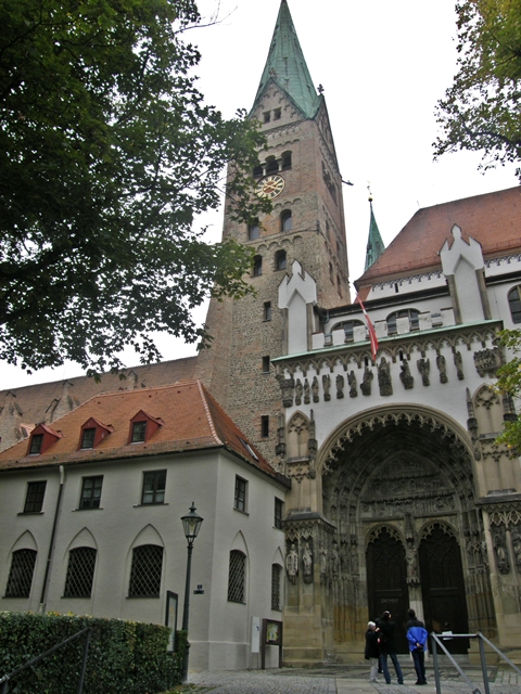
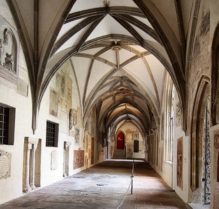
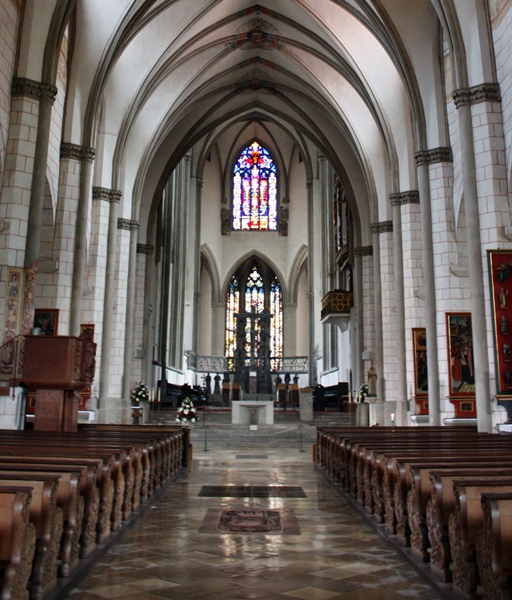
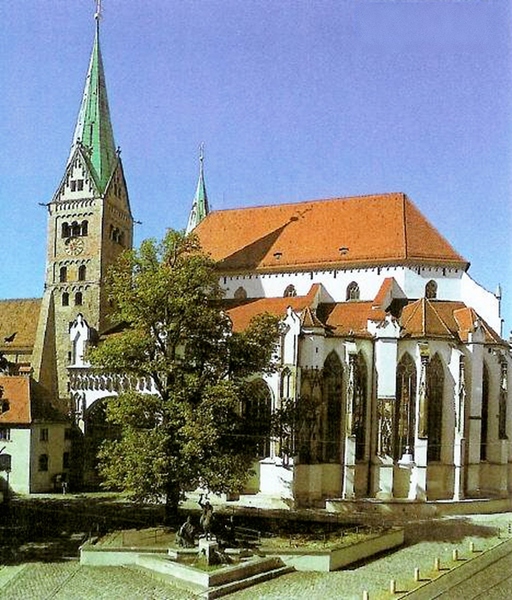
| Description | : | The Cathedral of Augsburg is the center church of the diocese of Augsburg in Bavaria. Officially called "Hohe Domkirche Unserer Lieben Frau zu Augsburg" (High Cathedral Church of our Beloved Lady of Augsburg) it dates back to the 8th century A.D. Enlarged, destroyed and rebuilt several times over the duration of 1000 years the current structure was built from 1852-1863. Several princes, noble men, bishops and a few commoners have found their final resting place either in the cloister (Kreuzgang), the St. Gertrud's Chapel or the main church. Over the past 1000 years many graves were lost though to renovation- and... Read More |
frequently asked questions (FAQ):
-
Where is Augsburger Dom?
Augsburger Dom is located at Frauentorstrasse 1 Augsburg, Stadtkreis Augsburg ,Bavaria (Bayern) ,Germany.
-
Augsburger Dom cemetery's updated grave count on graveviews.com?
0 memorials
-
Where are the coordinates of the Augsburger Dom?
Latitude: 48.3727780
Longitude: 10.8966670
Nearby Cemetories:
1. Sankt Anna Kirche
Augsburg, Stadtkreis Augsburg, Germany
Coordinate: 48.3677030, 10.8955090
2. Kath. Hermanfriedhof Augsburg
Augsburg, Stadtkreis Augsburg, Germany
Coordinate: 48.3636780, 10.8910390
3. Basilika Sankt Ulrich und Afra
Augsburg, Stadtkreis Augsburg, Germany
Coordinate: 48.3619100, 10.9000700
4. Protestantischer Friedhof
Augsburg, Stadtkreis Augsburg, Germany
Coordinate: 48.3536960, 10.9011900
5. Nordfriedhof
Augsburg, Stadtkreis Augsburg, Germany
Coordinate: 48.3899260, 10.8759980
6. Alter Ostfriedhof
Augsburg, Stadtkreis Augsburg, Germany
Coordinate: 48.3803140, 10.9277560
7. Neuer jüdischer Friedhof
Augsburg, Stadtkreis Augsburg, Germany
Coordinate: 48.3489050, 10.9023550
8. Jüdischer Friedhof Augsburg
Augsburg, Stadtkreis Augsburg, Germany
Coordinate: 48.3488500, 10.9021000
9. Westfriedhof
Augsburg, Stadtkreis Augsburg, Germany
Coordinate: 48.3674280, 10.8601560
10. Jüdischer Friedhof Augsburg
Kriegshaber, Stadtkreis Augsburg, Germany
Coordinate: 48.3718660, 10.8532310
11. Neuer Ostfriedhof
Augsburg, Stadtkreis Augsburg, Germany
Coordinate: 48.3679740, 10.9402740
12. Friedhof Göggingen
Goggingen, Stadtkreis Augsburg, Germany
Coordinate: 48.3456070, 10.8679250
13. Kath. Friedhof Kriegshaber
Kriegshaber, Stadtkreis Augsburg, Germany
Coordinate: 48.3820270, 10.8472520
14. Friedhof Stadtbergen
Stadtbergen, Landkreis Augsburg, Germany
Coordinate: 48.3644090, 10.8427480
15. Friedhof Leitershofen
Stadtbergen, Landkreis Augsburg, Germany
Coordinate: 48.3511280, 10.8345590
16. Friedhof Neusaess
Neusass, Landkreis Augsburg, Germany
Coordinate: 48.3973960, 10.8342570
17. Alte Friedhof Haunstetten
Haunstetten, Stadtkreis Augsburg, Germany
Coordinate: 48.3150280, 10.9112570
18. Friedhof Taefertingen
Tafertingen, Landkreis Augsburg, Germany
Coordinate: 48.4106670, 10.8286610
19. Friedhof Gersthofen
Gersthofen, Landkreis Augsburg, Germany
Coordinate: 48.4301720, 10.8761050
20. Neuer Friedhof Haunstetten
Augsburg, Stadtkreis Augsburg, Germany
Coordinate: 48.3075560, 10.8952040
21. Friedhof bei Herrgottsruh
Friedberg, Landkreis Aichach-Friedberg, Germany
Coordinate: 48.3583952, 10.9926363
22. Friedhof Ottmarshausen
Ottmarshausen, Landkreis Augsburg, Germany
Coordinate: 48.3980330, 10.8055660
23. Friedhof Hirblingen
Hirblingen, Landkreis Augsburg, Germany
Coordinate: 48.4227910, 10.8294790
24. Friedhof Hainhofen
Hainhofen, Landkreis Augsburg, Germany
Coordinate: 48.3869620, 10.7965810