
| Memorials | : | 71 |
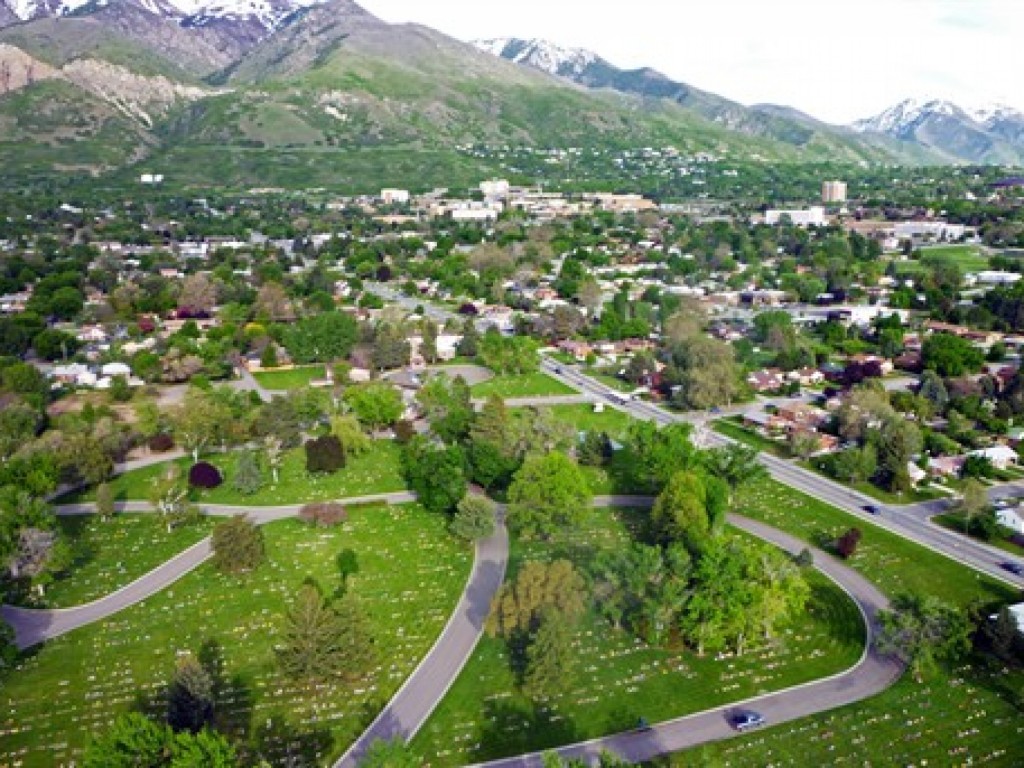
| Location | : | Ogden, Weber County, USA |
| Phone | : | 801-394-5556 |
| Coordinate | : | 41.2005997, -111.9610977 |
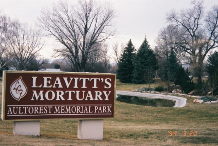
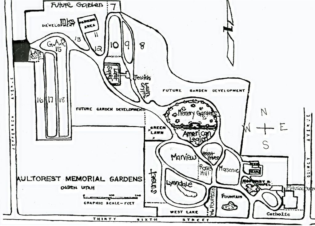
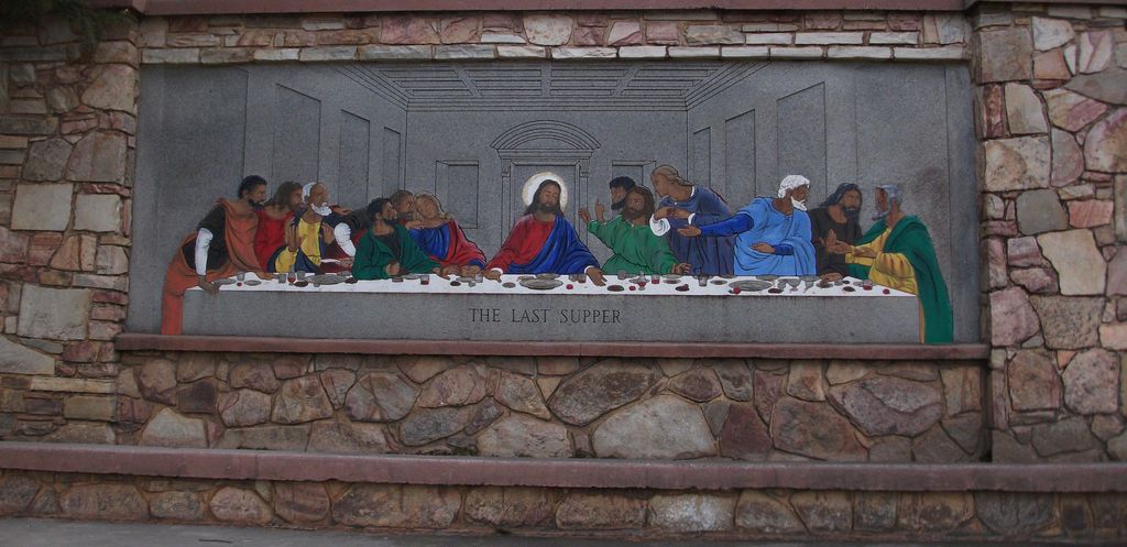
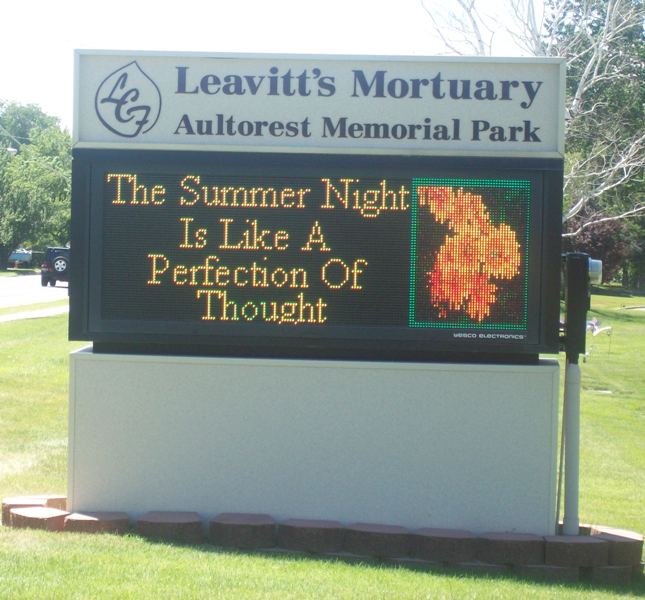
| Description | : | Aultorest Memorial Park was opened March 5, 1929 by James M. Harbertson under the name Mount Ogden Memorial Park. The mortuary was added in July 1933, the Mausoleum in 1935 and the crematory in 1937. Mr. Harbertson changed the name to Aultorest (All-to-rest) in 1938. In 1946, the abandoned Mountain View Cemetery was purchased from John Guthrie Haywood. In 1948 Thomas T. Leavitt married Lynnette Harbertson, who was James Harbertson's daughter, and in 1958 they purchased the property and changed its name to Leavitt's Chapel of Flowers Mortuary and Autorest Memorial Park. Burials in Aultorest began in 1929, but... Read More |
frequently asked questions (FAQ):
-
Where is Aultorest Memorial Park?
Aultorest Memorial Park is located at 838 36th Street Ogden, Weber County ,Utah , 84401USA.
-
Aultorest Memorial Park cemetery's updated grave count on graveviews.com?
61 memorials
-
Where are the coordinates of the Aultorest Memorial Park?
Latitude: 41.2005997
Longitude: -111.9610977
Nearby Cemetories:
1. Washington Heights Memorial Park
South Ogden, Weber County, USA
Coordinate: 41.1779900, -111.9700600
2. Good Shepherd Columbarium
Ogden, Weber County, USA
Coordinate: 41.2231000, -111.9731000
3. Ogden City Cemetery
Ogden, Weber County, USA
Coordinate: 41.2324982, -111.9621964
4. Tiffany Mack Memorial Pet Cemetery
Ogden, Weber County, USA
Coordinate: 41.2342300, -111.9600900
5. Lindquists Memorial Gardens of the Wasatch
South Ogden, Weber County, USA
Coordinate: 41.1631012, -111.9321976
6. Uintah Cemetery
Uintah, Weber County, USA
Coordinate: 41.1458015, -111.9421997
7. South Weber Cemetery
South Weber, Davis County, USA
Coordinate: 41.1425018, -111.9693985
8. Evergreen Memorial Park
Ogden, Weber County, USA
Coordinate: 41.2639210, -111.9583230
9. Roy City Cemetery
Roy, Weber County, USA
Coordinate: 41.1680984, -112.0353012
10. West Haven Cemetery
West Haven, Weber County, USA
Coordinate: 41.2388900, -112.0363000
11. Weber County Poor Farm Cemetery
Roy, Weber County, USA
Coordinate: 41.1613200, -112.0458700
12. Clinton City Cemetery
Clinton, Davis County, USA
Coordinate: 41.1260986, -112.0402985
13. Layton Hill Cemetery
Layton, Davis County, USA
Coordinate: 41.0988000, -111.9746300
14. Clearfield City Cemetery
Clearfield, Davis County, USA
Coordinate: 41.0983009, -112.0102997
15. Ben Lomond Cemetery
North Ogden, Weber County, USA
Coordinate: 41.3133011, -111.9646988
16. Lindquist Memorial Park
Layton, Davis County, USA
Coordinate: 41.0869210, -111.9504260
17. West Weber Cemetery
West Weber, Weber County, USA
Coordinate: 41.2757988, -112.0875015
18. Syracuse Cemetery
Syracuse, Davis County, USA
Coordinate: 41.0960999, -112.0456009
19. Mountain Green Cemetery
Mountain Green, Morgan County, USA
Coordinate: 41.1450005, -111.8022003
20. Hooper City Cemetery
Hooper, Weber County, USA
Coordinate: 41.1666985, -112.1306000
21. Plain City Cemetery
Plain City, Weber County, USA
Coordinate: 41.2943993, -112.0847015
22. West Point Cemetery
West Point, Davis County, USA
Coordinate: 41.1142006, -112.0997009
23. Huntsville Cemetery
Huntsville, Weber County, USA
Coordinate: 41.2647018, -111.8011017
24. Adams Gravesite
Layton, Davis County, USA
Coordinate: 41.0668880, -111.9099400