
| Memorials | : | 0 |
| Location | : | Karmøy kommune, Norway |
| Phone | : | +47 52 81 20 60 |
| Website | : | www.avaldsneskirke.no |
| Coordinate | : | 59.3564720, 5.2911990 |
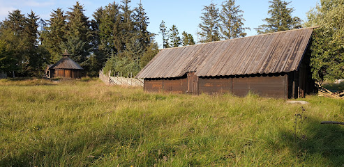
| Description | : | Avaldsnes (Avaldsnæs) was an ancient center of power on the west coast of Norway and is the site of one of Norway's more important areas of cultural history. Avaldsnes, formerly an independent municipality, is now a part of the municipality of Karmøy in Rogaland County, Norway. Karmøy is located southwest of the city of Haugesund in the traditional district of Haugaland. Karmøy was created as a new municipality on 1 January 1965 after the merger of Kopervik (city), Skudeneshavn (city), Skudenes, Stangaland, Torvastad, Åkra, and most of Avaldsnes. |
frequently asked questions (FAQ):
-
Where is Avaldsnes kirkegård?
Avaldsnes kirkegård is located at Kong Augvaldsveg 101 Karmøy kommune ,Rogaland fylke , 4262Norway.
-
Avaldsnes kirkegård cemetery's updated grave count on graveviews.com?
0 memorials
-
Where are the coordinates of the Avaldsnes kirkegård?
Latitude: 59.3564720
Longitude: 5.2911990
Nearby Cemetories:
1. Norheim gravplass
Karmøy kommune, Norway
Coordinate: 59.3791380, 5.3002080
2. Norheim Kirkegård
Karmøy kommune, Norway
Coordinate: 59.3807470, 5.3087380
3. Vår Frelsers Gravlund
Haugesund, Haugesund kommune, Norway
Coordinate: 59.3937920, 5.2884480
4. Torvastad kirkegård
Karmøy kommune, Norway
Coordinate: 59.3799542, 5.2317100
5. Christine Elisabeths Gravlund
Haugesund kommune, Norway
Coordinate: 59.4185290, 5.2656720
6. Søndre Hauge Gravlund
Haugesund, Haugesund kommune, Norway
Coordinate: 59.4199340, 5.2609370
7. Nordre Hauge gravlund
Haugesund, Haugesund kommune, Norway
Coordinate: 59.4209110, 5.2606140
8. Kopervik Kirke
Kopervik, Karmøy kommune, Norway
Coordinate: 59.2816990, 5.3029880
9. Stangeland gravplass
Kopervik, Karmøy kommune, Norway
Coordinate: 59.2786960, 5.3179940
10. Tysvaer
Tysvaer, Tysvær kommune, Norway
Coordinate: 59.3314170, 5.4916040
11. Åkra kirkegård
Akrehamn, Karmøy kommune, Norway
Coordinate: 59.2576700, 5.1944800
12. Ferkingstad gravplass
Ferkingstad, Karmøy kommune, Norway
Coordinate: 59.2128550, 5.1873220
13. Skjoldastraumen
Skjoldastraumen, Tysvær kommune, Norway
Coordinate: 59.4324960, 5.6141990
14. Skjoldastraumen Gamle
Skjoldastraumen, Tysvær kommune, Norway
Coordinate: 59.4323390, 5.6150460
15. Sveio Nye
Sveio, Sveio kommune, Norway
Coordinate: 59.5393490, 5.3387540
16. Bjelland Cemetery
Sveio kommune, Norway
Coordinate: 59.5470470, 5.3710300
17. Falnes Churchyard
Falnes, Karmøy kommune, Norway
Coordinate: 59.1518750, 5.2811310
18. Skjold Old Cemetery
Skjold, Vindafjord kommune, Norway
Coordinate: 59.5081160, 5.5961600
19. Bømlo gamle kyrkjegard
Bømlo kommune, Norway
Coordinate: 59.6087160, 5.2146090
20. Nedstrand Vestre
Tysvaer, Tysvær kommune, Norway
Coordinate: 59.3487100, 5.8000780
21. Nedstrand
Nedstrand, Tysvær kommune, Norway
Coordinate: 59.3500860, 5.8024920
22. Vats Cemetery
Skjold, Vindafjord kommune, Norway
Coordinate: 59.4930920, 5.7278190
23. Sørbø Church Cemetery
Vikevag, Rennesøy kommune, Norway
Coordinate: 59.1278680, 5.6437970
24. Utstein Kloster
Askje, Rennesøy kommune, Norway
Coordinate: 59.1029350, 5.5920310