
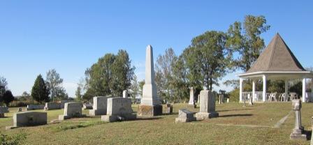
| Memorials | : | 48 |
| Location | : | Big Sandy, Benton County, USA |
| Coordinate | : | 36.1772003, -88.1164017 |
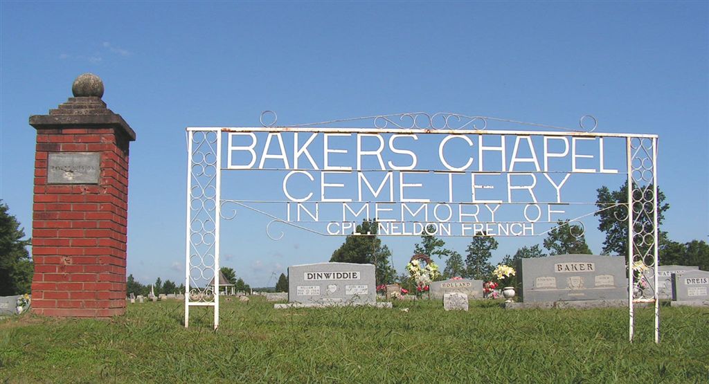
| Description | : | Location: From the intersection of Lower Big Sandy Rd and Baker's Chapel Cemetery Rd go 0.2 miles east. Baker's Chapel Church Rd joins Baker's Chapel Cemetery Rd. There are about 50 unmarked, unidentifiable graves. |
frequently asked questions (FAQ):
-
Where is Bakers Chapel Cemetery?
Bakers Chapel Cemetery is located at Big Sandy, Benton County ,Tennessee ,USA.
-
Bakers Chapel Cemetery cemetery's updated grave count on graveviews.com?
48 memorials
-
Where are the coordinates of the Bakers Chapel Cemetery?
Latitude: 36.1772003
Longitude: -88.1164017
Nearby Cemetories:
1. Weatherly Cemetery
Benton County, USA
Coordinate: 36.1455994, -88.1222000
2. Williams Grove Cemetery
Camden, Benton County, USA
Coordinate: 36.1516660, -88.1450530
3. Rushings Creek Cemetery
Camden, Benton County, USA
Coordinate: 36.1431340, -88.1096870
4. Moore Cemetery
Big Sandy, Benton County, USA
Coordinate: 36.1473000, -88.0852000
5. Ramble Creek Cemetery
Big Sandy, Benton County, USA
Coordinate: 36.2036000, -88.0784750
6. Dennis Rushing Cemetery
Big Sandy, Benton County, USA
Coordinate: 36.1391640, -88.0967380
7. Lowry Cemetery
Henry County, USA
Coordinate: 36.2132988, -88.1519012
8. Hudson-Willis Rushing Cemetery
Big Sandy, Benton County, USA
Coordinate: 36.1342690, -88.0903790
9. Carter Cemetery
Henry County, USA
Coordinate: 36.1699982, -88.1757965
10. Carter Cemetery
Mansfield, Henry County, USA
Coordinate: 36.1744310, -88.1774710
11. McRaes Chapel Cemetery
Big Sandy, Benton County, USA
Coordinate: 36.2187940, -88.0747570
12. Francisco Cemetery
Henry County, USA
Coordinate: 36.1547012, -88.1802979
13. Margaret McKenzie Brewer Cemetery
Big Sandy, Benton County, USA
Coordinate: 36.2028000, -88.0543000
14. French Cemetery
Henry County, USA
Coordinate: 36.2028008, -88.1800003
15. Craig - Farmer Family Cemetery
Henry County, USA
Coordinate: 36.2350006, -88.1292038
16. Cedar Grove Church of Christ Cemetery
Big Sandy, Benton County, USA
Coordinate: 36.1555280, -88.0420920
17. Manleyville Cemetery
Manleyville, Henry County, USA
Coordinate: 36.2268982, -88.1669006
18. Greer Cemetery
Camden, Benton County, USA
Coordinate: 36.1150910, -88.1450560
19. Richardson Cemetery
Big Sandy, Benton County, USA
Coordinate: 36.2346220, -88.0680200
20. Edward Lindsey Cemetery
Big Sandy, Benton County, USA
Coordinate: 36.2401740, -88.0707360
21. Mount Zion Cemetery
Benton County, USA
Coordinate: 36.1782840, -88.0200180
22. Beasley-Blanchard Cemetery
Benton County, USA
Coordinate: 36.1102982, -88.0643997
23. Liberty Community Cemetery
Liberty, Benton County, USA
Coordinate: 36.0974998, -88.1078033
24. Berry Cemetery
Big Sandy, Benton County, USA
Coordinate: 36.1506004, -88.0207977