
| Memorials | : | 71 |
| Location | : | Big Sandy, Benton County, USA |
| Coordinate | : | 36.2187940, -88.0747570 |
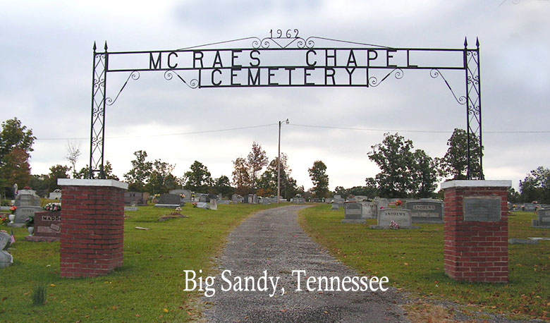
| Description | : | McRae's Chapel Cemetery is located about 12 miles Northeast of Camden, about 1-1/2 miles Southeast of Big Sandy and 1.4 miles east of 69A on Sulphur Creek Road. The 911 number across the road is 1285. There are many unmarked graves and many broken stones that cannot be read. Currently adjacent to the McRae's Chapel Funeral Home (previously the McRaes Methodist Church) on Sulphur Creek Road. |
frequently asked questions (FAQ):
-
Where is McRaes Chapel Cemetery?
McRaes Chapel Cemetery is located at 1285 Sulphur Creek Road Big Sandy, Benton County ,Tennessee , 38221USA.
-
McRaes Chapel Cemetery cemetery's updated grave count on graveviews.com?
71 memorials
-
Where are the coordinates of the McRaes Chapel Cemetery?
Latitude: 36.2187940
Longitude: -88.0747570
Nearby Cemetories:
1. Ramble Creek Cemetery
Big Sandy, Benton County, USA
Coordinate: 36.2036000, -88.0784750
2. Richardson Cemetery
Big Sandy, Benton County, USA
Coordinate: 36.2346220, -88.0680200
3. Edward Lindsey Cemetery
Big Sandy, Benton County, USA
Coordinate: 36.2401740, -88.0707360
4. Margaret McKenzie Brewer Cemetery
Big Sandy, Benton County, USA
Coordinate: 36.2028000, -88.0543000
5. Willow Cemetery
Big Sandy, Benton County, USA
Coordinate: 36.2548020, -88.0759660
6. Craig - Farmer Family Cemetery
Henry County, USA
Coordinate: 36.2350006, -88.1292038
7. Pleasant Ridge Cemetery
Big Sandy, Benton County, USA
Coordinate: 36.2630390, -88.0556540
8. Beaton Cemetery
Benton County, USA
Coordinate: 36.2677994, -88.0777969
9. Bakers Chapel Cemetery
Big Sandy, Benton County, USA
Coordinate: 36.1772003, -88.1164017
10. Mount Vinson Cemetery
Big Sandy, Benton County, USA
Coordinate: 36.2732060, -88.0686740
11. Roney Cemetery
Big Sandy, Benton County, USA
Coordinate: 36.2762160, -88.0668460
12. Mount Zion Cemetery
Benton County, USA
Coordinate: 36.1782840, -88.0200180
13. Lowry Cemetery
Henry County, USA
Coordinate: 36.2132988, -88.1519012
14. Cooper Cemetery
Big Sandy, Benton County, USA
Coordinate: 36.2783480, -88.0462480
15. Cedar Grove Church of Christ Cemetery
Big Sandy, Benton County, USA
Coordinate: 36.1555280, -88.0420920
16. Bucy Cemetery
Henry County, USA
Coordinate: 36.2860985, -88.1010971
17. Moore Cemetery
Big Sandy, Benton County, USA
Coordinate: 36.1473000, -88.0852000
18. Mount Carmel Congregational Methodist Church Cemet
Big Sandy, Benton County, USA
Coordinate: 36.2869850, -88.0377230
19. Manleyville Cemetery
Manleyville, Henry County, USA
Coordinate: 36.2268982, -88.1669006
20. Lindsey Cemetery
Benton County, USA
Coordinate: 36.2655983, -87.9989014
21. Wheatley Cemetery
Benton County, USA
Coordinate: 36.1864014, -87.9878006
22. Pierce Cemetery
Big Sandy, Benton County, USA
Coordinate: 36.2972060, -88.0789180
23. Rushings Creek Cemetery
Camden, Benton County, USA
Coordinate: 36.1431340, -88.1096870
24. Berry Cemetery
Big Sandy, Benton County, USA
Coordinate: 36.1506004, -88.0207977