| Memorials | : | 1 |
| Location | : | West Butterwick, North Lincolnshire Unitary Authority, England |
| Coordinate | : | 53.5432720, -0.7423210 |
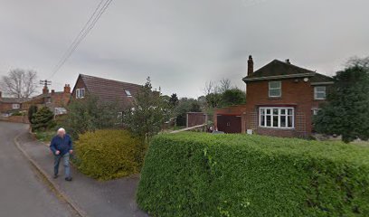
| Description | : | The Baptist chapel with burial ground can be identified in maps from the early 1900s, but it was an empty lot in the 1950s and on the site there is now a private home. |
frequently asked questions (FAQ):
-
Where is Baptist Burial Ground?
Baptist Burial Ground is located at West Butterwick, North Lincolnshire Unitary Authority ,Lincolnshire ,England.
-
Baptist Burial Ground cemetery's updated grave count on graveviews.com?
1 memorials
-
Where are the coordinates of the Baptist Burial Ground?
Latitude: 53.5432720
Longitude: -0.7423210
Nearby Cemetories:
1. St Mary the Virgin Churchyard
West Butterwick, North Lincolnshire Unitary Authority, England
Coordinate: 53.5426407, -0.7412120
2. St John The Baptist Churchyard Extension
Burringham, North Lincolnshire Unitary Authority, England
Coordinate: 53.5708230, -0.7439800
3. St Oswald Churchyard
Althorpe, North Lincolnshire Unitary Authority, England
Coordinate: 53.5765570, -0.7408910
4. All Saints Churchyard
Belton, North Lincolnshire Unitary Authority, England
Coordinate: 53.5478600, -0.8199200
5. Holy Trinity Churchyard
Messingham, North Lincolnshire Unitary Authority, England
Coordinate: 53.5323250, -0.6583030
6. St Andrew Churchyard
Epworth, North Lincolnshire Unitary Authority, England
Coordinate: 53.5256450, -0.8231740
7. Owston Ferry Cemetery
Owston Ferry, North Lincolnshire Unitary Authority, England
Coordinate: 53.4966300, -0.7827500
8. Epworth Municipal Cemetery
Epworth, North Lincolnshire Unitary Authority, England
Coordinate: 53.5206600, -0.8239000
9. Woodlands Cemetery and Crematorium
Scunthorpe, North Lincolnshire Unitary Authority, England
Coordinate: 53.5810900, -0.6744900
10. St Martin's Churchyard
Owston Ferry, North Lincolnshire Unitary Authority, England
Coordinate: 53.4933920, -0.7886380
11. St Peter Ad Vincula Church
Bottesford, North Lincolnshire Unitary Authority, England
Coordinate: 53.5533120, -0.6448410
12. St Peter Churchyard
Scotter, West Lindsey District, England
Coordinate: 53.4966600, -0.6636500
13. Scotter Cemetery
Scotter, West Lindsey District, England
Coordinate: 53.4942000, -0.6665520
14. St Lawrence Churchyard
Scunthorpe, North Lincolnshire Unitary Authority, England
Coordinate: 53.5864180, -0.6554010
15. Brumby Cemetery
Scunthorpe, North Lincolnshire Unitary Authority, England
Coordinate: 53.5799400, -0.6448700
16. Crosby Cemetery
Scunthorpe, North Lincolnshire Unitary Authority, England
Coordinate: 53.5978800, -0.6639600
17. Scunthorpe Cemetery
Scunthorpe, North Lincolnshire Unitary Authority, England
Coordinate: 53.5932400, -0.6512140
18. Laughton Cemetery
Laughton, West Lindsey District, England
Coordinate: 53.4681287, -0.7228939
19. St Marks Church
Amcotts, North Lincolnshire Unitary Authority, England
Coordinate: 53.6166950, -0.7088900
20. All Saints Churchyard
Laughton, West Lindsey District, England
Coordinate: 53.4656600, -0.7224400
21. St Genewys Churchyard
Scotton, West Lindsey District, England
Coordinate: 53.4810900, -0.6597690
22. St. Nicholas' Churchyard
Haxey, North Lincolnshire Unitary Authority, England
Coordinate: 53.4896400, -0.8489650
23. Crowle Cemetery
Crowle, North Lincolnshire Unitary Authority, England
Coordinate: 53.6090660, -0.8285680
24. All Saints Churchyard Old
Flixborough, North Lincolnshire Unitary Authority, England
Coordinate: 53.6178950, -0.6754930

