
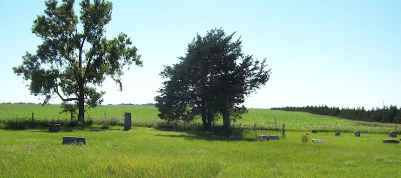
| Memorials | : | 9 |
| Location | : | Naper, Boyd County, USA |
| Coordinate | : | 42.9730988, -99.1564026 |
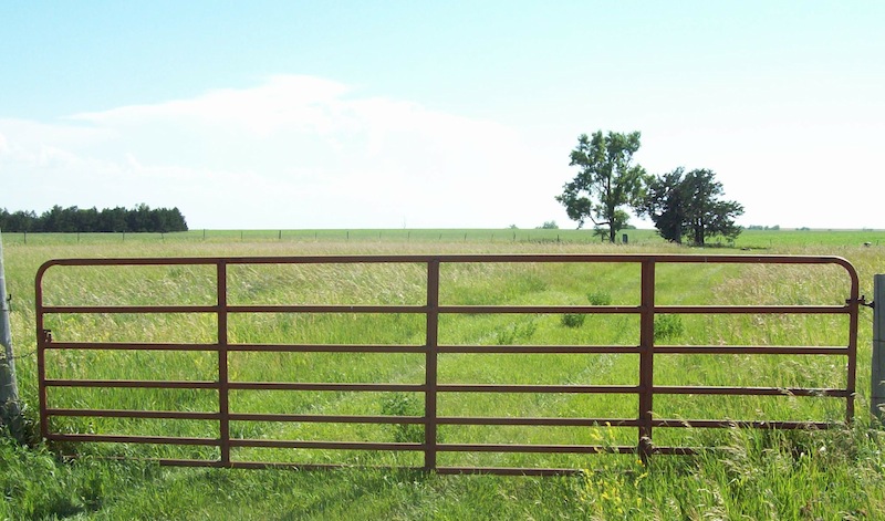
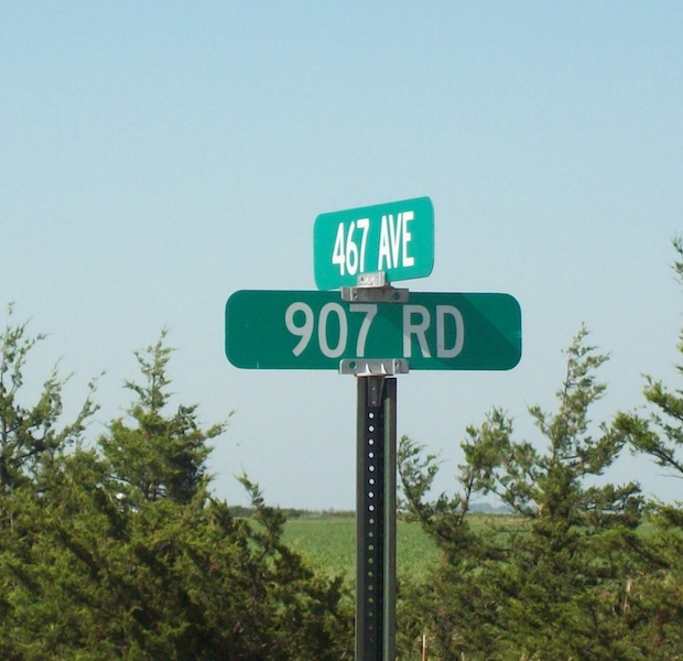
| Description | : | Two miles west of Naper on Highway 12, turn north on Road 468 for 1 mile. Turn west (left) onto Road 907 go 1 mile. Diagonal entrance to cemetery is on the SW portion of the intersection of Road 467 and Road 907. Cemetery located on Schock property. |
frequently asked questions (FAQ):
-
Where is Baptist Cemetery?
Baptist Cemetery is located at Naper, Boyd County ,Nebraska ,USA.
-
Baptist Cemetery cemetery's updated grave count on graveviews.com?
9 memorials
-
Where are the coordinates of the Baptist Cemetery?
Latitude: 42.9730988
Longitude: -99.1564026
Nearby Cemetories:
1. German Cemetery
Naper, Boyd County, USA
Coordinate: 42.9696999, -99.1350021
2. Lutheran Cemetery
Naper, Boyd County, USA
Coordinate: 42.9585980, -99.1268810
3. Saint Francis Xavier Cemetery
Saint Charles, Gregory County, USA
Coordinate: 43.0094337, -99.1375152
4. Sacred Heart Cemetery
Naper, Boyd County, USA
Coordinate: 42.9586400, -99.0905900
5. Knoll Crest Cemetery
Naper, Boyd County, USA
Coordinate: 42.9589005, -99.0875015
6. Milks Camp Episcopal Cemetery
Saint Charles, Gregory County, USA
Coordinate: 43.0378199, -99.1552354
7. Ponca Creek UCC Cemetery
Gregory County, USA
Coordinate: 43.0451800, -99.1491700
8. Oak Dale Cemetery
Naper, Boyd County, USA
Coordinate: 42.8847008, -99.1939011
9. Mount Zion Cemetery
Naper, Boyd County, USA
Coordinate: 42.9701200, -99.0183400
10. Immanuel Lutheran Cemetery
Jamison, Keya Paha County, USA
Coordinate: 42.9977989, -99.3139038
11. Spotted Tail Cemetery
Jamison, Keya Paha County, USA
Coordinate: 42.9799995, -99.3324966
12. Herrick Cemetery
Herrick, Gregory County, USA
Coordinate: 43.1110000, -99.1970000
13. Pleasant Valley Cemetery
Bonesteel, Gregory County, USA
Coordinate: 43.0327988, -98.9796982
14. Southside Cemetery
Holt County, USA
Coordinate: 42.8842139, -98.9931842
15. Wolf Creek Cemetery
Keya Paha County, USA
Coordinate: 42.9516330, -99.3801570
16. Adams Cemetery
Holt County, USA
Coordinate: 42.8706000, -98.9694500
17. Gregory County Home Cemetery
Gregory, Gregory County, USA
Coordinate: 43.1253014, -99.2866974
18. Saint Marys Cemetery
Bonesteel, Gregory County, USA
Coordinate: 43.0816994, -98.9413986
19. Rosebud Cemetery
Bonesteel, Gregory County, USA
Coordinate: 43.0835991, -98.9405975
20. Highland Cemetery
Fairfax, Gregory County, USA
Coordinate: 43.0236015, -98.8930969
21. Cleveland Cemetery
Holt County, USA
Coordinate: 42.7761002, -99.1091995
22. Trinity Lutheran Cemetery
Fairfax, Gregory County, USA
Coordinate: 43.0102997, -98.8842010
23. Sacred Heart Cemetery
Burke, Gregory County, USA
Coordinate: 43.1507988, -99.2913971
24. Peace Cemetery
Gregory County, USA
Coordinate: 43.0816994, -99.3946991