
| Memorials | : | 0 |
| Location | : | Brooklyn, Kings County (Brooklyn), USA |
| Coordinate | : | 40.6367700, -74.0346500 |
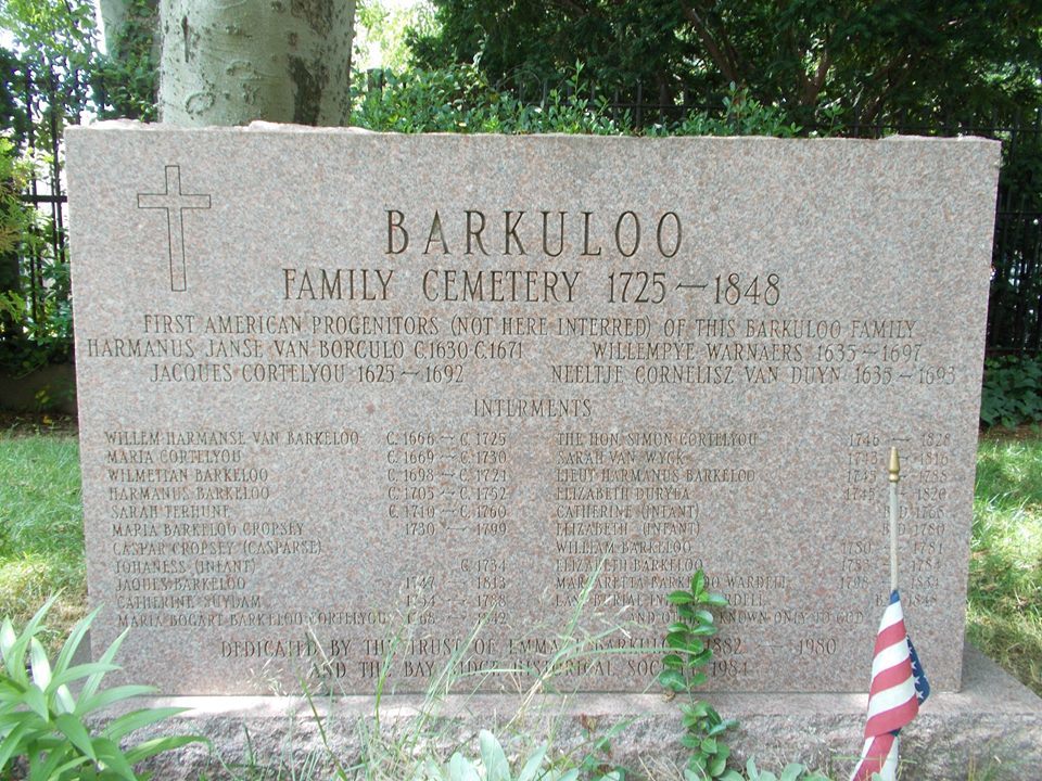
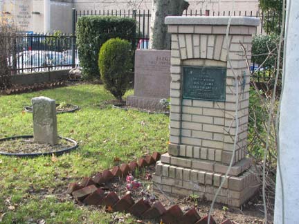
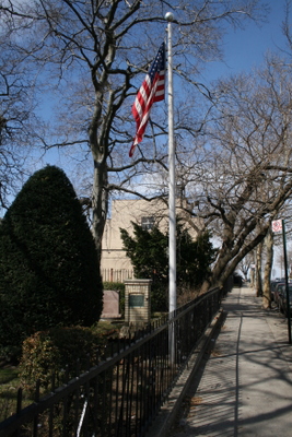
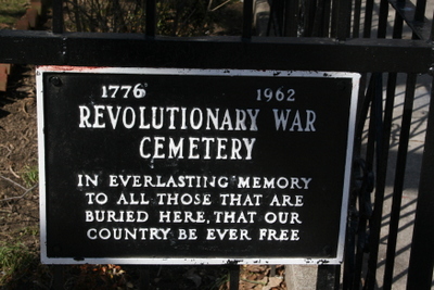
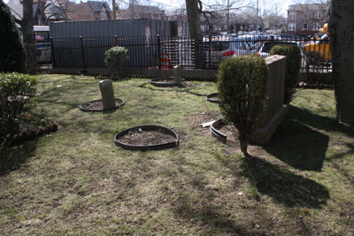
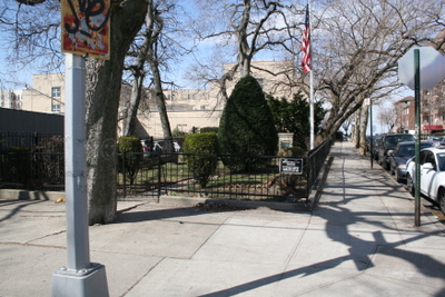
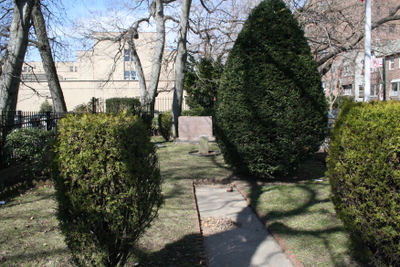
| Description | : | This smallest cemetery in Brooklyn, the "Revolutionary Cemetery" in Bay Ridge, at the corner of Narrows Avenue and Mackay Place was founded in 1725 by Dutch immigrant William Harmans Barkaloo. The "revolutionary" appellation comes from a plaque erected in 1962 on the protective gate, which indicates that several Revolutionary War veterans are buried here; though some historians dismiss the claim as spurious, others say that William Barkaloo's sons, Harmans and Jacques, fought in the Battle of Brooklyn, which raged in Bay Ridge and throughout the towns of New Utrecht and Brooklyn. The last burial took place in 1848. ... Read More |
frequently asked questions (FAQ):
-
Where is Barkaloo Cemetery?
Barkaloo Cemetery is located at Brooklyn, Kings County (Brooklyn) ,New York ,USA.
-
Barkaloo Cemetery cemetery's updated grave count on graveviews.com?
0 memorials
-
Where are the coordinates of the Barkaloo Cemetery?
Latitude: 40.6367700
Longitude: -74.0346500
Nearby Cemetories:
1. Christ Episcopal Church Columbarium
Bay Ridge, Kings County (Brooklyn), USA
Coordinate: 40.6330372, -74.0296246
2. Christ Church Bay Ridge Columbarium
Brooklyn, Kings County (Brooklyn), USA
Coordinate: 40.6330720, -74.0294720
3. Grace Methodist Episcopal Church Cemetery
Bay Ridge, Kings County (Brooklyn), USA
Coordinate: 40.6344190, -74.0174060
4. Saint Johns Episcopal Church Columbarium
Bay Ridge, Kings County (Brooklyn), USA
Coordinate: 40.6128890, -74.0313520
5. Marine Hospital Quarantine Cemetery
Richmond, Richmond County (Staten Island), USA
Coordinate: 40.6414530, -74.0775400
6. Saint Pauls Memorial Church Memorial Garden
Stapleton, Richmond County (Staten Island), USA
Coordinate: 40.6324010, -74.0789740
7. New Utrecht Cemetery
Bensonhurst, Kings County (Brooklyn), USA
Coordinate: 40.6107900, -74.0058700
8. Green-Wood Cemetery
Brooklyn, Kings County (Brooklyn), USA
Coordinate: 40.6521988, -73.9910965
9. Garibaldi-Meucci Museum
Staten Island, Richmond County (Staten Island), USA
Coordinate: 40.6152230, -74.0738583
10. Seamans Retreat Cemetery
Clifton, Richmond County (Staten Island), USA
Coordinate: 40.6210780, -74.0793590
11. Van Deventer Family Burial Ground
Fort Wadsworth, Richmond County (Staten Island), USA
Coordinate: 40.6018710, -74.0594250
12. Christ Church New Brighton Columbarium
New Brighton, Richmond County (Staten Island), USA
Coordinate: 40.6436900, -74.0930570
13. Washington Cemetery
Brooklyn, Kings County (Brooklyn), USA
Coordinate: 40.6192017, -73.9757996
14. Silver Mount Cemetery
Sunnyside, Richmond County (Staten Island), USA
Coordinate: 40.6218987, -74.0952988
15. Silver Lake Quarantine Cemetery
Staten Island, Richmond County (Staten Island), USA
Coordinate: 40.6216893, -74.0956989
16. Unitarian Church of Staten Island Memorial Garden
New Brighton, Richmond County (Staten Island), USA
Coordinate: 40.6430780, -74.0986540
17. Sailors Snug Harbor Cemetery
New Brighton, Richmond County (Staten Island), USA
Coordinate: 40.6378100, -74.1001400
18. Silver Lake Cemetery
Sunnyside, Richmond County (Staten Island), USA
Coordinate: 40.6206017, -74.0971985
19. Old Clove Baptist Cemetery
Emerson Hill, Richmond County (Staten Island), USA
Coordinate: 40.6087494, -74.0913010
20. Woodland Cemetery
Sunnyside, Richmond County (Staten Island), USA
Coordinate: 40.6194000, -74.0982971
21. Robert Randall Burial Site
West New Brighton, Richmond County (Staten Island), USA
Coordinate: 40.6447190, -74.1019820
22. Friends Quaker Cemetery
Brooklyn, Kings County (Brooklyn), USA
Coordinate: 40.6593933, -73.9720764
23. Saint Mary's Catholic Cemetery
Grasmere, Richmond County (Staten Island), USA
Coordinate: 40.5954100, -74.0819700
24. Saint Marys Episcopal Church Columbarium
West New Brighton, Richmond County (Staten Island), USA
Coordinate: 40.6353170, -74.1086150