
| Memorials | : | 14 |
| Location | : | Batemans Bay, Eurobodalla Shire, Australia |
| Phone | : | DEFUNCT |
| Coordinate | : | -35.7166672, 150.1833344 |
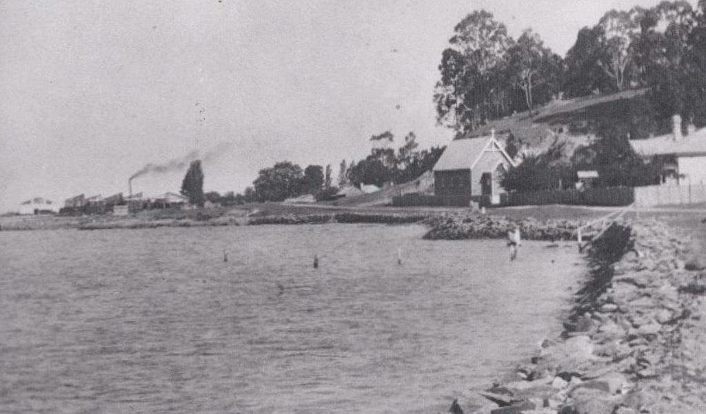
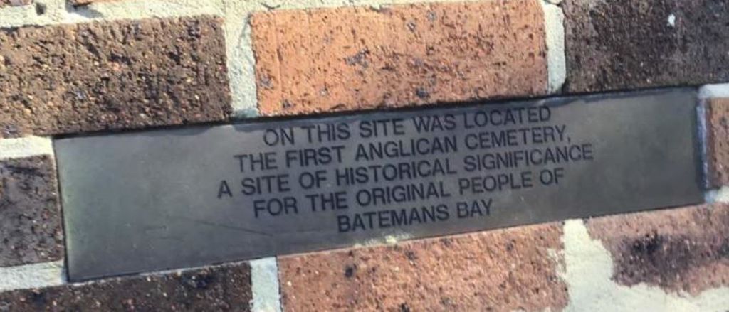
| Description | : | Cemetery was removed around 1985. Some remaining 10 headstones were removed and taken for cleaning, then placed at St Paul Garden of Remembrance, Batemans Bay Anglican Church Yard now located at 6 Herarde Street, Batemans Bay. The earliest headstone dates from 1892 and the last from 1927. Local records show that 46 burials were registered in the cemetery, other reports suggest that it could be as high as 65 graves with 14 marked headstones at time of destruction. |
frequently asked questions (FAQ):
-
Where is Batemans Bay Old Anglican Cemetery?
Batemans Bay Old Anglican Cemetery is located at On Cliff Beach Road, Batemans Bay, New South Wales, Australia Batemans Bay, Eurobodalla Shire ,New South Wales , 2536Australia.
-
Batemans Bay Old Anglican Cemetery cemetery's updated grave count on graveviews.com?
14 memorials
-
Where are the coordinates of the Batemans Bay Old Anglican Cemetery?
Latitude: -35.7166672
Longitude: 150.1833344
Nearby Cemetories:
1. Batemans Bay Cemetery
Batemans Bay, Eurobodalla Shire, Australia
Coordinate: -35.7207690, 150.1756980
2. Batemans Bay Old Catholic
Batemans Bay, Eurobodalla Shire, Australia
Coordinate: -35.7093950, 150.1764310
3. Batemans Bay Historic Cemetery
Batemans Bay, Eurobodalla Shire, Australia
Coordinate: -35.7089400, 150.1762900
4. Nelligen Cemetery
Nelligen, Eurobodalla Shire, Australia
Coordinate: -35.6516110, 150.1338960
5. Mogo Old Church of England Cemetery
Mogo, Eurobodalla Shire, Australia
Coordinate: -35.7851910, 150.1409350
6. Nelligen Church Of England Cemetery Former
Nelligen, Eurobodalla Shire, Australia
Coordinate: -35.6477114, 150.1387833
7. Mogo General Cemetery
Mogo, Eurobodalla Shire, Australia
Coordinate: -35.7908860, 150.1366900
8. Tomakin Cemetery
Tomakin, Eurobodalla Shire, Australia
Coordinate: -35.8297010, 150.1930720
9. Mrs Abraham Malebers Grave
Broulee, Eurobodalla Shire, Australia
Coordinate: -35.8563090, 150.1894210
10. Broulee Memorial Gardens & Crematorium
Broulee, Eurobodalla Shire, Australia
Coordinate: -35.8550440, 150.1430800
11. Currowan Cemetery
Currowan, Eurobodalla Shire, Australia
Coordinate: -35.5765330, 150.0580070
12. Moruya Heads Cemetery
Moruya Heads, Eurobodalla Shire, Australia
Coordinate: -35.9087270, 150.1612160
13. Glenduart Cemetery
Moruya, Eurobodalla Shire, Australia
Coordinate: -35.8896350, 150.0670760
14. Lucks Cemetery
Moruya, Eurobodalla Shire, Australia
Coordinate: -35.9085890, 150.0426920
15. Moruya Cemetery
Moruya, Eurobodalla Shire, Australia
Coordinate: -35.9233510, 150.0755760
16. Kiora Cemetery
Kiora, Eurobodalla Shire, Australia
Coordinate: -35.9167050, 150.0411770
17. Congo Point Colonial Grave
Congo Park, Eurobodalla Shire, Australia
Coordinate: -35.9559590, 150.1580970
18. Frederic Lester-Blanchard Lone Grave
Eurobodalla Shire, Australia
Coordinate: -35.9330700, 149.9278000
19. Araluen Catholic Cemetery
Araluen, Queanbeyan–Palerang Regional Council, Australia
Coordinate: -35.6340000, 149.8228333
20. Bingi Bingi Brinja Aboriginal massacre site
Bergalia, Eurobodalla Shire, Australia
Coordinate: -36.0214600, 150.1511990
21. Araluen Church of England Cemetery
Araluen, Queanbeyan–Palerang Regional Council, Australia
Coordinate: -35.6110340, 149.7795490
22. Mongarlowe Cemetery
Mongarlowe, Queanbeyan–Palerang Regional Council, Australia
Coordinate: -35.4242770, 149.9411370
23. Bodalla General Cemetery
Bodalla, Eurobodalla Shire, Australia
Coordinate: -36.0833321, 150.0500031
24. Majors Creek Cemetery
Majors Creek, Queanbeyan–Palerang Regional Council, Australia
Coordinate: -35.5804770, 149.7281970