
| Memorials | : | 25 |
| Location | : | Baxter Springs, Cherokee County, USA |
| Phone | : | 913-758-4105 |
| Website | : | www.cem.va.gov/CEM/cems/lots/baxtersprings.asp |
| Coordinate | : | 37.0320810, -94.7706520 |
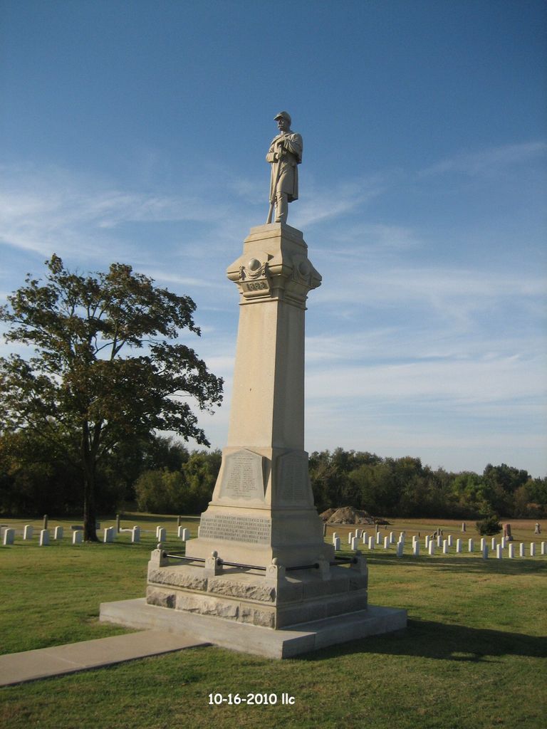
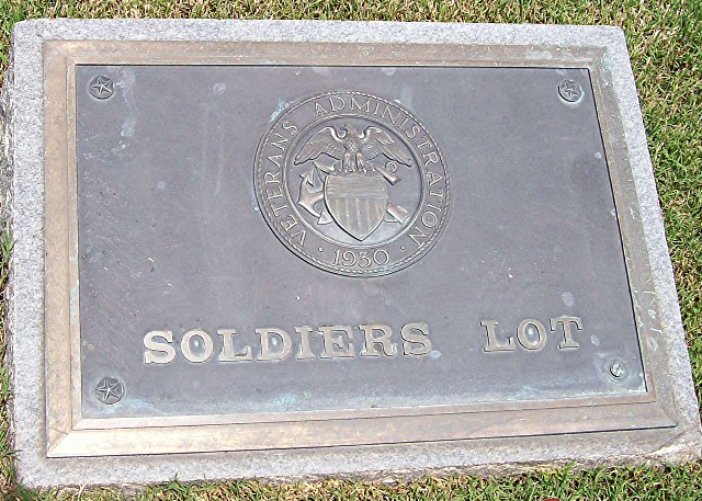
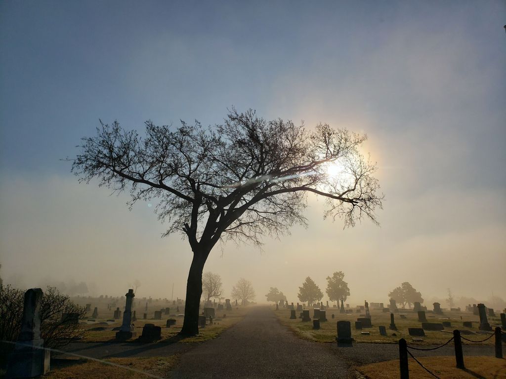
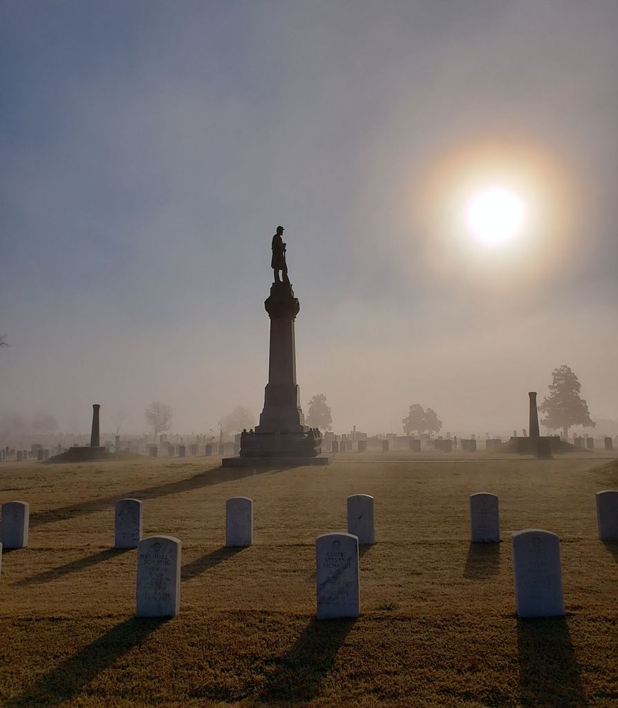
| Description | : | Baxter Springs Soldier's Lot is located inside the Baxter Springs City Cemetery and is administered as a separate cemetery by the US Veteran's Administration as a National Cemetery. Link to the VA Cemetery page: Baxter Springs City Cemetery Soldiers' Lot ------------------- HISTORICAL INFORMATION Baxter Springs Soldiers' Lot is located in the north-central portion of the city cemetery in Baxter Springs, Kansas, approximately 60 miles south of Fort Scott. The cemetery may have been in use before the city of Baxter Springs was incorporated in 1868. The city of Baxter Springs donated the 0.7-acre soldiers' lot to the United States incrementally after the Civil War in... Read More |
frequently asked questions (FAQ):
-
Where is Baxter Springs City Cemetery Soldiers' Lot?
Baxter Springs City Cemetery Soldiers' Lot is located at Hwy 166, approx. 2 miles west of Baxter Springs, KS. Baxter Springs, Cherokee County ,Kansas , 66713USA.
-
Baxter Springs City Cemetery Soldiers' Lot cemetery's updated grave count on graveviews.com?
25 memorials
-
Where are the coordinates of the Baxter Springs City Cemetery Soldiers' Lot?
Latitude: 37.0320810
Longitude: -94.7706520

Nearby Cemetories:
1. Baxter Springs Cemetery
Baxter Springs, Cherokee County, USA
Coordinate: 37.0318985, -94.7696991
2. Ferris Cemetery
Baxter Springs, Cherokee County, USA
Coordinate: 37.0459160, -94.7726380
3. Pleasantview Cemetery
Baxter Springs, Cherokee County, USA
Coordinate: 37.0675011, -94.7574997
4. Usrey Family Cemetery
Baxter Springs, Cherokee County, USA
Coordinate: 37.0784400, -94.7580200
5. Dockery Family Cemetery
Riverton, Cherokee County, USA
Coordinate: 37.0789700, -94.7950800
6. Lowell Cemetery
Lowell, Cherokee County, USA
Coordinate: 37.0388985, -94.7007980
7. Pence Cemetery
Baxter Springs, Cherokee County, USA
Coordinate: 37.0128100, -94.6936900
8. Beasley Cemetery
Treece, Cherokee County, USA
Coordinate: 37.0758018, -94.8311005
9. Quaker Valley Cemetery
Riverton, Cherokee County, USA
Coordinate: 37.0828018, -94.7174988
10. Gandy Cemetery
Riverton, Cherokee County, USA
Coordinate: 37.0670700, -94.6918900
11. Brush Creek Cemetery
Columbus, Cherokee County, USA
Coordinate: 37.1175003, -94.7733002
12. Stevenson Cemetery
Galena, Cherokee County, USA
Coordinate: 37.0749300, -94.6729100
13. Faith Community Cemetery
Galena, Cherokee County, USA
Coordinate: 37.0719300, -94.6709000
14. Greenlawn Cemetery
Columbus, Cherokee County, USA
Coordinate: 37.0446600, -94.8823900
15. Green Family Cemetery
Quapaw, Ottawa County, USA
Coordinate: 36.9690100, -94.6853800
16. Newman Cemetery
Ottawa County, USA
Coordinate: 36.9752998, -94.6761017
17. Stafford-Shapp Memorial Cemetery
Ottawa County, USA
Coordinate: 36.9373130, -94.7537270
18. Hill Crest Cemetery
Galena, Cherokee County, USA
Coordinate: 37.0757904, -94.6624374
19. Griffin Cemetery
Ottawa County, USA
Coordinate: 36.9353485, -94.7471237
20. Saint Marys Quapaw Cemetery
Ottawa County, USA
Coordinate: 36.9325400, -94.7543400
21. Hoffman-Quapaw Family Cemetery
Ottawa County, USA
Coordinate: 36.9425200, -94.7118800
22. Beattie Family Cemetery
Quapaw, Ottawa County, USA
Coordinate: 36.9583028, -94.6838727
23. Boston Mills-Cox Cemetery
Cherokee County, USA
Coordinate: 37.1096820, -94.6871280
24. Quapaw Family Cemetery
Lincolnville, Ottawa County, USA
Coordinate: 36.9296532, -94.7567368