
| Memorials | : | 0 |
| Location | : | Fruit Hill, Hamilton County, USA |
| Coordinate | : | 39.0631900, -84.3635600 |
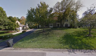
| Description | : | The cemetery is located on top of a hill on the west side of Markley Road north of Bennett Road and 0.5 miles north of Five Mile Road. The cemetery is 0.1 acres in size with the first burial in 1837 and last in 1910. The cemetery was established on 1 November 1885. The map location is approximate based upon historical descriptions of the location. The cemetery is located in Anderson Township, Hamilton County, Ohio, and is # 4514 (Bennett Cemetery / Liberty Chapel) in “Ohio Cemeteries 1803-2003”, compiled by the Ohio Genealogical Society. |
frequently asked questions (FAQ):
-
Where is Bennett Cemetery?
Bennett Cemetery is located at Markley Road Fruit Hill, Hamilton County ,Ohio , 45230USA.
-
Bennett Cemetery cemetery's updated grave count on graveviews.com?
0 memorials
-
Where are the coordinates of the Bennett Cemetery?
Latitude: 39.0631900
Longitude: -84.3635600
Nearby Cemetories:
1. Guardian Angels Cemetery
Mount Washington, Hamilton County, USA
Coordinate: 39.0741997, -84.3613968
2. Five Mile Church Cemetery
Cincinnati, Hamilton County, USA
Coordinate: 39.0532930, -84.3745010
3. Stagg Farm Cemetery
Fruit Hill, Hamilton County, USA
Coordinate: 39.0784970, -84.3624470
4. Asbury Cemetery
Asbury, Hamilton County, USA
Coordinate: 39.0657997, -84.3432999
5. Salem Cemetery
Salem Heights, Hamilton County, USA
Coordinate: 39.0751000, -84.3919000
6. Saint Timothys Episcopal Church Columbarium
Cincinnati, Hamilton County, USA
Coordinate: 39.0725680, -84.3304500
7. Bridges Family Cemetery
Sherwood Village, Hamilton County, USA
Coordinate: 39.0909090, -84.3609590
8. Clough Baptist Church Cemetery
Newtown, Hamilton County, USA
Coordinate: 39.0931015, -84.3660965
9. Hillcrest Cemetery
Hamilton County, USA
Coordinate: 39.0691986, -84.4030991
10. Mount Washington Cemetery
Mount Washington, Hamilton County, USA
Coordinate: 39.0904503, -84.3888702
11. Ayer Family Cemetery #1
Asbury, Hamilton County, USA
Coordinate: 39.0357860, -84.3376150
12. Wolfangel Cemetery #3
Newtown, Hamilton County, USA
Coordinate: 39.0970790, -84.3538300
13. Lutheran Church of the Resurrection Memorial Garden
Anderson Township, Hamilton County, USA
Coordinate: 39.0871100, -84.3299790
14. Ayres Cemetery #2
Forestville, Hamilton County, USA
Coordinate: 39.0610580, -84.3165890
15. Saint Anne Convent Cemetery
Melbourne, Campbell County, USA
Coordinate: 39.0284030, -84.3801510
16. Durham Family Cemetery (Defunct)
Forestville, Hamilton County, USA
Coordinate: 39.0658798, -84.3145294
17. Tucker Family Cemetery
Melbourne, Campbell County, USA
Coordinate: 39.0157000, -84.3788010
18. Nine Mile Cemetery
Ninemile, Clermont County, USA
Coordinate: 39.0654760, -84.2990550
19. Saint John Lutheran Church Cemetery
Camp Springs, Campbell County, USA
Coordinate: 39.0144150, -84.3826140
20. John Family Cemetery
Ninemile, Clermont County, USA
Coordinate: 39.0369240, -84.3030760
21. Mount Moriah Cemetery
Withamsville, Clermont County, USA
Coordinate: 39.0706177, -84.2906036
22. Medaris Family Cemetery
Pierce Township, Clermont County, USA
Coordinate: 39.0358167, -84.2912167
23. Martin Cemetery #1
Newtown, Hamilton County, USA
Coordinate: 39.1259280, -84.3621190
24. Rose Hill Cemetery
Cincinnati, Hamilton County, USA
Coordinate: 39.1138458, -84.3136292