
| Memorials | : | 0 |
| Location | : | Saale-Orla-Kreis, Germany |
| Coordinate | : | 50.5842860, 11.8035650 |
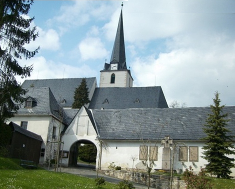
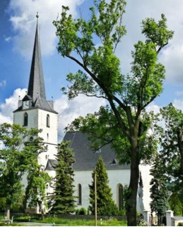
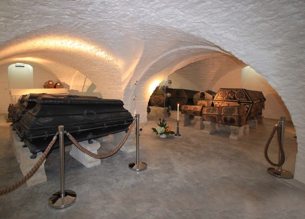
| Description | : | The Bergkirche in Schleiz is located on the Bergfriedhof. It has been the burial place for several members of the royal house of Reuss-Schleiz. Underneath the Baroque church are several crypts. The von Reuss family, named all of their male children Heinrich (English: Henry) since the end of the 12th century in honour of Henry VI, Holy Roman Emperor (1190–97), to whom they owed the estates of Weida and Gera. The head of each branch of the family bore the German title Fürst (Prince) as did their children. After World War I, the Reuss territories were unified in 1919 as the... Read More |
frequently asked questions (FAQ):
-
Where is Bergkirche St. Marien in Schleiz?
Bergkirche St. Marien in Schleiz is located at Village of Schleiz, Bergstrasse 11 Saale-Orla-Kreis ,Thüringen ,Germany.
-
Bergkirche St. Marien in Schleiz cemetery's updated grave count on graveviews.com?
0 memorials
-
Where are the coordinates of the Bergkirche St. Marien in Schleiz?
Latitude: 50.5842860
Longitude: 11.8035650
Nearby Cemetories:
1. Bergfriedhof in Schleiz
Saale-Orla-Kreis, Germany
Coordinate: 50.5832810, 11.8033930
2. Löhma Friedhof
Lohma, Saale-Orla-Kreis, Germany
Coordinate: 50.6117810, 11.8526237
3. Friedhof Gräfenwarth
Saale-Orla-Kreis, Germany
Coordinate: 50.5296820, 11.7507200
4. Schöndorf Friedhof
Schondorf, Saale-Orla-Kreis, Germany
Coordinate: 50.6182343, 11.6945198
5. Friedhof Zeulenroda
Landkreis Greiz, Germany
Coordinate: 50.6443040, 11.9818400
6. Sankt Christophorus
Ebersdorf, Saale-Orla-Kreis, Germany
Coordinate: 50.4852034, 11.6670510
7. Stadtfriedhof
Hirschberg, Saale-Orla-Kreis, Germany
Coordinate: 50.4115120, 11.8106840
8. Krölpaer Friedhof
Krölpa, Saale-Orla-Kreis, Germany
Coordinate: 50.6791650, 11.5325350
9. Friedhof Könitz
Unterwellenborn, Landkreis Saalfeld-Rudolstädt, Germany
Coordinate: 50.6536246, 11.4887529
10. Herzogliche Grabstätten
Trockenborn-Wolfersdorf, Saale-Holzland-Kreis, Germany
Coordinate: 50.7865170, 11.6976960
11. Friedhof Renthendorf
Renthendorf, Saale-Holzland-Kreis, Germany
Coordinate: 50.8070310, 11.8476510
12. Friedhof II
Plauen, Vogtlandkreis, Germany
Coordinate: 50.4973000, 12.1378200
13. Friedhof Grosskamsdorf
Grosskamsdorf, Saale-Orla-Kreis, Germany
Coordinate: 50.6456313, 11.4547378
14. KZ Laura
Schmiedebach, Landkreis Saalfeld-Rudolstädt, Germany
Coordinate: 50.4906650, 11.4719680
15. Friedhof I
Plauen, Vogtlandkreis, Germany
Coordinate: 50.5059295, 12.1453020
16. Johanniskirche
Plauen, Vogtlandkreis, Germany
Coordinate: 50.4932097, 12.1377472
17. Sankt Marien
Weida, Landkreis Greiz, Germany
Coordinate: 50.7721700, 12.0615000
18. Hauptfriedhof
Plauen, Vogtlandkreis, Germany
Coordinate: 50.4905450, 12.1720910
19. Kahla Friedhof
Kahla, Saale-Holzland-Kreis, Germany
Coordinate: 50.8019101, 11.5796081
20. Stadtkirche St Marien
Greiz, Landkreis Greiz, Germany
Coordinate: 50.6560000, 12.1995000
21. Friedhof Hof
Hof, Stadtkreis Hof, Germany
Coordinate: 50.3300050, 11.9181600
22. Friedhof Hof
Hof, Stadtkreis Hof, Germany
Coordinate: 50.3280194, 11.9143828
23. St. Michaeliskirche
Hof, Stadtkreis Hof, Germany
Coordinate: 50.3219160, 11.9199880
24. Nordhalben Cemetery
Nordhalben, Landkreis Kronach, Germany
Coordinate: 50.3757727, 11.5117363