
| Memorials | : | 3848 |
| Location | : | Malvern, Carroll County, USA |
| Coordinate | : | 40.6925011, -81.1588974 |
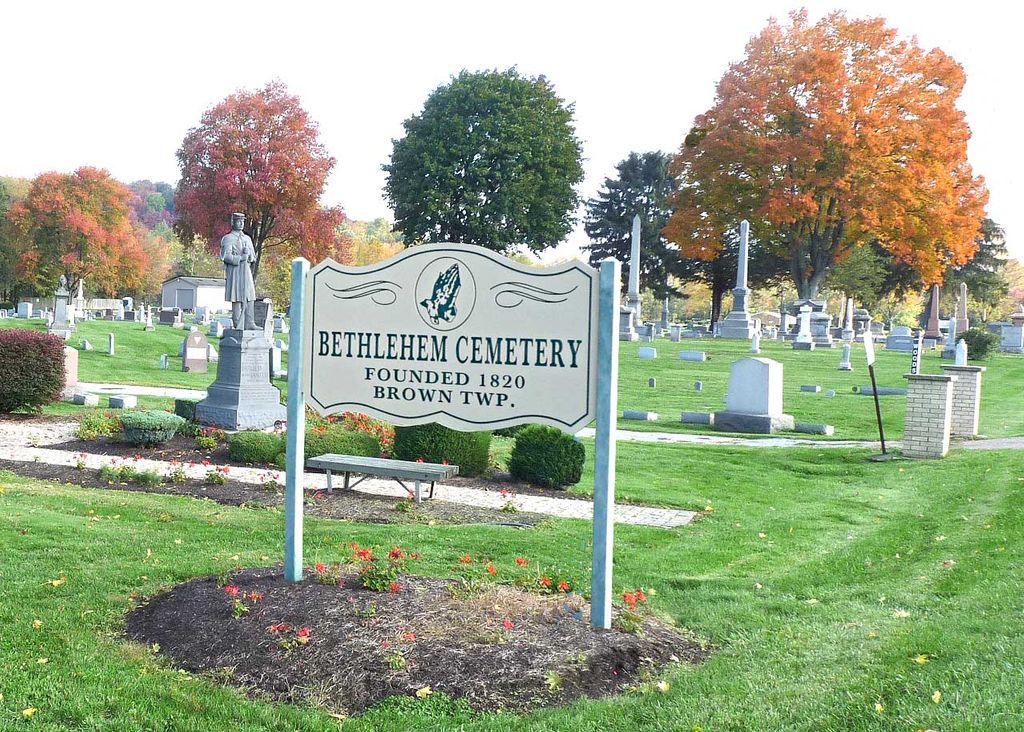
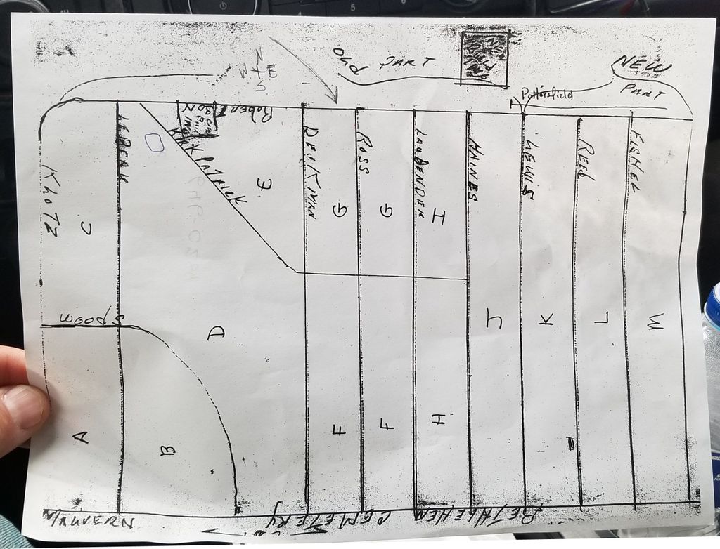
| Description | : | The cemetery is located on the west side of Alliance Road NW (Ohio State Route 183) about 0.3 miles north of its intersection with Canton Road NW (Ohio State Route 43). The cemetery was established in 1820. The cemetery is located in Brown Township, Carroll County, Ohio, and is # 1389 (Bethehem Cemetery / Malvern Cemetery) in “Ohio Cemeteries 1803-2003”, compiled by the Ohio Genealogical Society. The cemetery is registered with the Ohio Division of Real Estate and Professional Licensing (ODRE) as the Bethlehem Cemetery with registration license number CGR.0000980441. The U.S. Geological Survey (USGS) Geographic Names... Read More |
frequently asked questions (FAQ):
-
Where is Bethlehem Cemetery?
Bethlehem Cemetery is located at State Route 183 Malvern, Carroll County ,Ohio , 44644USA.
-
Bethlehem Cemetery cemetery's updated grave count on graveviews.com?
3842 memorials
-
Where are the coordinates of the Bethlehem Cemetery?
Latitude: 40.6925011
Longitude: -81.1588974
Nearby Cemetories:
1. Saint Francis Xavier Cemetery
Malvern, Carroll County, USA
Coordinate: 40.6880989, -81.1742020
2. Hardesty Cemetery
Malvern, Carroll County, USA
Coordinate: 40.6925011, -81.1766968
3. Bever Cemetery
Carroll County, USA
Coordinate: 40.7117004, -81.1414032
4. Pekin Cemetery
Pekin, Carroll County, USA
Coordinate: 40.7158940, -81.1308110
5. Devils Half Acre Cemetery
Oneida, Carroll County, USA
Coordinate: 40.6697006, -81.1235962
6. Pekin Burial Ground
Pekin, Carroll County, USA
Coordinate: 40.7170380, -81.1254630
7. Liberty Cemetery
Minerva, Stark County, USA
Coordinate: 40.7290001, -81.1529999
8. Salem Cemetery
Stark County, USA
Coordinate: 40.7230988, -81.2089005
9. Pleasant Grove Cemetery
Carroll County, USA
Coordinate: 40.6589012, -81.1089020
10. Valley Street Cemetery
Carroll County, USA
Coordinate: 40.7248001, -81.1065979
11. Slagle Cemetery
Paris, Stark County, USA
Coordinate: 40.7428017, -81.1449966
12. Chestnut Knob Cemetery
Carroll County, USA
Coordinate: 40.6772003, -81.0886002
13. Hewitt-Creighton Cemetery
Malvern, Carroll County, USA
Coordinate: 40.6721110, -81.2302710
14. East Lawn Cemetery
Minerva, Stark County, USA
Coordinate: 40.7289009, -81.0960999
15. Woods Cemetery
Carroll County, USA
Coordinate: 40.6377983, -81.1947021
16. New Harrisburg Cemetery
New Harrisburg, Carroll County, USA
Coordinate: 40.6208000, -81.1483002
17. Harsh-Swamp Cemetery
Carroll County, USA
Coordinate: 40.6413994, -81.0892029
18. Robertsville Cemetery
Robertsville, Stark County, USA
Coordinate: 40.7637000, -81.1889000
19. Glass Cemetery
Mapleton, Stark County, USA
Coordinate: 40.7301370, -81.2469010
20. Macedonia Cemetery
Carroll County, USA
Coordinate: 40.6217003, -81.1994019
21. Heritage Memorial Gardens
Paris Township, Stark County, USA
Coordinate: 40.7498016, -81.0898972
22. Waynesburg Cemetery
Waynesburg, Stark County, USA
Coordinate: 40.6688995, -81.2566986
23. Plaines Cemetery
West Township, Columbiana County, USA
Coordinate: 40.7419270, -81.0762320
24. Moore Cemetery
Augusta, Carroll County, USA
Coordinate: 40.7064018, -81.0539017