
| Memorials | : | 26 |
| Location | : | Low Gap, Boone County, USA |
| Coordinate | : | 38.0175300, -81.8670600 |
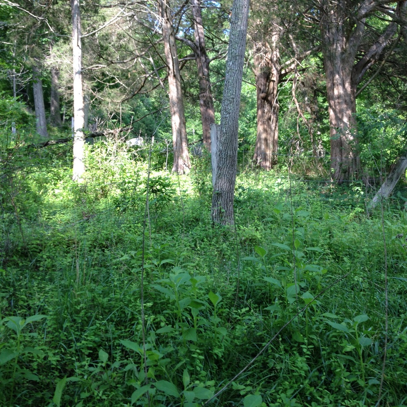
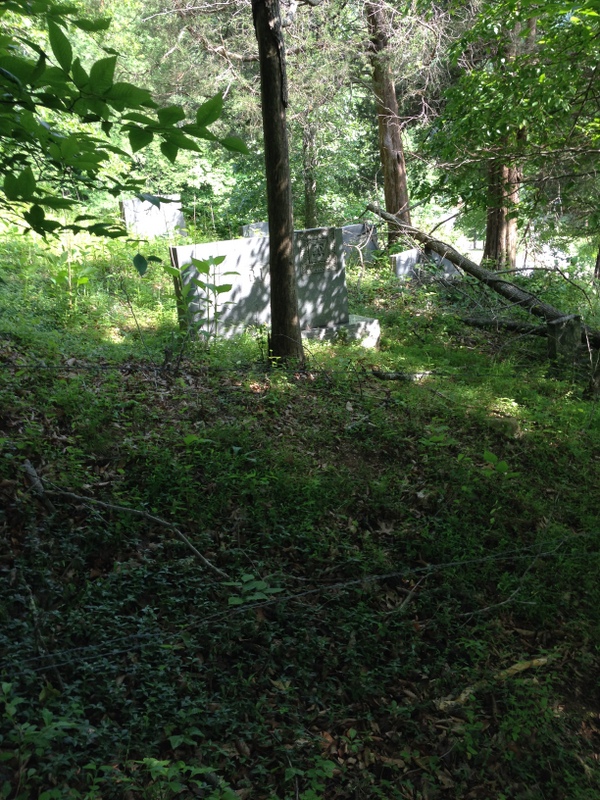
| Description | : | Directions: travel South from Danville, WV on US 119. Turn left onto Low Gap Road; travel approx. 1 mile to Jimmie Hollow Road on left. Bias Cemetery is located on the mountain immediately to the right beside the Buckner residence and the mountain opposite of the Miller/A.C. Canterbury Cemetery. No parking and no path to cemetery; extremely hard uphill climb crossing thru barbed wire fence; cemetery in poor condition but tree removal and clearing scheduled summer of 2014; many stones overturned, broken or buried in undergrowth. |
frequently asked questions (FAQ):
-
Where is Bias Cemetery?
Bias Cemetery is located at Low Gap, Boone County ,West Virginia ,USA.
-
Bias Cemetery cemetery's updated grave count on graveviews.com?
26 memorials
-
Where are the coordinates of the Bias Cemetery?
Latitude: 38.0175300
Longitude: -81.8670600
Nearby Cemetories:
1. Canterbury Cemetery
Low Gap, Boone County, USA
Coordinate: 38.0176900, -81.8674000
2. Bias Cemetery
Boone County, USA
Coordinate: 38.0175018, -81.8660965
3. Floyd Miller Cemetery
Danville, Boone County, USA
Coordinate: 38.0197780, -81.8714420
4. Miller Cemetery
Low Gap, Boone County, USA
Coordinate: 38.0193700, -81.8519700
5. Danville Memorial Park
Danville, Boone County, USA
Coordinate: 38.0313750, -81.8721900
6. Pauley Family Cemetery
Greenview, Boone County, USA
Coordinate: 37.9991989, -81.8542023
7. Robert C. Ball Cemetery
Greenview, Boone County, USA
Coordinate: 37.9998400, -81.8504300
8. Rufus C. Ball Cemetery
Greenview, Boone County, USA
Coordinate: 38.0000100, -81.8471200
9. Ball Cemetery
Boone County, USA
Coordinate: 37.9996986, -81.8469009
10. Burwell Ballard Cemetery
Low Gap, Boone County, USA
Coordinate: 38.0280310, -81.8344330
11. Memory Gardens
Madison, Boone County, USA
Coordinate: 38.0281200, -81.8340700
12. Cox's Fork Osborne Cemetery
Boone County, USA
Coordinate: 38.0310350, -81.8986280
13. Caldwell Cemetery
Madison, Boone County, USA
Coordinate: 38.0261490, -81.8324140
14. Bell Cemetery
Boone County, USA
Coordinate: 38.0130997, -81.9041977
15. Allen Cemetery
Low Gap, Boone County, USA
Coordinate: 38.0307190, -81.8331730
16. Family Gardens Cemetery
Low Gap, Boone County, USA
Coordinate: 38.0272700, -81.8311300
17. Hager Cemetery
Boone County, USA
Coordinate: 37.9892006, -81.8443985
18. Green Family Cemetery
Bandytown, Boone County, USA
Coordinate: 38.0581017, -81.8653030
19. Powell Cemetery
Greenview, Boone County, USA
Coordinate: 37.9944000, -81.8233032
20. Boone Memorial Park
Madison, Boone County, USA
Coordinate: 38.0484630, -81.8312900
21. Kentucky Knoll Cemetery
Boone County, USA
Coordinate: 37.9977989, -81.8197021
22. Campbell Family Cemetery
Hewett, Boone County, USA
Coordinate: 37.9819565, -81.9001617
23. Cook Cemetery
Boone County, USA
Coordinate: 37.9831009, -81.8305969
24. Nelson Cemetery
Hewett, Boone County, USA
Coordinate: 37.9707260, -81.8617490