
| Memorials | : | 40 |
| Location | : | Low Gap, Boone County, USA |
| Coordinate | : | 38.0176900, -81.8674000 |
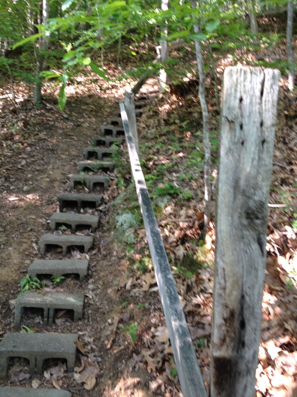
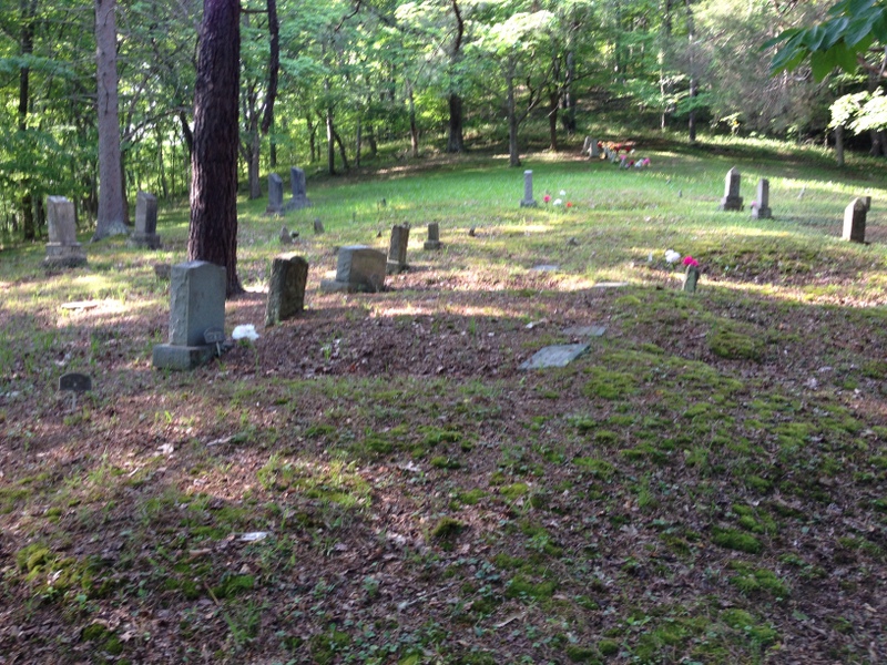
| Description | : | Note names on headstones are spelled Canterberry. Many Mitchell, Miller and Bias headstones; many illegible headstones in this cemetery. Directions: From Danville, WV, take US 119 South. Turn left on Low Gap Road. Travel approx. 1 mile to Jimmie Hollow Road on left. This cemetery is located on the left mountain, directly across the road from the Buckner residence (on the opposite mountain from the Bias Cemetery) and is evidenced by a small, concreted drainage beside the hollow road. The path is clear but becomes steep. The steeper portions have block steps and a handrail making... Read More |
frequently asked questions (FAQ):
-
Where is Canterbury Cemetery?
Canterbury Cemetery is located at Low Gap, Boone County ,West Virginia ,USA.
-
Canterbury Cemetery cemetery's updated grave count on graveviews.com?
40 memorials
-
Where are the coordinates of the Canterbury Cemetery?
Latitude: 38.0176900
Longitude: -81.8674000
Nearby Cemetories:
1. Bias Cemetery
Low Gap, Boone County, USA
Coordinate: 38.0175300, -81.8670600
2. Bias Cemetery
Boone County, USA
Coordinate: 38.0175018, -81.8660965
3. Floyd Miller Cemetery
Danville, Boone County, USA
Coordinate: 38.0197780, -81.8714420
4. Miller Cemetery
Low Gap, Boone County, USA
Coordinate: 38.0193700, -81.8519700
5. Danville Memorial Park
Danville, Boone County, USA
Coordinate: 38.0313750, -81.8721900
6. Pauley Family Cemetery
Greenview, Boone County, USA
Coordinate: 37.9991989, -81.8542023
7. Robert C. Ball Cemetery
Greenview, Boone County, USA
Coordinate: 37.9998400, -81.8504300
8. Rufus C. Ball Cemetery
Greenview, Boone County, USA
Coordinate: 38.0000100, -81.8471200
9. Ball Cemetery
Boone County, USA
Coordinate: 37.9996986, -81.8469009
10. Burwell Ballard Cemetery
Low Gap, Boone County, USA
Coordinate: 38.0280310, -81.8344330
11. Cox's Fork Osborne Cemetery
Boone County, USA
Coordinate: 38.0310350, -81.8986280
12. Memory Gardens
Madison, Boone County, USA
Coordinate: 38.0281200, -81.8340700
13. Caldwell Cemetery
Madison, Boone County, USA
Coordinate: 38.0261490, -81.8324140
14. Bell Cemetery
Boone County, USA
Coordinate: 38.0130997, -81.9041977
15. Allen Cemetery
Low Gap, Boone County, USA
Coordinate: 38.0307190, -81.8331730
16. Family Gardens Cemetery
Low Gap, Boone County, USA
Coordinate: 38.0272700, -81.8311300
17. Hager Cemetery
Boone County, USA
Coordinate: 37.9892006, -81.8443985
18. Green Family Cemetery
Bandytown, Boone County, USA
Coordinate: 38.0581017, -81.8653030
19. Powell Cemetery
Greenview, Boone County, USA
Coordinate: 37.9944000, -81.8233032
20. Boone Memorial Park
Madison, Boone County, USA
Coordinate: 38.0484630, -81.8312900
21. Kentucky Knoll Cemetery
Boone County, USA
Coordinate: 37.9977989, -81.8197021
22. Campbell Family Cemetery
Hewett, Boone County, USA
Coordinate: 37.9819565, -81.9001617
23. Cook Cemetery
Boone County, USA
Coordinate: 37.9831009, -81.8305969
24. Nelson Cemetery
Hewett, Boone County, USA
Coordinate: 37.9707260, -81.8617490