
| Memorials | : | 0 |
| Location | : | Bath and North East Somerset Unitary Authority, England |
| Coordinate | : | 51.3341900, -2.5958300 |
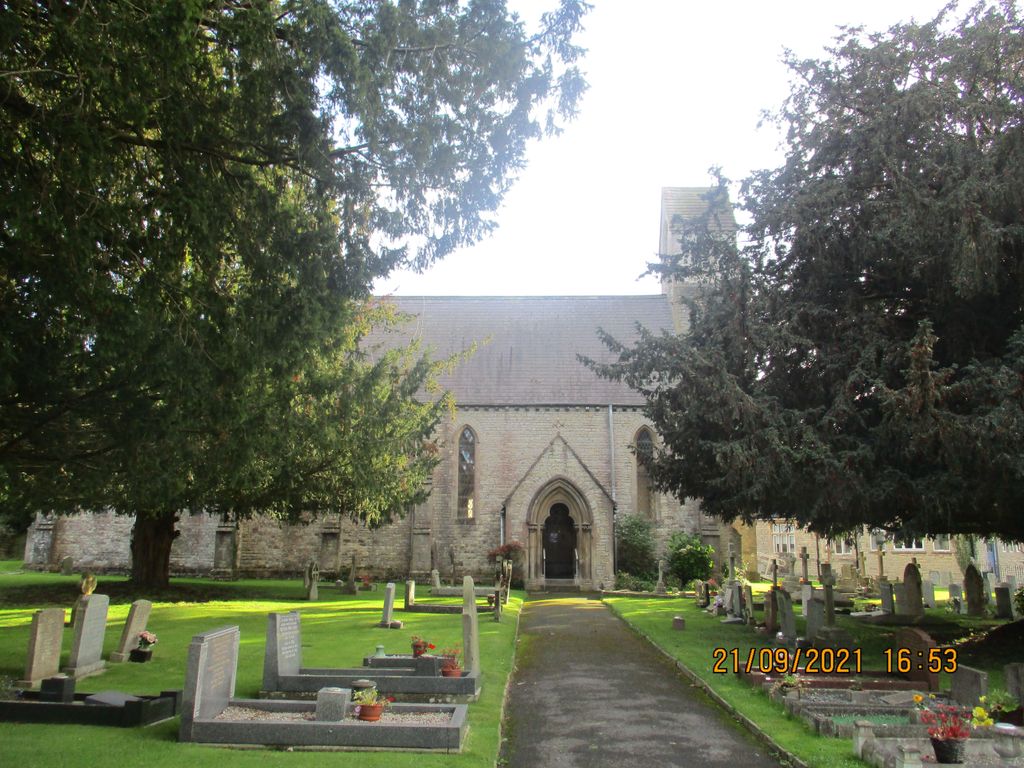
| Description | : | Bishop Sutton is a small village in Somerset, south of Chew Valley Lake and north of the Mendip Hills, approximately ten miles south of Bristol on the A368, Weston-super-Mare to Bath road. Bishop Sutton and the neighbouring village of Stowey form the civil parish of Stowey Sutton. |
frequently asked questions (FAQ):
-
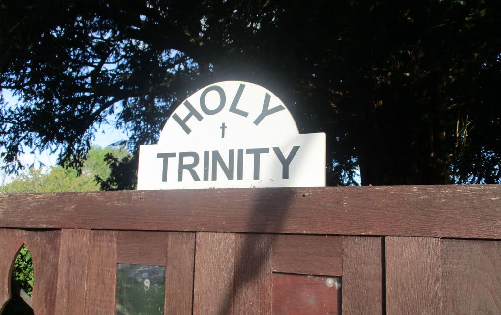
Where is Bishop's Sutton Holy Trinity Churchyard?
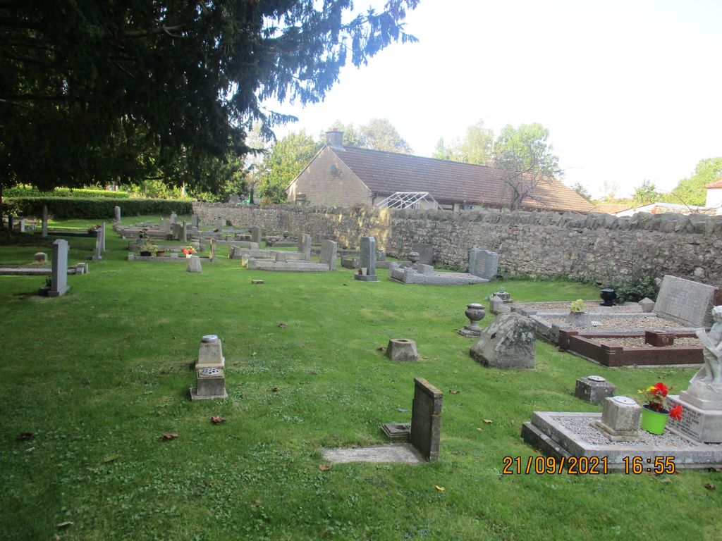
Bishop's Sutton Holy Trinity Churchyard is located at Wick Road Bath and North East Somerset Unitary Authority ,Somerset , BS39 5XDEngland.
-
Bishop's Sutton Holy Trinity Churchyard cemetery's updated grave count on graveviews.com?
0 memorials
-
Where are the coordinates of the Bishop's Sutton Holy Trinity Churchyard?
Latitude: 51.3341900
Longitude: -2.5958300

Nearby Cemetories:
1. St Nicholas & the Blessed Virgin Mary
Stowey Sutton, Bath and North East Somerset Unitary Authority, England
Coordinate: 51.3329190, -2.5764850
2. St Margarets Churchyard
Hinton Blewett, Bath and North East Somerset Unitary Authority, England
Coordinate: 51.3104000, -2.5834000
3. St. James' Churchyard
Cameley, Bath and North East Somerset Unitary Authority, England
Coordinate: 51.3158560, -2.5606190
4. Chew Stoke Methodist Churchyard
Chew Stoke, Bath and North East Somerset Unitary Authority, England
Coordinate: 51.3518196, -2.6332706
5. Chew Magna Baptist Churchyard
Chew Magna, Bath and North East Somerset Unitary Authority, England
Coordinate: 51.3648736, -2.6094282
6. St. Andrew's Churchyard
Chew Magna, Bath and North East Somerset Unitary Authority, England
Coordinate: 51.3664560, -2.6089140
7. St Mary the Virgin Churchyard
Stanton Drew, Bath and North East Somerset Unitary Authority, England
Coordinate: 51.3657390, -2.5788440
8. St. Andrew's Churchyard
Chew Stoke, Bath and North East Somerset Unitary Authority, England
Coordinate: 51.3548580, -2.6379190
9. Harptree Cemetery
East Harptree, Bath and North East Somerset Unitary Authority, England
Coordinate: 51.3056390, -2.6238890
10. Saint Augustine of Hippo
Clutton, Bath and North East Somerset Unitary Authority, England
Coordinate: 51.3281990, -2.5430220
11. Saint Laurence Churchyard
East Harptree, Bath and North East Somerset Unitary Authority, England
Coordinate: 51.3011730, -2.6245740
12. St Michael the Archangel Churchyard
Compton Martin, Bath and North East Somerset Unitary Authority, England
Coordinate: 51.3107380, -2.6534510
13. Saint Mary the Virgin Churchyard
Litton, Mendip District, England
Coordinate: 51.2899860, -2.5838440
14. Saint Thomas Churchyard
Pensford, Bath and North East Somerset Unitary Authority, England
Coordinate: 51.3710450, -2.5495820
15. Pensford Methodist Churchyard
Pensford, Bath and North East Somerset Unitary Authority, England
Coordinate: 51.3731030, -2.5506730
16. The Blessed Virgin Mary Churchyard
Nempnett Thrubwell, Bath and North East Somerset Unitary Authority, England
Coordinate: 51.3407560, -2.6720673
17. Blessed Virgin Mary Churchyard
Nempnett Thrubwell, Bath and North East Somerset Unitary Authority, England
Coordinate: 51.3407790, -2.6721100
18. Saint Leonard Churchyard
Chelwood, Bath and North East Somerset Unitary Authority, England
Coordinate: 51.3546300, -2.5246880
19. St. Mary's Churchyard
West Harptree, Bath and North East Somerset Unitary Authority, England
Coordinate: 51.3032530, -2.6582110
20. Holy Trinity Churchyard
Norton Malreward, Bath and North East Somerset Unitary Authority, England
Coordinate: 51.3831750, -2.5711360
21. St. Bartholomew Churchyard
Ubley, Bath and North East Somerset Unitary Authority, England
Coordinate: 51.3214600, -2.6766900
22. All Saints Churchyard
Publow, Bath and North East Somerset Unitary Authority, England
Coordinate: 51.3751100, -2.5423600
23. Holy Trinity Churchyard
High Littleton, Bath and North East Somerset Unitary Authority, England
Coordinate: 51.3195810, -2.5115860
24. St. John the Baptist Churchyard
Farrington Gurney, Bath and North East Somerset Unitary Authority, England
Coordinate: 51.2993710, -2.5248000