
| Memorials | : | 78 |
| Location | : | Blackwell, Kay County, USA |
| Phone | : | (580) 363-3826 |
| Coordinate | : | 36.7752991, -97.2809982 |
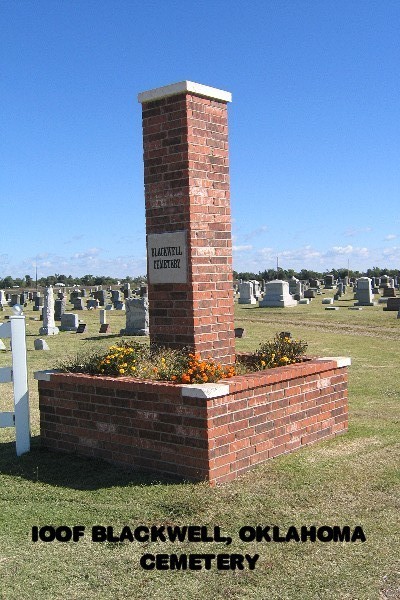
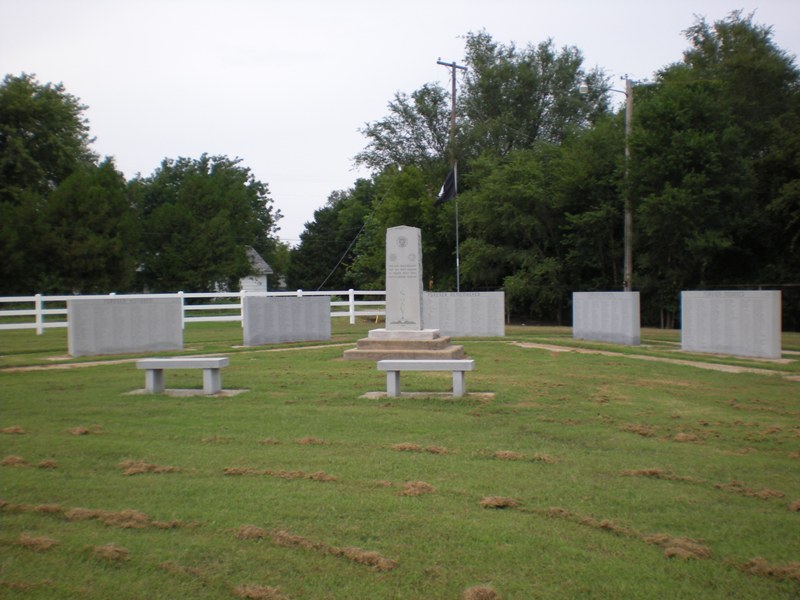
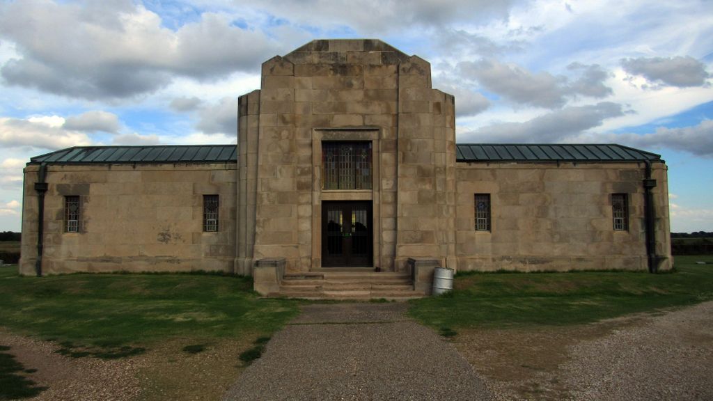
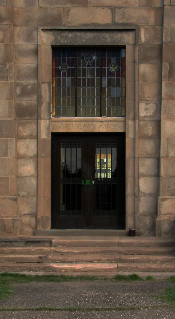
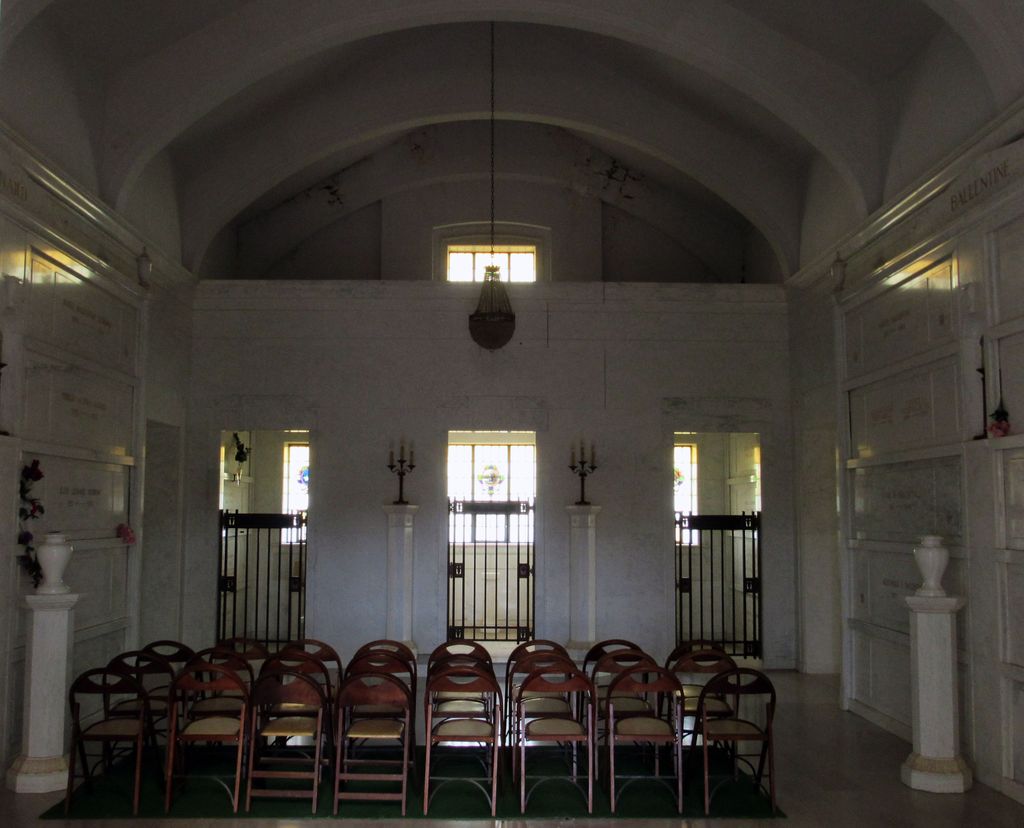
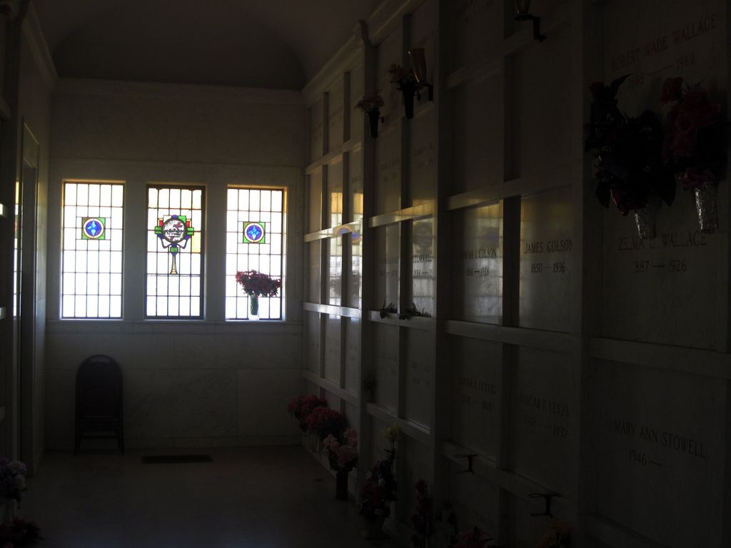
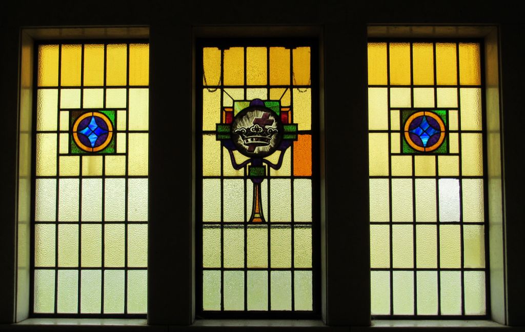
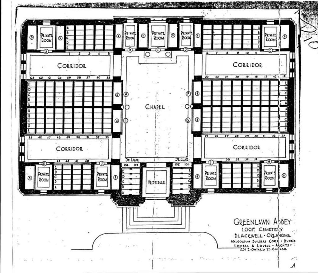
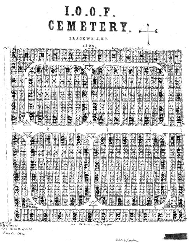
| Description | : | History of the Roberts-IOOF Cemetery A group of people met in a little schoolhouse on South Main Street in Blackwell to organize the Blackwell Independent Order of Odd Fellows (IOOF) Lodge. Twenty-six acres of land were purchased from George Carson for an Odd Fellows cemetery south of town. The ground was plotted and lots were sold in 1894. On July 1, 1894, Lot 8, Block 290 was sold to Walter Butterfield, whose wife was buried on that date. According to lodge records, it was the first burial in the cemetery. Green Lawn Abbey mausoleum was constructed in 1926 by... Read More |
frequently asked questions (FAQ):
-
Where is Blackwell Cemetery?
Blackwell Cemetery is located at S Hwy 177 Blackwell, Kay County ,Oklahoma , 74631USA.
-
Blackwell Cemetery cemetery's updated grave count on graveviews.com?
73 memorials
-
Where are the coordinates of the Blackwell Cemetery?
Latitude: 36.7752991
Longitude: -97.2809982
Nearby Cemetories:
1. Tonkawa IOOF Cemetery
Tonkawa, Kay County, USA
Coordinate: 36.6955800, -97.3242300
2. Saint Johns Cemetery
Blackwell, Kay County, USA
Coordinate: 36.8252983, -97.1900024
3. Round Grove Cemetery
Tonkawa, Kay County, USA
Coordinate: 36.7094002, -97.1967010
4. Tonkawa Indian Cemetery
Tonkawa, Kay County, USA
Coordinate: 36.6726100, -97.2643800
5. Prairie Chapel Cemetery
Blackwell, Kay County, USA
Coordinate: 36.7964400, -97.1400700
6. Banner Cemetery
Kildare, Kay County, USA
Coordinate: 36.8403015, -97.1292038
7. Mount Olive Cemetery
Nardin, Kay County, USA
Coordinate: 36.7957993, -97.4593964
8. Braman Cemetery
Braman, Kay County, USA
Coordinate: 36.9277992, -97.3094025
9. Oak Grove Cemetery
Ponca City, Kay County, USA
Coordinate: 36.6876500, -97.1072600
10. Odd Fellows Cemetery
Ponca City, Kay County, USA
Coordinate: 36.6893997, -97.1046066
11. Eddy New Home Cemetery
Grant County, USA
Coordinate: 36.7311600, -97.4802800
12. Saint Marys Catholic Cemetery
Ponca City, Kay County, USA
Coordinate: 36.6875000, -97.1038971
13. Prairie View Cemetery
Tonkawa, Kay County, USA
Coordinate: 36.6002998, -97.3003006
14. Triumph Cemetery
Kay County, USA
Coordinate: 36.9275017, -97.3917007
15. First Christian Church Columbarium
Ponca City, Kay County, USA
Coordinate: 36.7053210, -97.0788450
16. River View Cemetery
Alcorn, Kay County, USA
Coordinate: 36.6300621, -97.4076996
17. Resthaven Memorial Park
Ponca City, Kay County, USA
Coordinate: 36.7550011, -97.0588989
18. Grace Episcopal Church Columbarium
Ponca City, Kay County, USA
Coordinate: 36.7037630, -97.0683930
19. Ponca Tribal Cemetery
Ponca City, Kay County, USA
Coordinate: 36.6432991, -97.1132965
20. Bayard Cemetery
Deer Creek, Grant County, USA
Coordinate: 36.7747002, -97.5344009
21. Cowboy Hill Cemetery
Ponca City, Kay County, USA
Coordinate: 36.6068993, -97.1380997
22. Plainview Cemetery
Newkirk, Kay County, USA
Coordinate: 36.9775400, -97.2278200
23. Grandview Cemetery
Marland, Noble County, USA
Coordinate: 36.5649400, -97.2792200
24. Darland Cemetery
Deer Creek, Grant County, USA
Coordinate: 36.8400002, -97.5528030