
| Memorials | : | 1 |
| Location | : | Blooming Grove, Franklin County, USA |
| Coordinate | : | 39.5046730, -85.0640869 |
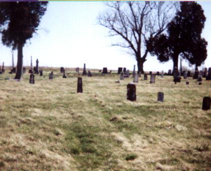
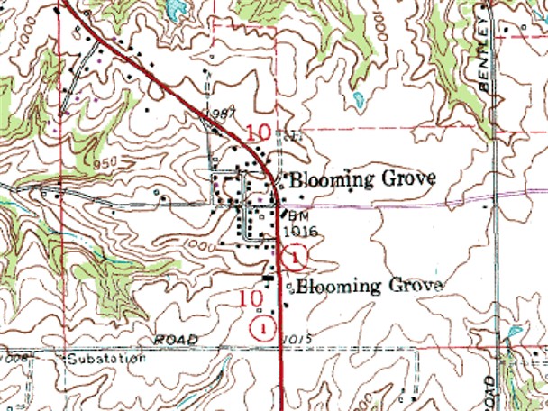
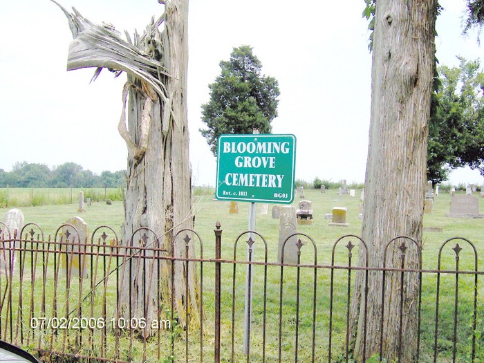
| Description | : | The cemetery is located in Blooming Grove Township (E half of Section 10 Township 12N Range 13E) at the north end of Precht Drive about 0.1 miles north of its intersection with Church Street (Indiana State Highway 1). Indiana Cemetery Locations, Volume 4, published by the Indiana Genealogical Society (April 2009), gives the primary cemetery name as Blooming Grove Cemetery. The cemetery is listed in the Cemetery and Burial Grounds Registry of the Indiana Department of Natural Resources (DNR) and in the State Historical Architectural and Archaeological Research Database (SHAARD) with Cemetery Record Number CR-24-5 (Blooming Grove). The... Read More |
frequently asked questions (FAQ):
-
Where is Blooming Grove Cemetery?
Blooming Grove Cemetery is located at Precht Drive Blooming Grove, Franklin County ,Indiana , 47012USA.
-
Blooming Grove Cemetery cemetery's updated grave count on graveviews.com?
1 memorials
-
Where are the coordinates of the Blooming Grove Cemetery?
Latitude: 39.5046730
Longitude: -85.0640869
Nearby Cemetories:
1. Pettigrew Cemetery
Blooming Grove, Franklin County, USA
Coordinate: 39.5022000, -85.0503000
2. Anspach Farm Cemetery
Blooming Grove, Franklin County, USA
Coordinate: 39.5054450, -85.0453950
3. Allen Burial Ground
Blooming Grove, Franklin County, USA
Coordinate: 39.5165140, -85.0780410
4. McIlwaine Burying Ground
Jackson Township, Fayette County, USA
Coordinate: 39.5274460, -85.0678930
5. Old Parrott Cemetery
Everton, Fayette County, USA
Coordinate: 39.5276580, -85.0867510
6. Duck Creek Stone Church Cemetery
Blooming Grove, Franklin County, USA
Coordinate: 39.5047040, -85.1021030
7. Ebenezer Cemetery
Brookville, Franklin County, USA
Coordinate: 39.4688988, -85.0464020
8. Jim Run Road Cemetery
Blooming Grove Township, Franklin County, USA
Coordinate: 39.5070600, -85.1190410
9. McKendrie Cemetery
Franklin County, USA
Coordinate: 39.4665590, -85.0927430
10. Little Childrens Home Cemetery
Laurel, Franklin County, USA
Coordinate: 39.5131740, -85.1212730
11. Riker Cemetery
Brookville, Franklin County, USA
Coordinate: 39.4494020, -85.0889840
12. Everton Cemetery
Everton, Fayette County, USA
Coordinate: 39.5597649, -85.0901337
13. Sims Cemetery (Defunct)
Liberty, Union County, USA
Coordinate: 39.5309750, -84.9956820
14. Poplar Ridge Cemetery
Everton, Fayette County, USA
Coordinate: 39.5619000, -85.0447000
15. Collett Cemetery
Yellow Bank, Franklin County, USA
Coordinate: 39.4417940, -85.0763440
16. Halstead Cemetery
Brookville, Franklin County, USA
Coordinate: 39.4357010, -85.0788050
17. Warne Cemetery
Brookville, Franklin County, USA
Coordinate: 39.4336000, -85.0472000
18. Wilson Cemetery
Yellow Bank, Franklin County, USA
Coordinate: 39.4303000, -85.0683000
19. Longnecker Cemetery
Metamora, Franklin County, USA
Coordinate: 39.4386000, -85.1086000
20. Sims-Brier Cemetery
Old Bath, Franklin County, USA
Coordinate: 39.5158386, -84.9646606
21. Metamora Cemetery
Metamora, Franklin County, USA
Coordinate: 39.4516449, -85.1391296
22. Calpha Cemetery
Brookville, Franklin County, USA
Coordinate: 39.4260990, -85.0706760
23. Mount Garrison Cemetery
Everton, Fayette County, USA
Coordinate: 39.5842018, -85.0730972
24. Vincent Cemetery
Franklin County, USA
Coordinate: 39.4281000, -85.0328000