
| Memorials | : | 0 |
| Location | : | Blooming Grove, Franklin County, USA |
| Coordinate | : | 39.5047040, -85.1021030 |
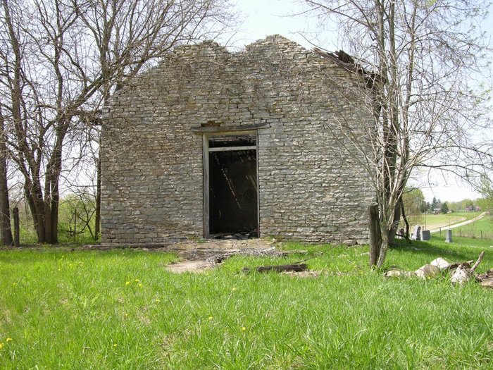
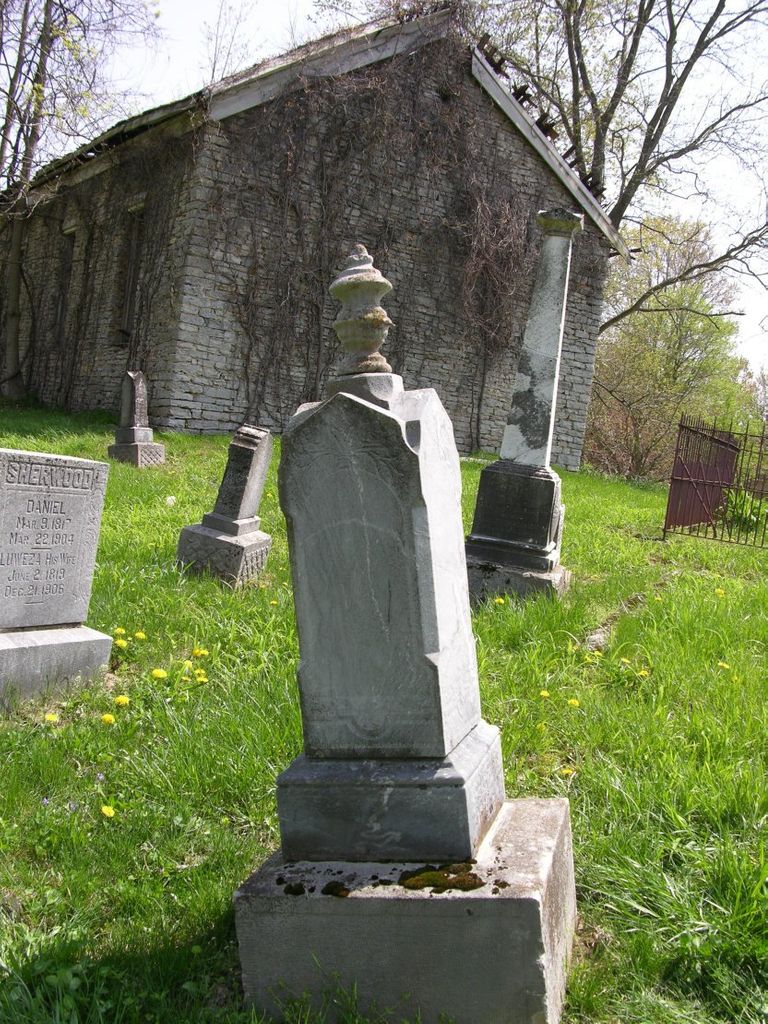
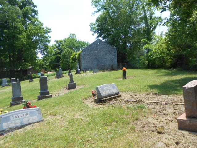
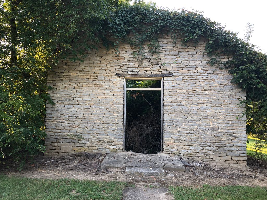
| Description | : | The cemetery is located on the north side of Stone Church Road about 200 feet northwest of its intersection with Upper Smokey Hollow Road. Indiana Cemetery Locations, Volume 4, published by the Indiana Genealogical Society (April 2009), gives the primary cemetery name as Stone Church Cemetery with an alternate name of Duck Creek Cemetery. The cemetery is listed in the Cemetery and Burial Grounds Registry of the Indiana Department of Natural Resources (DNR) and in the State Historical Architectural and Archaeological Research Database (SHAARD) with Cemetery Record Number CR-24-6 (Duck Creek Stone Church / Duck Creek). The Indiana... Read More |
frequently asked questions (FAQ):
-
Where is Duck Creek Stone Church Cemetery?
Duck Creek Stone Church Cemetery is located at 17403 – 17845 Stone Church Road Blooming Grove, Franklin County ,Indiana , 47024USA.
-
Duck Creek Stone Church Cemetery cemetery's updated grave count on graveviews.com?
0 memorials
-
Where are the coordinates of the Duck Creek Stone Church Cemetery?
Latitude: 39.5047040
Longitude: -85.1021030
Nearby Cemetories:
1. Jim Run Road Cemetery
Blooming Grove Township, Franklin County, USA
Coordinate: 39.5070600, -85.1190410
2. Little Childrens Home Cemetery
Laurel, Franklin County, USA
Coordinate: 39.5131740, -85.1212730
3. Allen Burial Ground
Blooming Grove, Franklin County, USA
Coordinate: 39.5165140, -85.0780410
4. Old Parrott Cemetery
Everton, Fayette County, USA
Coordinate: 39.5276580, -85.0867510
5. Blooming Grove Cemetery
Blooming Grove, Franklin County, USA
Coordinate: 39.5046730, -85.0640869
6. McIlwaine Burying Ground
Jackson Township, Fayette County, USA
Coordinate: 39.5274460, -85.0678930
7. McKendrie Cemetery
Franklin County, USA
Coordinate: 39.4665590, -85.0927430
8. Pettigrew Cemetery
Blooming Grove, Franklin County, USA
Coordinate: 39.5022000, -85.0503000
9. Anspach Farm Cemetery
Blooming Grove, Franklin County, USA
Coordinate: 39.5054450, -85.0453950
10. Chance Cemetery
Laurel, Franklin County, USA
Coordinate: 39.5025000, -85.1717000
11. Everton Cemetery
Everton, Fayette County, USA
Coordinate: 39.5597649, -85.0901337
12. Ebenezer Cemetery
Brookville, Franklin County, USA
Coordinate: 39.4688988, -85.0464020
13. Riker Cemetery
Brookville, Franklin County, USA
Coordinate: 39.4494020, -85.0889840
14. Murray Cemetery
Metamora, Franklin County, USA
Coordinate: 39.4653000, -85.1569000
15. Bochim Cemetery
Laurel, Franklin County, USA
Coordinate: 39.5203450, -85.1757820
16. Metamora Cemetery
Metamora, Franklin County, USA
Coordinate: 39.4516449, -85.1391296
17. Laurel North Cemetery
Laurel, Franklin County, USA
Coordinate: 39.5218040, -85.1779590
18. Mobley Addition Church of Christ Cemetery
Metamora, Franklin County, USA
Coordinate: 39.4508270, -85.1449950
19. Conwell Cemetery
Laurel, Franklin County, USA
Coordinate: 39.5047070, -85.1850450
20. Green Cemetery
Nulltown, Fayette County, USA
Coordinate: 39.5583400, -85.1495100
21. Collett Cemetery
Yellow Bank, Franklin County, USA
Coordinate: 39.4417940, -85.0763440
22. Saint Raphael Cemetery
Laurel, Franklin County, USA
Coordinate: 39.5042750, -85.1878510
23. Longnecker Cemetery
Metamora, Franklin County, USA
Coordinate: 39.4386000, -85.1086000
24. Mount Zion Cemetery
Jackson Township, Fayette County, USA
Coordinate: 39.5700900, -85.1261700