
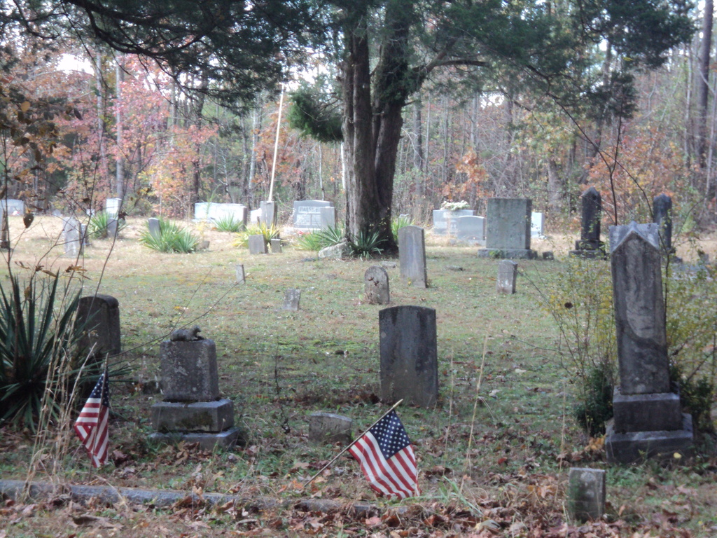
| Memorials | : | 8 |
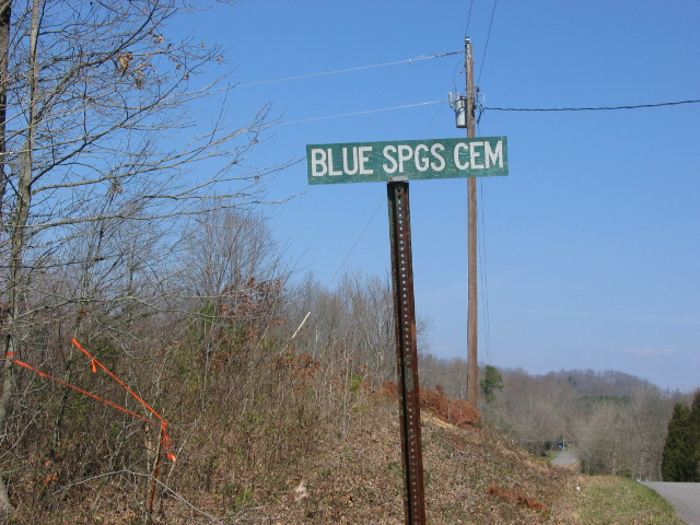
| Location | : | Roane County, USA |
| Coordinate | : | 35.6581001, -84.5785980 |
| Description | : | South of Kingston: From the junction of Highway 59 and Highway 72, travel east on Highway 72 for about 5.5 miles and turn right onto Highway 322. Travel on Highway 322 for about 3.7 miles and turn right onto Johnson Valley Road. Travel on Johnson Valley for 2.5 miles. Turn right on Buckner Road and go .8 miles. Stay to the left to stay on Buckner Road. Go about one mile and look for the small cemetery sign on the right. Turn right on the small lane and go to the end of the... Read More |
frequently asked questions (FAQ):
-
Where is Blue Springs Cemetery?
Blue Springs Cemetery is located at Roane County ,Tennessee ,USA.
-
Blue Springs Cemetery cemetery's updated grave count on graveviews.com?
7 memorials
-
Where are the coordinates of the Blue Springs Cemetery?
Latitude: 35.6581001
Longitude: -84.5785980
Nearby Cemetories:
1. Basket Cemetery
Roane County, USA
Coordinate: 35.6589012, -84.5963974
2. Johnson Chapel Cemetery
Blue Springs, Roane County, USA
Coordinate: 35.6742400, -84.5691500
3. Shelton Grove Baptist Church Cemetery
Loudon County, USA
Coordinate: 35.6395010, -84.5578010
4. Fisher Cemetery
McMinn County, USA
Coordinate: 35.6314011, -84.5963974
5. Cedar Fork Baptist Church Cemetery
Cedar Fork, Roane County, USA
Coordinate: 35.6670000, -84.5419000
6. Mount Cumberland Cemetery
McMinn County, USA
Coordinate: 35.6356010, -84.5397034
7. Fenders Methodist Church Cemetery
Luttrell, Loudon County, USA
Coordinate: 35.6493500, -84.5314200
8. Clarks Dry Fork Cemetery
Roane County, USA
Coordinate: 35.6960983, -84.5991974
9. Edgemon Cemetery
Ten Mile, Meigs County, USA
Coordinate: 35.6549988, -84.6316986
10. Beulah Chapel Cemetery
McMinn County, USA
Coordinate: 35.6194000, -84.6108017
11. Concord Cemetery
Ten Mile, Meigs County, USA
Coordinate: 35.6422005, -84.6358032
12. Matthews Cemetery
Roane County, USA
Coordinate: 35.7099991, -84.5880966
13. Pleasant Hill United Methodist Church Cemetery
Philadelphia, Loudon County, USA
Coordinate: 35.7072167, -84.5544444
14. Crabtree Cemetery
Meigs County, USA
Coordinate: 35.6921450, -84.6289610
15. Murrays Chapel Cemetery
Loudon County, USA
Coordinate: 35.6221419, -84.5138108
16. Community Baptist Church Cemetery
McMinn County, USA
Coordinate: 35.6157990, -84.6380997
17. Mount Zion Cemetery
Ten Mile, Meigs County, USA
Coordinate: 35.6253014, -84.6466980
18. Hall Cemetery
Roane County, USA
Coordinate: 35.7228012, -84.5824966
19. Richardson Cemetery
Loudon County, USA
Coordinate: 35.6256600, -84.5085700
20. Fethias Woolsey Cemetery
Meigs County, USA
Coordinate: 35.7022018, -84.6436005
21. Old Ten Mile Cemetery
Meigs County, USA
Coordinate: 35.6632996, -84.6639023
22. McPherson Family Cemetery
Ten Mile, Meigs County, USA
Coordinate: 35.6883890, -84.6558060
23. Baldwin Cemetery
Meigs County, USA
Coordinate: 35.6589012, -84.6652985
24. Jones Cemetery
Monroe County, USA
Coordinate: 35.6581001, -84.4863968