
| Memorials | : | 3 |
| Location | : | Claudell, Smith County, USA |
| Coordinate | : | 39.6187800, -99.0428200 |
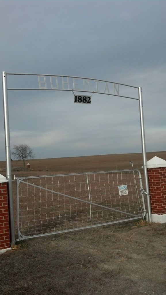
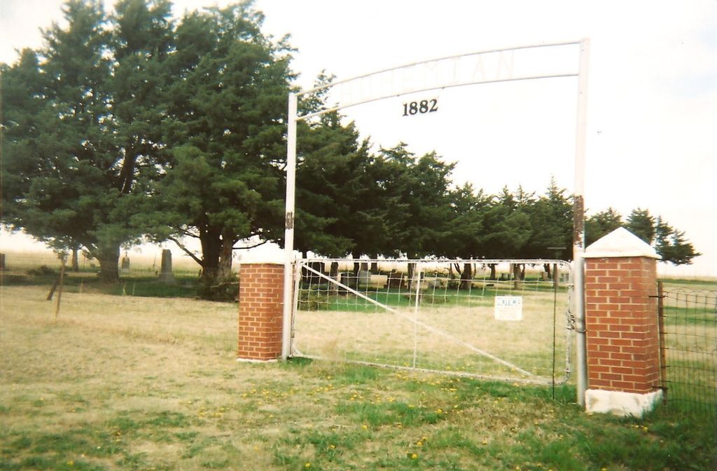
| Description | : | Located in the southeast portion of the northwest quarter of Section 17 in DOR township. It is 1 acre and was established 21 July 1884 when land was obtained from Joseph and Mary Kallash. Indexed by Connie Lull. This info is found in the Smith County, Kansas Tombstone Inscriptions Volume I |
frequently asked questions (FAQ):
-
Where is Bohemian Cemetery?
Bohemian Cemetery is located at Claudell, Smith County ,Kansas ,USA.
-
Bohemian Cemetery cemetery's updated grave count on graveviews.com?
3 memorials
-
Where are the coordinates of the Bohemian Cemetery?
Latitude: 39.6187800
Longitude: -99.0428200
Nearby Cemetories:
1. Saint Francis Catholic Cemetery
Cedar, Smith County, USA
Coordinate: 39.6328011, -98.9816971
2. Leasburg Cemetery
Cedar, Smith County, USA
Coordinate: 39.5819016, -98.9728012
3. Pleasant Ridge Cemetery
Kirwin, Phillips County, USA
Coordinate: 39.5963000, -99.1234000
4. Kirwin Cemetery
Kirwin, Phillips County, USA
Coordinate: 39.6781006, -99.1421967
5. Ash Rock Cemetery
Woodston, Rooks County, USA
Coordinate: 39.5248909, -99.0817719
6. Cedar Cemetery
Cedar, Smith County, USA
Coordinate: 39.6685982, -98.9310989
7. Spring Branch Cemetery
Woodston, Rooks County, USA
Coordinate: 39.5099983, -99.0580978
8. Grant Center Cemetery
Alton, Osborne County, USA
Coordinate: 39.5242004, -98.9708023
9. Olive Branch Cemetery
Kensington, Smith County, USA
Coordinate: 39.7418800, -99.0470800
10. Greenwood Cemetery
Kirwin, Phillips County, USA
Coordinate: 39.5931900, -99.2064600
11. Agra Cemetery
Agra, Phillips County, USA
Coordinate: 39.7571600, -99.1220400
12. Pioneer Cemetery
Alton, Osborne County, USA
Coordinate: 39.4742012, -98.9749985
13. Saint John Lutheran Cemetery
Athol, Smith County, USA
Coordinate: 39.7269900, -98.8971600
14. Saint John Lutheran Cemetery
Kensington, Smith County, USA
Coordinate: 39.7744700, -99.0308700
15. Gaylord Cemetery
Gaylord, Smith County, USA
Coordinate: 39.6598300, -98.8416700
16. Sumner Cemetery
Alton, Osborne County, USA
Coordinate: 39.4799995, -98.9338913
17. Pleasant Valley Cemetery
Osborne County, USA
Coordinate: 39.4583015, -99.0077972
18. Christ Cemetery
Gaylord, Smith County, USA
Coordinate: 39.6988100, -98.8556700
19. Butler Cemetery
Osborne County, USA
Coordinate: 39.5400009, -98.8494034
20. Hillsdale Cemetery
Gretna, Phillips County, USA
Coordinate: 39.7308006, -99.2097015
21. West Hope Cemetery
Rooks County, USA
Coordinate: 39.5024986, -99.2110977
22. Bow Creek Cemetery
Glade, Phillips County, USA
Coordinate: 39.5681000, -99.2696991
23. Lawrence Creek Cemetery
Portis, Osborne County, USA
Coordinate: 39.5541440, -98.8148290
24. Woodston Cemetery
Woodston, Rooks County, USA
Coordinate: 39.4375000, -99.1268997