
| Memorials | : | 5 |
| Location | : | Ogallala, Keith County, USA |
| Coordinate | : | 41.1324997, -101.7256012 |
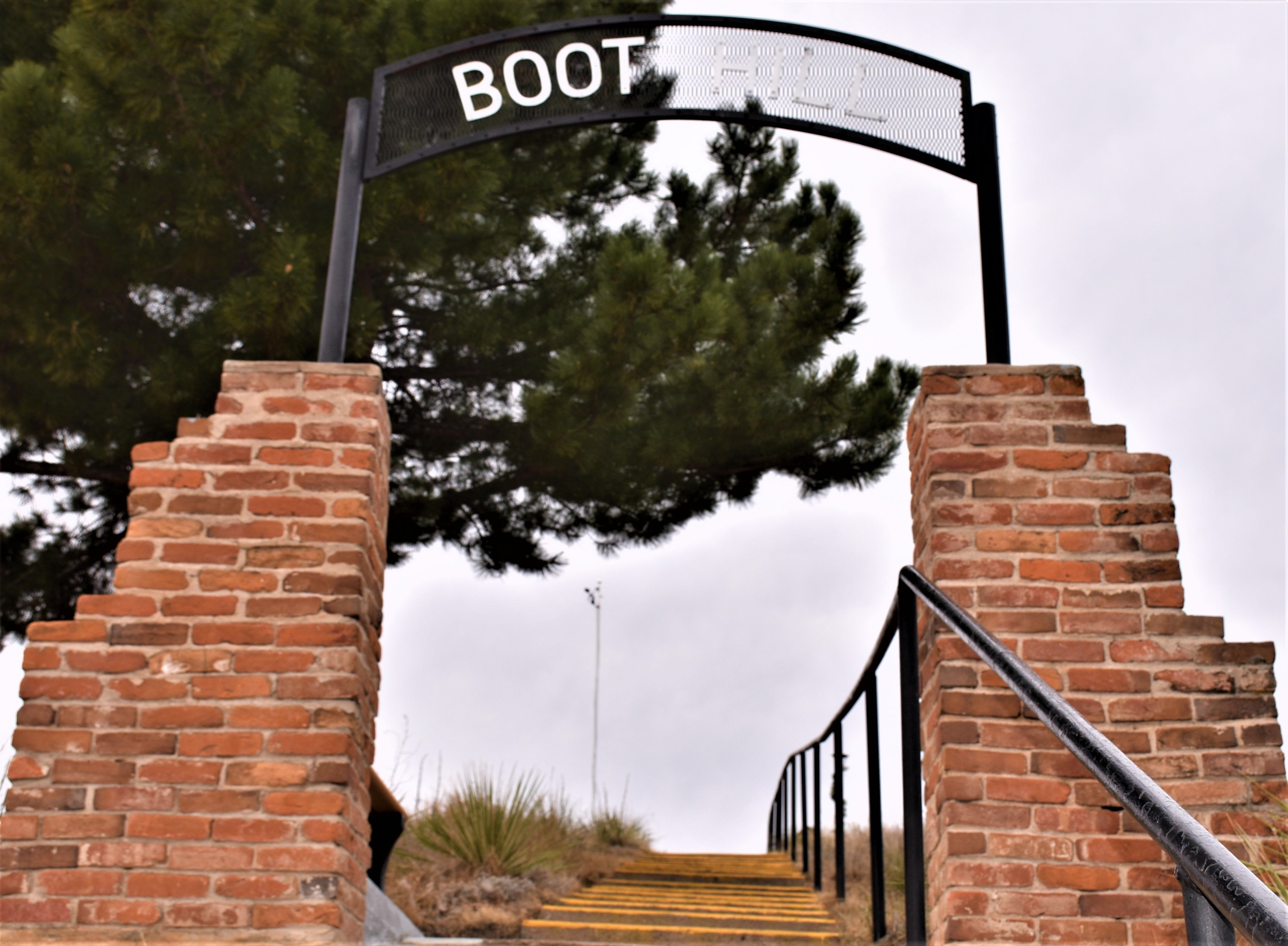
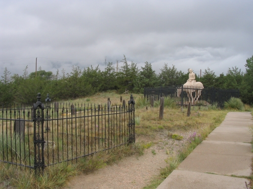
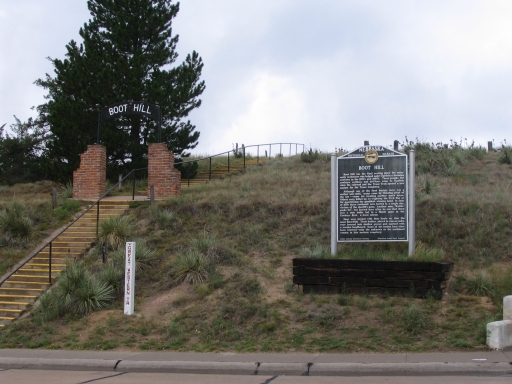
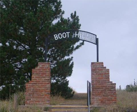
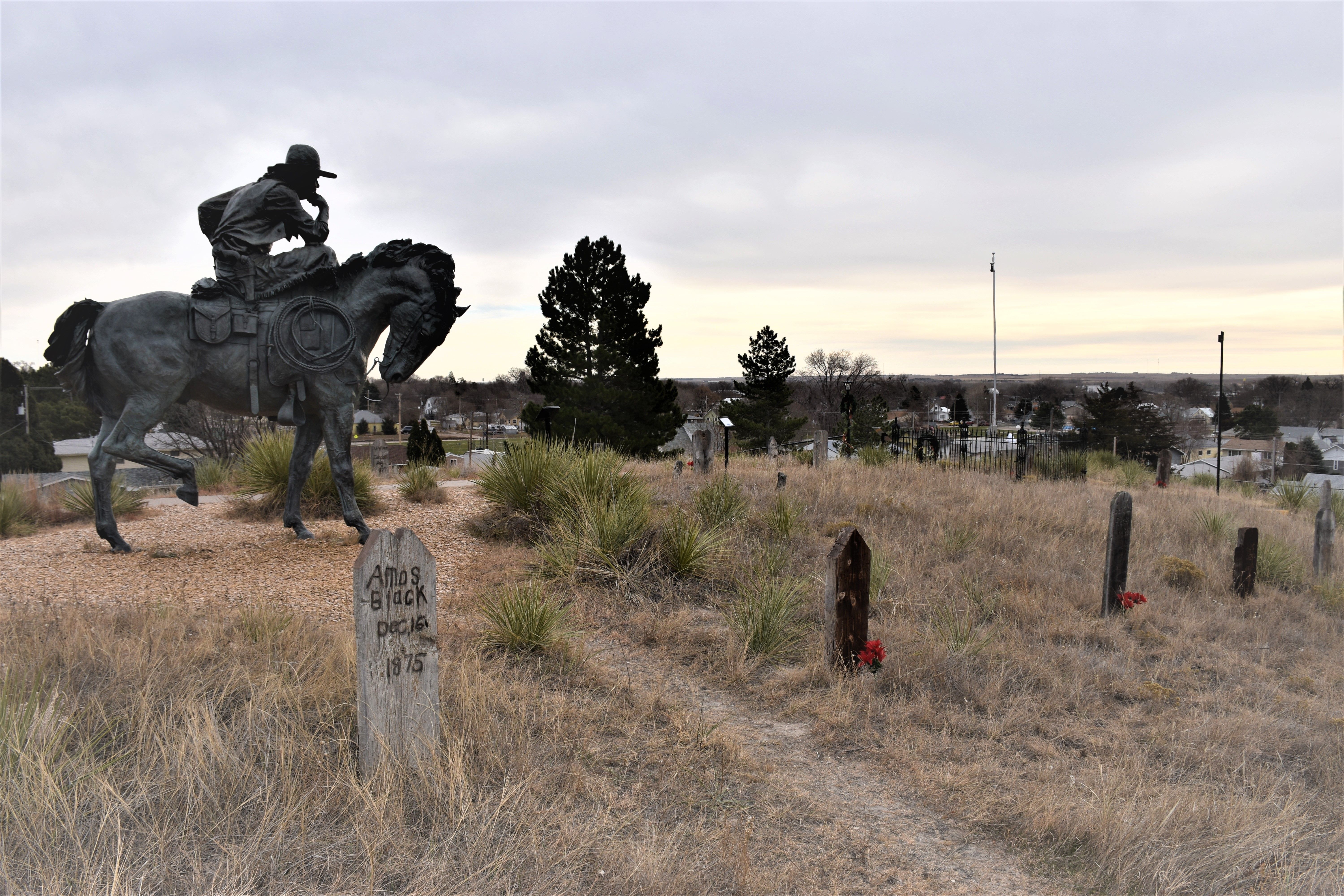
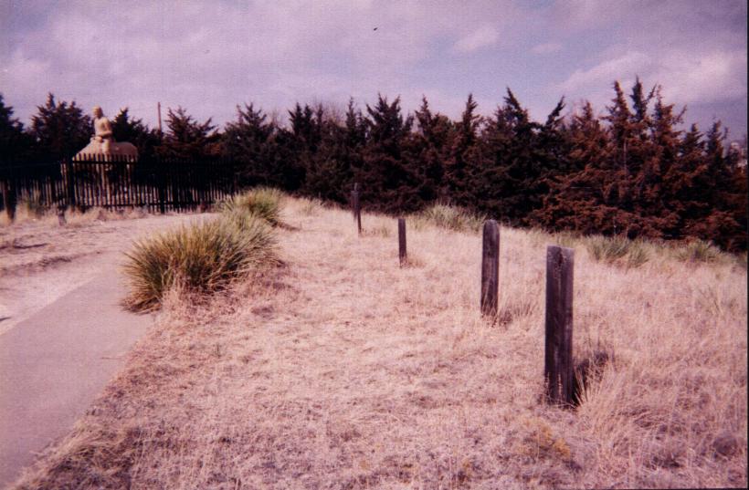
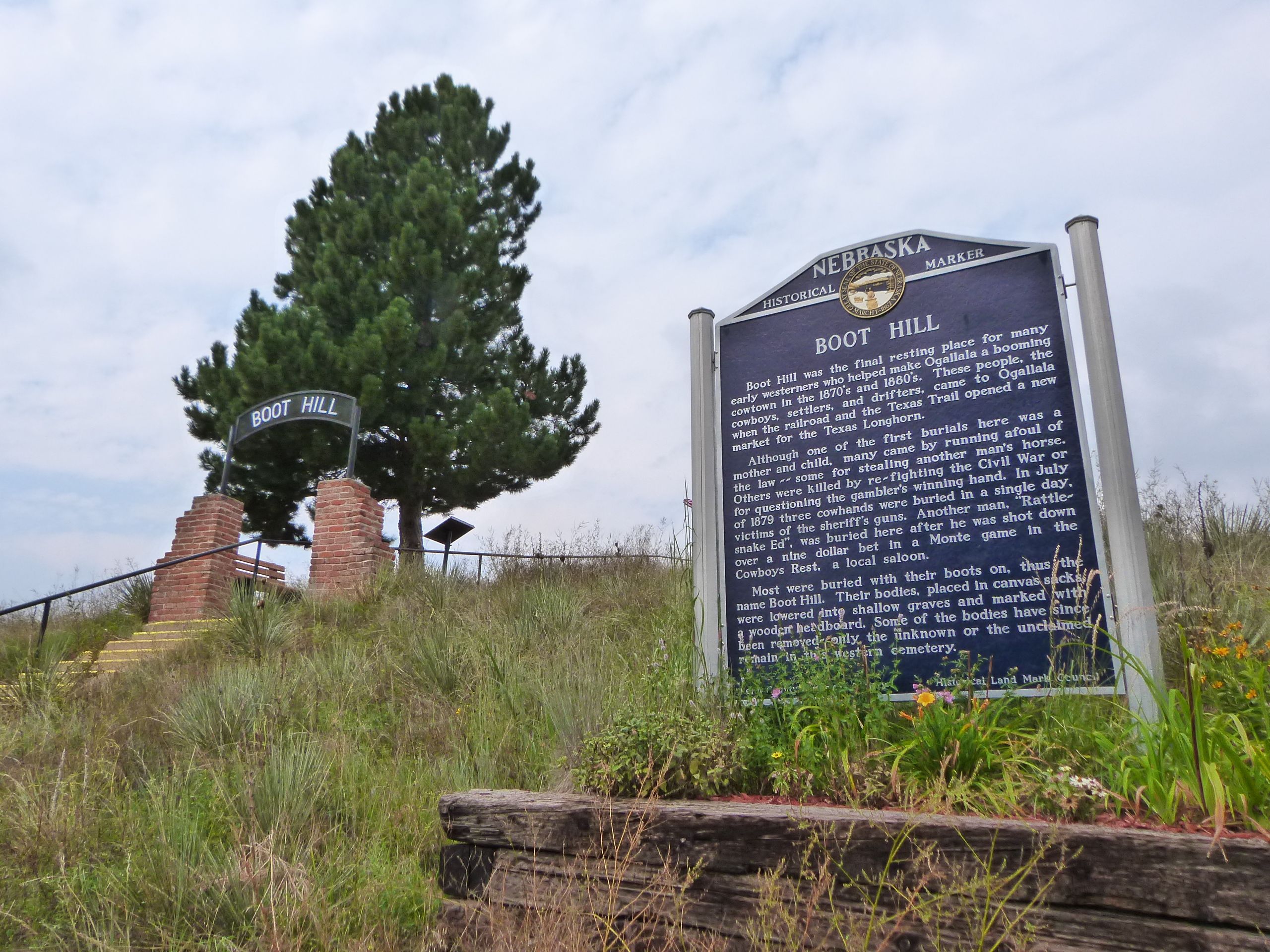
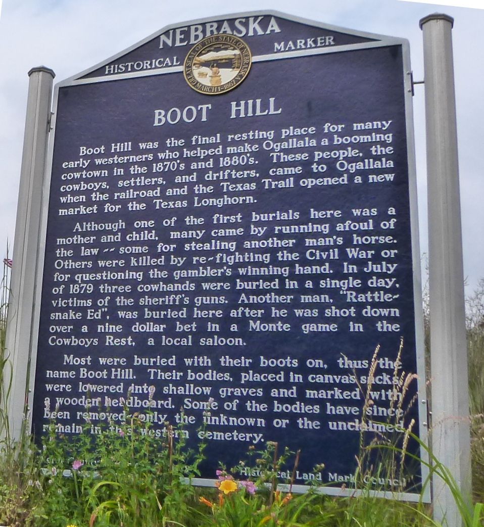
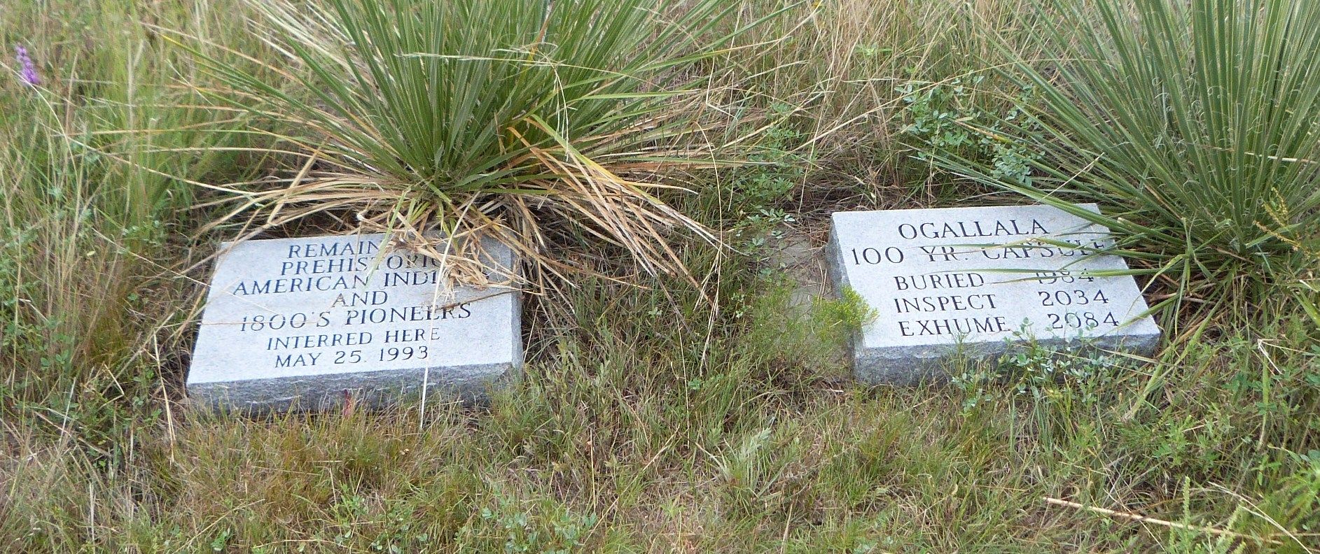
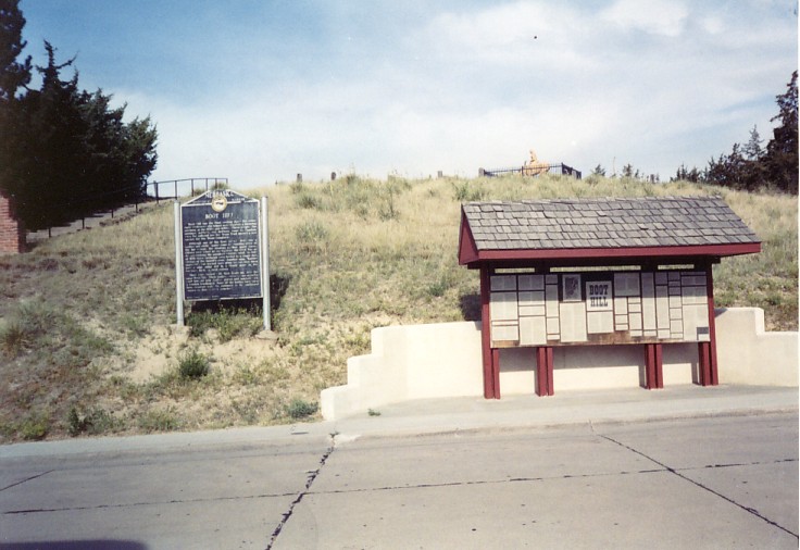
| Description | : | This cemetery, that at first had no name and later was called Boot Hill, was for most of its brief use a burial ground for people who were often forgotten even during their lifetimes. There is no certain record of when people first used this hill overlooking the South Platte River valley as a final resting place. Before Boot Hill was abandoned in early 1885, when the Ogallala Cemetery west of town came into general use, at least 48 bodies were laid to rest here and there were probably more. At least 14 murders occurred during the... Read More |
frequently asked questions (FAQ):
-
Where is Boot Hill Cemetery?
Boot Hill Cemetery is located at Ogallala, Keith County ,Nebraska ,USA.
-
Boot Hill Cemetery cemetery's updated grave count on graveviews.com?
5 memorials
-
Where are the coordinates of the Boot Hill Cemetery?
Latitude: 41.1324997
Longitude: -101.7256012
Nearby Cemetories:
1. Ogallala Cemetery
Ogallala, Keith County, USA
Coordinate: 41.1286011, -101.7472000
2. Saint John's Lutheran Church Cemetery
Ogallala, Keith County, USA
Coordinate: 41.0617000, -101.5983000
3. Brule Cemetery
Brule, Keith County, USA
Coordinate: 41.1060982, -101.8822021
4. Lemoyne Cemetery
Lemoyne, Keith County, USA
Coordinate: 41.2723000, -101.8123000
5. Trinity Lutheran Cemetery
Grant, Perkins County, USA
Coordinate: 40.9605000, -101.7478000
6. Pickard Cemetery
Keith County, USA
Coordinate: 41.0482240, -101.4809320
7. Paxton Cemetery
Paxton, Keith County, USA
Coordinate: 41.1088982, -101.3569031
8. Big Springs Cemetery
Big Springs, Deuel County, USA
Coordinate: 41.0592003, -102.0931015
9. Fairview Cemetery
Grant, Perkins County, USA
Coordinate: 40.8372002, -101.7391968
10. Day Cemetery
Deuel County, USA
Coordinate: 41.1921997, -102.1331024
11. Zion Cemetery
Deuel County, USA
Coordinate: 41.1641998, -102.1530991
12. Madrid Cemetery
Madrid, Perkins County, USA
Coordinate: 40.8371510, -101.5380900
13. Plum Creek Cemetery
Garden County, USA
Coordinate: 41.3469009, -102.0828018
14. Ash Hollow Cemetery
Lewellen, Garden County, USA
Coordinate: 41.3083000, -102.1252975
15. Frontier Cemetery
Sutherland, Lincoln County, USA
Coordinate: 41.0912000, -101.2531000
16. Walpole Cemetery
Perkins County, USA
Coordinate: 40.9157982, -101.3422012
17. Glen Echo Church Cemetery
Paxton, Keith County, USA
Coordinate: 41.3228320, -101.3084220
18. Ash Creek Cemetery
Lewellen, Garden County, USA
Coordinate: 41.3521996, -102.1205978
19. Fairview Cemetery
Garden County, USA
Coordinate: 41.4524994, -102.0233002
20. Elsie Cemetery
Elsie, Perkins County, USA
Coordinate: 40.8499050, -101.3666140
21. Durham Cemetery
Garden County, USA
Coordinate: 41.3314018, -102.2074966
22. Hillside Cemetery
Julesburg, Sedgwick County, USA
Coordinate: 40.9692001, -102.2406006
23. Arthur Cemetery
Arthur, Arthur County, USA
Coordinate: 41.5646530, -101.7058360
24. Sutherland Riverview Cemetery
Sutherland, Lincoln County, USA
Coordinate: 41.1357994, -101.1355972