
| Memorials | : | 2 |
| Location | : | Lemoyne, Keith County, USA |
| Coordinate | : | 41.2723000, -101.8123000 |
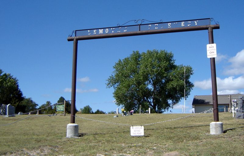
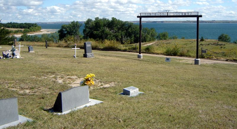
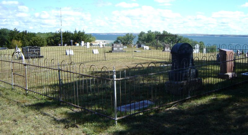
| Description | : | The Town of Lemoyne was founded by Lemoyne Jacobs in the early 1880's near the North Platte River as a stop for the Union Pacific Railroad. There was a railroad station, stockyard, church, school, bank, store and creamery, hotel, barbershop, highways, phone lines, and a population of over 200 when in 1937 the Public Works Administration began work on Kinglsey Dam, the second-largest hydraulic earthen dam in the world. The entire town was moved to higher ground before dedication of Kingsley Dam in 1941, and Lemoyne Cemetery was flooded by 22 mile long Lake McConaughy. The Cemetery is now... Read More |
frequently asked questions (FAQ):
-
Where is Lemoyne Cemetery?
Lemoyne Cemetery is located at Lemoyne, Keith County ,Nebraska ,USA.
-
Lemoyne Cemetery cemetery's updated grave count on graveviews.com?
2 memorials
-
Where are the coordinates of the Lemoyne Cemetery?
Latitude: 41.2723000
Longitude: -101.8123000
Nearby Cemetories:
1. Ogallala Cemetery
Ogallala, Keith County, USA
Coordinate: 41.1286011, -101.7472000
2. Boot Hill Cemetery
Ogallala, Keith County, USA
Coordinate: 41.1324997, -101.7256012
3. Brule Cemetery
Brule, Keith County, USA
Coordinate: 41.1060982, -101.8822021
4. Plum Creek Cemetery
Garden County, USA
Coordinate: 41.3469009, -102.0828018
5. Ash Hollow Cemetery
Lewellen, Garden County, USA
Coordinate: 41.3083000, -102.1252975
6. Fairview Cemetery
Garden County, USA
Coordinate: 41.4524994, -102.0233002
7. Ash Creek Cemetery
Lewellen, Garden County, USA
Coordinate: 41.3521996, -102.1205978
8. Day Cemetery
Deuel County, USA
Coordinate: 41.1921997, -102.1331024
9. Saint John's Lutheran Church Cemetery
Ogallala, Keith County, USA
Coordinate: 41.0617000, -101.5983000
10. Zion Cemetery
Deuel County, USA
Coordinate: 41.1641998, -102.1530991
11. Big Springs Cemetery
Big Springs, Deuel County, USA
Coordinate: 41.0592003, -102.0931015
12. Durham Cemetery
Garden County, USA
Coordinate: 41.3314018, -102.2074966
13. Arthur Cemetery
Arthur, Arthur County, USA
Coordinate: 41.5646530, -101.7058360
14. Trinity Lutheran Cemetery
Grant, Perkins County, USA
Coordinate: 40.9605000, -101.7478000
15. Pickard Cemetery
Keith County, USA
Coordinate: 41.0482240, -101.4809320
16. Paxton Cemetery
Paxton, Keith County, USA
Coordinate: 41.1088982, -101.3569031
17. Glen Echo Church Cemetery
Paxton, Keith County, USA
Coordinate: 41.3228320, -101.3084220
18. Berea Lutheran Cemetery
Chappell, Deuel County, USA
Coordinate: 41.2008900, -102.3439080
19. Kingery Cemetery
Garden County, USA
Coordinate: 41.5278015, -102.2514038
20. Hollman Gravesite
Oshkosh, Garden County, USA
Coordinate: 41.3782700, -102.3515500
21. Center Valley Baptist Church Cemetery
Arthur, Arthur County, USA
Coordinate: 41.6010900, -101.4646900
22. Antelope Valley Cemetery
Oshkosh, Garden County, USA
Coordinate: 41.4705000, -102.3098000
23. Oshkosh Cemetery
Oshkosh, Garden County, USA
Coordinate: 41.4235992, -102.3414001
24. Valley View Cemetery
McPherson County, USA
Coordinate: 41.4244003, -101.2647018