| Memorials | : | 40 |
| Location | : | Buctouche, Kent County, Canada |
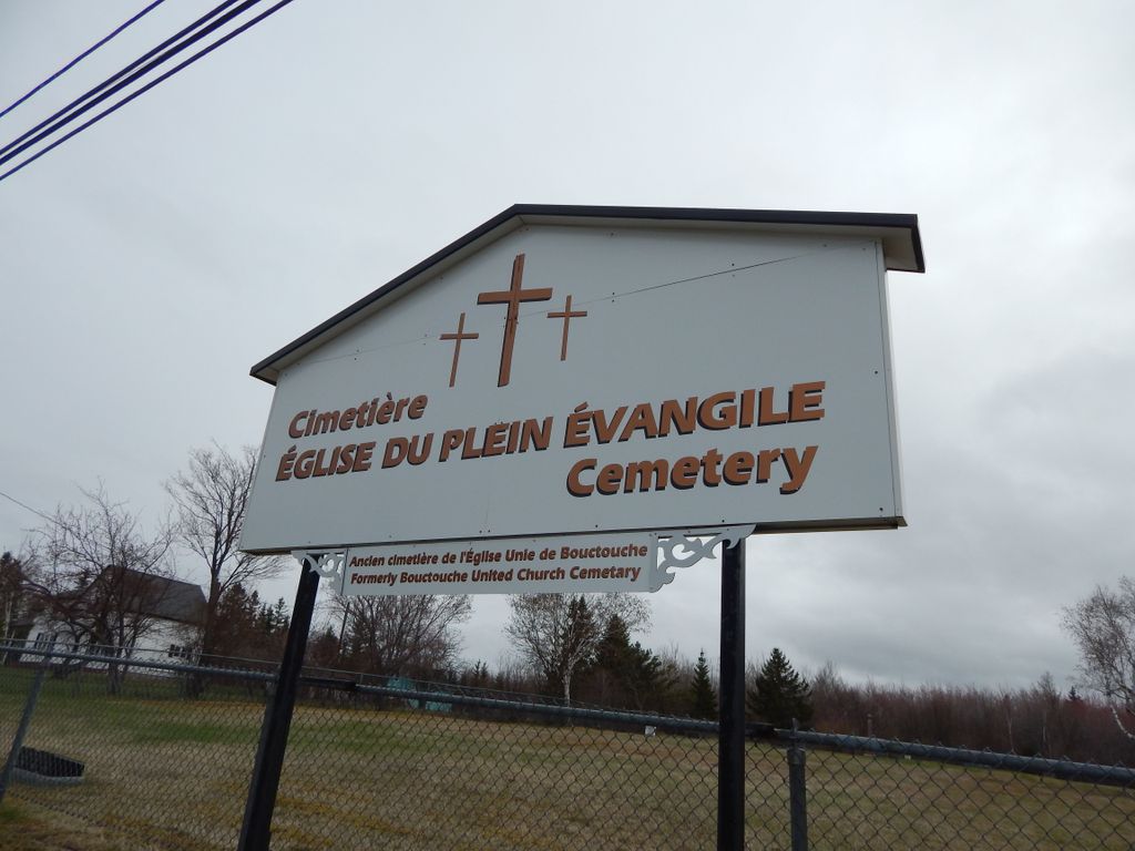
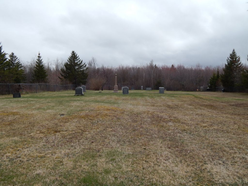
| Description | : | The cemetery is outside of Boutouche, across the river on Highway 134 south on the way to Saint-Francois-de-Kent. The sign indicates it is currently the Full Gospel Church Cemetery/Eglise du Plein Evangile and formerly the United Church Cemetery. Originally, it was the cemetery of the Bouctouche Methodist Church. Methodism came to New Brunswick in 1781, introduced by Rev. William Black at Point du Bute. In 1848, Richibucto, population 3,000, supported a Roman Catholic Church, an Anglican Church, and "a Scotch Kirk and a Methodist place of worship." By the late 1800's, Bouctouche followed suit. The Presbyterian Church... Read More |
frequently asked questions (FAQ):
-
Where is Bouctouche United Church Cemetery?
Bouctouche United Church Cemetery is located at No GPS information available Add GPSHighway 134 south Buctouche, Kent County ,New Brunswick ,Canada.
-
Bouctouche United Church Cemetery cemetery's updated grave count on graveviews.com?
40 memorials
Nearby Cemetories:
1. Acadieville Cemetery
Acadieville, Kent County, Canada
Coordinate: 46.4678379, -64.7127546
2. Adamsville Baptist Cemetery
Adamsville, Kent County, Canada
Coordinate: 46.5211100, -65.0864800
3. Saint Timothy’s Roman Catholic Cemetery
Adamsville, Kent County, Canada
4. Aldouane Roman Catholic Cemetery
Aldouane, Kent County, Canada
Coordinate: 46.3736210, -65.1051660
5. Saint Bartholomew Roman Catholic Cemetery
Bass River, Kent County, Canada
Coordinate: 46.3849490, -65.0982270
6. St. Mark's Presbyterian Cemetery
Bass River, Kent County, Canada
Coordinate: 46.3731000, -64.8706940
7. St. James Presbyterian Church Cemetery
Beersville, Kent County, Canada
Coordinate: 46.3435910, -64.9109250
8. United-Methodist Church Cemetery
Beersville, Kent County, Canada
9. Saint Anne's Roman Catholic Cemetery
Big Cove, Kent County, Canada
Coordinate: 46.3455140, -64.6149060
10. (New) Bouctouche Roman Catholic Cemetery
Bouctouche, Kent County, Canada
Coordinate: 46.3341150, -64.6150500
11. Saint Jean Baptiste Roman Catholic Cemetery
Bouctouche, Kent County, Canada
Coordinate: 46.4873010, -65.0904990
12. Saint John's Presbyterian Cemetery
Bouctouche, Kent County, Canada
Coordinate: 46.3080700, -64.8913800
13. St. Lawrence Anglican Church Cemetery
Bouctouche, Kent County, Canada
Coordinate: 46.4678379, -64.7127546
14. Saint Paul’s Anglican Church Cemetery
Browns Yard, Kent County, Canada
Coordinate: 46.5211100, -65.0864800
15. Sainte-Anne-de-Kent Cemetery
Buctouche, Kent County, Canada
16. Saint Andrew's Presbyterian Church Cemetery
Clairville, Kent County, Canada
Coordinate: 46.3736210, -65.1051660
17. Saint Matthews United Church Cemetery
Clairville, Kent County, Canada
Coordinate: 46.3849490, -65.0982270
18. Coates Mills United Church Cemetery
Coates Mills, Kent County, Canada
Coordinate: 46.3731000, -64.8706940
19. Fisher Hill Baptist Church Cemetery
Coates Mills, Kent County, Canada
Coordinate: 46.3435910, -64.9109250
20. Sherwood Homestead Cemetery
Coates Mills, Kent County, Canada
21. Saint Pierre de Cocagne Parish Cemetery
Cocagne, Kent County, Canada
Coordinate: 46.3455140, -64.6149060
22. St. Albans Anglican Cemetery
Cocagne, Kent County, Canada
Coordinate: 46.3341150, -64.6150500
23. Fords Mills United Church Cemetery
Fords Mills, Kent County, Canada
Coordinate: 46.4873010, -65.0904990
24. Gladeside Cemetery
Gladeside, Kent County, Canada
Coordinate: 46.3080700, -64.8913800


