
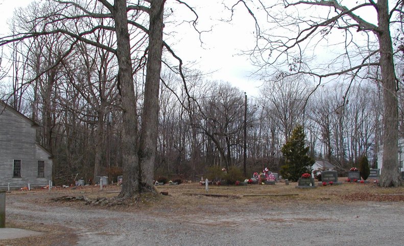
| Memorials | : | 27 |
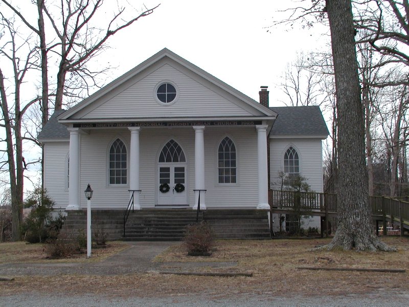
| Location | : | West Point, King William County, USA |
| Coordinate | : | 37.5913010, -76.8940964 |
frequently asked questions (FAQ):
-
Where is Brett Reed Presbyterian Church Cemetery?
Brett Reed Presbyterian Church Cemetery is located at West Point, King William County ,Virginia ,USA.
-
Brett Reed Presbyterian Church Cemetery cemetery's updated grave count on graveviews.com?
27 memorials
-
Where are the coordinates of the Brett Reed Presbyterian Church Cemetery?
Latitude: 37.5913010
Longitude: -76.8940964
Nearby Cemetories:
1. Sweet Hall Cemetery
King William County, USA
Coordinate: 37.5700360, -76.9037120
2. Bethany Baptist Church Cemetery
King William County, USA
Coordinate: 37.6095730, -76.9281000
3. Saint Johns Church Cemetery
West Point, King William County, USA
Coordinate: 37.6161694, -76.9212737
4. Ephesus Baptist Church Cemetery
West Point, King William County, USA
Coordinate: 37.5790700, -76.8454120
5. Trinity Baptist Church Cemetery
West Point, King William County, USA
Coordinate: 37.6351250, -76.9309950
6. Second Elam Baptist Church Cemetery
Lanexa, New Kent County, USA
Coordinate: 37.5225650, -76.8999570
7. Mattaponi Indian Reservation Baptist Cemetery
West Point, King William County, USA
Coordinate: 37.6620273, -76.9136790
8. Lanesville Cemetery
King William County, USA
Coordinate: 37.6101390, -76.9838610
9. Eames Family Cemetery
New Kent County, USA
Coordinate: 37.5168953, -76.8864136
10. Immanuel Chapel Episcopal Church Cemetery
King and Queen County, USA
Coordinate: 37.6706908, -76.8781389
11. Colosse Cemetery
West Point, King William County, USA
Coordinate: 37.6585680, -76.9510897
12. Old Town Farm
King William County, USA
Coordinate: 37.5864760, -76.9974970
13. Sunny Slope Cemetery
West Point, King William County, USA
Coordinate: 37.5477982, -76.8031006
14. Union Hope Baptist Church Cemetery
King William, King William County, USA
Coordinate: 37.6101830, -76.9977670
15. Saint Theresas Cemetery
West Point, King William County, USA
Coordinate: 37.5466995, -76.8032990
16. Union Hope Baptist Church Cemetery
Ino, King and Queen County, USA
Coordinate: 37.5997600, -77.0016000
17. Pamunkey Indian Reservation
King William, King William County, USA
Coordinate: 37.5747220, -77.0013890
18. New Kent Chapel Cemetery
Lanexa, New Kent County, USA
Coordinate: 37.5173250, -76.9534180
19. Pamunkey Methodist Church Cemetery
Lanexa, New Kent County, USA
Coordinate: 37.5020700, -76.8968540
20. Angel View Baptist Church Cemetery
Lanexa, New Kent County, USA
Coordinate: 37.5023230, -76.8752810
21. New Elam Baptist Church Cemetery
New Kent, New Kent County, USA
Coordinate: 37.5236910, -76.9704920
22. Pamunkey Indian Baptist Church Cemetery
King William, King William County, USA
Coordinate: 37.5749910, -77.0073300
23. Saint Luke's Baptist Church Cemetery
New Kent County, USA
Coordinate: 37.5200700, -76.8193130
24. Olivet Baptist Church Cemetery
Shanghai, King and Queen County, USA
Coordinate: 37.6052130, -76.7752000