
| Memorials | : | 0 |
| Location | : | Union City, Randolph County, USA |
| Coordinate | : | 40.2249985, -84.8058014 |
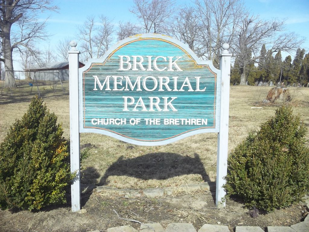
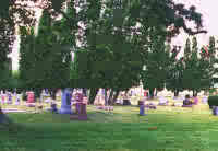
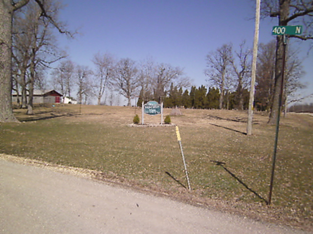
| Description | : | The cemetery is located in Jackson Township (E half of the SE quadrant of the SE quadrant of Section 13 Township 18N Range 1W) on the west side of N State Line Road about 400 feet north of its intersection with E County Road 400 N. Indiana Cemetery Locations, Volume 1, published by the Indiana Genealogical Society (02 April 2005), gives the primary cemetery name as German Baptist Cemetery with alternate names of Brethren Cemetery, Brick Cemetery, and Dunkard Cemetery. The cemetery is listed in the Cemetery and Burial Grounds Registry of the Indiana Department of Natural Resources... Read More |
frequently asked questions (FAQ):
-
Where is Brick Memorial Park Cemetery?
Brick Memorial Park Cemetery is located at N State Line Road (County Road 900 E / County Road 12) Union City, Randolph County ,Indiana , 47390USA.
-
Brick Memorial Park Cemetery cemetery's updated grave count on graveviews.com?
0 memorials
-
Where are the coordinates of the Brick Memorial Park Cemetery?
Latitude: 40.2249985
Longitude: -84.8058014
Nearby Cemetories:
1. Saint Marys Catholic Cemetery
Union City, Randolph County, USA
Coordinate: 40.2238998, -84.8236008
2. McFarland Cemetery
Darke County, USA
Coordinate: 40.2210999, -84.7771988
3. New Lisbon Cemetery
New Lisbon, Randolph County, USA
Coordinate: 40.2427580, -84.8241060
4. Lisbon Cemetery
Union City, Randolph County, USA
Coordinate: 40.2436450, -84.8252030
5. Union City Cemetery
Union City, Randolph County, USA
Coordinate: 40.1982994, -84.8283005
6. Johnson Burying Grounds
Union City, Randolph County, USA
Coordinate: 40.2326202, -84.8470993
7. Parent Cemetery
Union City, Darke County, USA
Coordinate: 40.1911354, -84.7887878
8. Raper Chapel Cemetery
Darke County, USA
Coordinate: 40.2675460, -84.7774610
9. Whitesell-Conklin Cemetery
Union City, Randolph County, USA
Coordinate: 40.2000008, -84.8621979
10. Hillgrove Cemetery
Hill Grove, Darke County, USA
Coordinate: 40.1793890, -84.7709680
11. Hoover Cemetery
Union City, Randolph County, USA
Coordinate: 40.1585999, -84.8193970
12. Snell Cemetery
Hill Grove, Darke County, USA
Coordinate: 40.1685982, -84.7564011
13. George Washington Hoover Cemetery
Union City, Randolph County, USA
Coordinate: 40.2876590, -84.8420930
14. Strait Cemetery
Ansonia, Darke County, USA
Coordinate: 40.2290450, -84.7091110
15. Kaucher Family Cemetery
Hill Grove, Darke County, USA
Coordinate: 40.1511110, -84.7658330
16. Teegarden Congregational Christian Church Cemetery
Ansonia, Darke County, USA
Coordinate: 40.2212219, -84.7005997
17. Shockney Cemetery
Randolph County, USA
Coordinate: 40.1518420, -84.8581410
18. Pleasant Hill Cemetery
Madison Township, Jay County, USA
Coordinate: 40.3090477, -84.8247375
19. Mount Zion Cemetery
Mississinawa Township, Darke County, USA
Coordinate: 40.3091800, -84.7874200
20. Spring Hill Cemetery
Darke County, USA
Coordinate: 40.1383018, -84.7900009
21. Old Prospect Cemetery
Saratoga, Randolph County, USA
Coordinate: 40.2564011, -84.9141998
22. Saratoga Cemetery
Saratoga, Randolph County, USA
Coordinate: 40.2364006, -84.9233017
23. Old Jericho Burying Ground
Harrisville, Randolph County, USA
Coordinate: 40.1574470, -84.8860040
24. Old Teegarden Cemetery
Woodington, Darke County, USA
Coordinate: 40.2069016, -84.6881027