
| Memorials | : | 3 |
| Location | : | Laurel Dale, Mineral County, USA |
| Coordinate | : | 39.3120230, -79.1104240 |
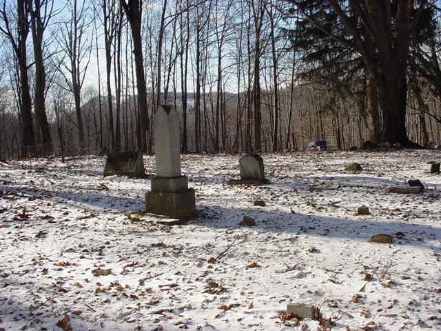
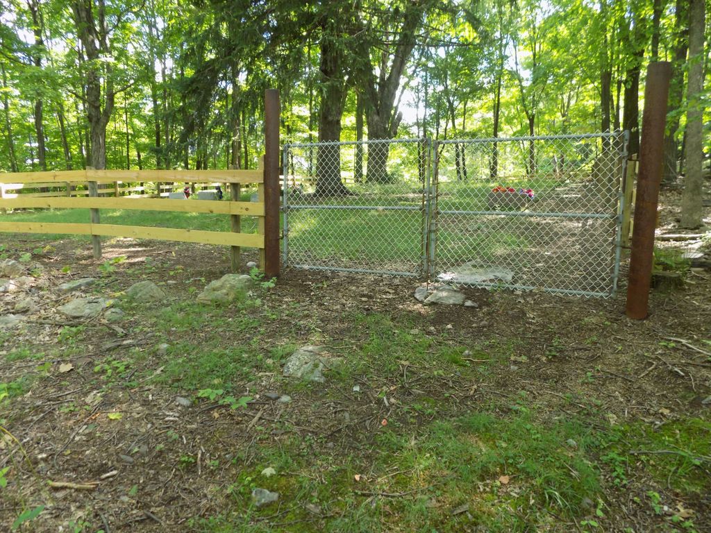
| Description | : | The cemetery is located on the old Russell V. Brown, Sr. property at Laural Dale, WV and the ground has been reserved for the purpose of family burials. Forrest Brown owns the land on the left of the graveyard and Barbara and Floyd Coakley own the land on the right. They are the son and daughter of Russell and Anna Lea Brown Info and photos; courtesy of Dottie Hughes |
frequently asked questions (FAQ):
-
Where is Brown-Tephabock Cemetery?
Brown-Tephabock Cemetery is located at Laurel Dale, Mineral County ,West Virginia ,USA.
-
Brown-Tephabock Cemetery cemetery's updated grave count on graveviews.com?
3 memorials
-
Where are the coordinates of the Brown-Tephabock Cemetery?
Latitude: 39.3120230
Longitude: -79.1104240
Nearby Cemetories:
1. Burgess Cemetery
Laurel Dale, Mineral County, USA
Coordinate: 39.3126360, -79.1093620
2. Evans Cemetery
Hartmansville, Mineral County, USA
Coordinate: 39.3046490, -79.1535100
3. Dixon Cemetery
Sulphur City, Mineral County, USA
Coordinate: 39.3424988, -79.1350021
4. Ward Cemetery
New Creek, Mineral County, USA
Coordinate: 39.3378792, -79.0655899
5. Hartmansville United Methodist Church Cemetery
Hartmansville, Mineral County, USA
Coordinate: 39.3194000, -79.1659100
6. Claysville United Methodist Church Cemetery
New Creek, Mineral County, USA
Coordinate: 39.3425250, -79.0680940
7. Kight Cemetery
New Creek, Mineral County, USA
Coordinate: 39.3475980, -79.0635400
8. Ferrebee-Tucker Cemetery
Antioch, Mineral County, USA
Coordinate: 39.2933080, -79.0380260
9. John Rotruck Cemetery
Martin, Grant County, USA
Coordinate: 39.2623640, -79.0662430
10. Amtower Cemetery
Scherr, Grant County, USA
Coordinate: 39.2558600, -79.1454000
11. Knobley Memorial Gardens
Martin, Grant County, USA
Coordinate: 39.2550400, -79.0733700
12. Davis Cemetery
Mineral County, USA
Coordinate: 39.3119011, -79.0278015
13. Davis Cemetery
Antioch, Mineral County, USA
Coordinate: 39.3117394, -79.0276057
14. Harris Gap Cemetery
Martin, Grant County, USA
Coordinate: 39.2488720, -79.0860700
15. Thrush Cemetery
Mineral County, USA
Coordinate: 39.3163950, -79.0244850
16. Ebert Family Cemetery
Scherr, Grant County, USA
Coordinate: 39.2497100, -79.1484900
17. Kalbaugh Cemetery
Elk Garden, Mineral County, USA
Coordinate: 39.3744011, -79.1583023
18. Nethken Hill Cemetery
Elk Garden, Mineral County, USA
Coordinate: 39.3755989, -79.1592026
19. R.D. Dean Memorial I.O.O.F. Cemetery
Elk Garden, Mineral County, USA
Coordinate: 39.3767580, -79.1584820
20. Leatherman - Harris Farm Cemetery
Martin, Grant County, USA
Coordinate: 39.2518300, -79.0505420
21. Homan Cemetery
Antioch, Mineral County, USA
Coordinate: 39.3360110, -79.0109840
22. Elk Garden Cemetery Old
Elk Garden, Mineral County, USA
Coordinate: 39.3850670, -79.1588600
23. Old Jimmy Likins Cemetery
Martin, Grant County, USA
Coordinate: 39.2438870, -79.0486910
24. McNemar Cemetery
Martin, Grant County, USA
Coordinate: 39.2270260, -79.0941170