
| Memorials | : | 0 |
| Location | : | Martin, Grant County, USA |
| Coordinate | : | 39.2623640, -79.0662430 |
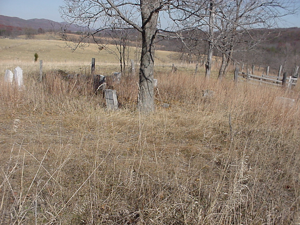
| Description | : | This cemetery is located east of the Knobley road and right off of the Harness Run/Poplar schoolhouse road. It was surveyed by Dottie Hughes (At the moment, 2004 the property has been sold and I don't know who owns it now) |
frequently asked questions (FAQ):
-
Where is John Rotruck Cemetery?
John Rotruck Cemetery is located at Martin, Grant County ,West Virginia ,USA.
-
John Rotruck Cemetery cemetery's updated grave count on graveviews.com?
0 memorials
-
Where are the coordinates of the John Rotruck Cemetery?
Latitude: 39.2623640
Longitude: -79.0662430
Nearby Cemetories:
1. Knobley Memorial Gardens
Martin, Grant County, USA
Coordinate: 39.2550400, -79.0733700
2. Leatherman - Harris Farm Cemetery
Martin, Grant County, USA
Coordinate: 39.2518300, -79.0505420
3. Harris Gap Cemetery
Martin, Grant County, USA
Coordinate: 39.2488720, -79.0860700
4. Old Jimmy Likins Cemetery
Martin, Grant County, USA
Coordinate: 39.2438870, -79.0486910
5. Smith Cemetery
Martin, Grant County, USA
Coordinate: 39.2369070, -79.0445920
6. Rotruck Brother's Cemetery
Martin, Grant County, USA
Coordinate: 39.2318870, -79.0538190
7. Mumbert Cemetery
Williamsport, Grant County, USA
Coordinate: 39.2315550, -79.0401940
8. Ferrebee-Tucker Cemetery
Antioch, Mineral County, USA
Coordinate: 39.2933080, -79.0380260
9. McNemar Cemetery
Martin, Grant County, USA
Coordinate: 39.2270260, -79.0941170
10. Hines-Evans Cemetery
Martin, Grant County, USA
Coordinate: 39.2173260, -79.0791610
11. Joseph Williams Cemetery
Williamsport, Grant County, USA
Coordinate: 39.2338110, -79.0174380
12. George - Rotruck Cemetery
Martin, Grant County, USA
Coordinate: 39.2232440, -79.1086860
13. Davis Cemetery
Antioch, Mineral County, USA
Coordinate: 39.3117394, -79.0276057
14. Davis Cemetery
Mineral County, USA
Coordinate: 39.3119011, -79.0278015
15. Williams Family Cemetery
Williamsport, Grant County, USA
Coordinate: 39.2117649, -79.0299582
16. Brown-Tephabock Cemetery
Laurel Dale, Mineral County, USA
Coordinate: 39.3120230, -79.1104240
17. Burgess Cemetery
Laurel Dale, Mineral County, USA
Coordinate: 39.3126360, -79.1093620
18. Amtower Cemetery
Scherr, Grant County, USA
Coordinate: 39.2558600, -79.1454000
19. Thrush Cemetery
Mineral County, USA
Coordinate: 39.3163950, -79.0244850
20. Ebert Family Cemetery
Scherr, Grant County, USA
Coordinate: 39.2497100, -79.1484900
21. Green Hill Cemetery
Medley, Grant County, USA
Coordinate: 39.1928200, -79.0665000
22. Ward Cemetery
New Creek, Mineral County, USA
Coordinate: 39.3378792, -79.0655899
23. Evans Cemetery
Hartmansville, Mineral County, USA
Coordinate: 39.3046490, -79.1535100
24. Claysville United Methodist Church Cemetery
New Creek, Mineral County, USA
Coordinate: 39.3425250, -79.0680940