
| Memorials | : | 0 |
| Location | : | James Island, Charleston County, USA |
| Coordinate | : | 32.7172500, -79.9653300 |
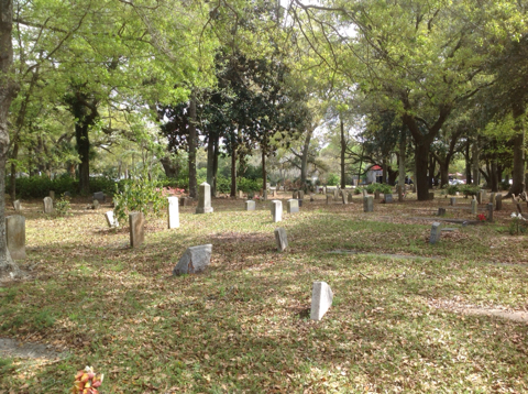
| Description | : | Burn Church Cemetery is adjacent to the James Island Presbyterian Church Cemetery next to Folly Rd. The two cemeteries are separated by a hedge of azalea bushes. James Island Presbyterian Church was founded in the early 1700’s. Before the Civil War, slaves sat in the balcony as plantation owners and other white parishioners worshipped from the main floor. During the Civil War the building fell victim to flames from surrounding fields. After the war, some of the black parishioners decided to build another church about a half mile from the original church, where they had worshipped and where their ancestors... Read More |
frequently asked questions (FAQ):
-
Where is Burn Church Cemetery?
Burn Church Cemetery is located at Corner Folly Road & Fort Johnson Road James Island, Charleston County ,South Carolina , 29412-USA.
-
Burn Church Cemetery cemetery's updated grave count on graveviews.com?
0 memorials
-
Where are the coordinates of the Burn Church Cemetery?
Latitude: 32.7172500
Longitude: -79.9653300
Nearby Cemetories:
1. James Island Presbyterian Church Cemetery
James Island, Charleston County, USA
Coordinate: 32.7178917, -79.9642029
2. Saint James Presbyterian Church Cemetery
James Island, Charleston County, USA
Coordinate: 32.7195816, -79.9569092
3. Secessionville Road Cemetery
James Island, Charleston County, USA
Coordinate: 32.7268500, -79.9565000
4. Saint James Memorial Gardens
James Island, Charleston County, USA
Coordinate: 32.7049900, -79.9747300
5. James Island Baptist Church
James Island, Charleston County, USA
Coordinate: 32.7316971, -79.9619293
6. Evergreen Cemetery
James Island, Charleston County, USA
Coordinate: 32.7027140, -79.9734650
7. Payne RMUE Church Cemetery
Charleston, Charleston County, USA
Coordinate: 32.7337600, -79.9632800
8. First Baptist Church Cemetery
James Island, Charleston County, USA
Coordinate: 32.7265200, -79.9484000
9. Payne RMUE Church Memorial Garden
James Island, Charleston County, USA
Coordinate: 32.7035179, -79.9792328
10. Bishop Gadsden Columbarium
Charleston, Charleston County, USA
Coordinate: 32.7341340, -79.9758710
11. Saint James Episcopal Church Cemetery
James Island, Charleston County, USA
Coordinate: 32.7350273, -79.9767914
12. James Island Civil War Battlefield
James Island, Charleston County, USA
Coordinate: 32.7045800, -79.9460600
13. Stem Point Memorial Cemetery
James Island, Charleston County, USA
Coordinate: 32.6872711, -79.9561539
14. Bethel AME Church Cemetery
James Island, Charleston County, USA
Coordinate: 32.7456100, -79.9813200
15. Mount Sinai Evangelistic Cemetery
James Island, Charleston County, USA
Coordinate: 32.7483960, -79.9883470
16. Heavenly Rest Cemetery
Charleston, Charleston County, USA
Coordinate: 32.7494500, -79.9868500
17. Wesley United Methodist Church Cemetery
Johns Island, Charleston County, USA
Coordinate: 32.7017700, -80.0157300
18. McLeod Cemetery
James Island, Charleston County, USA
Coordinate: 32.7645000, -79.9737100
19. Holy Cross Cemetery
James Island, Charleston County, USA
Coordinate: 32.7411160, -79.9151860
20. Saint Peters Episcopal Church Cemetery
Charleston, Charleston County, USA
Coordinate: 32.7750015, -79.9357986
21. First Baptist Churchyard
Charleston, Charleston County, USA
Coordinate: 32.7737122, -79.9306564
22. First Scots Presbyterian Church Cemetery
Charleston, Charleston County, USA
Coordinate: 32.7742271, -79.9315872
23. Cathedral of Saint John the Baptist
Charleston, Charleston County, USA
Coordinate: 32.7763020, -79.9344420
24. Cedar Spring Baptist Church Cemetery
Johns Island, Charleston County, USA
Coordinate: 32.7128900, -80.0432400