
| Memorials | : | 6 |
| Location | : | Burney, Shasta County, USA |
| Coordinate | : | 41.0228400, -121.6456300 |
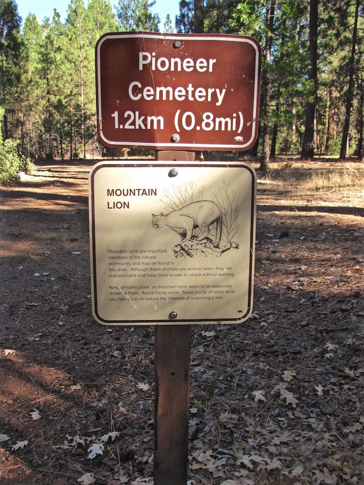
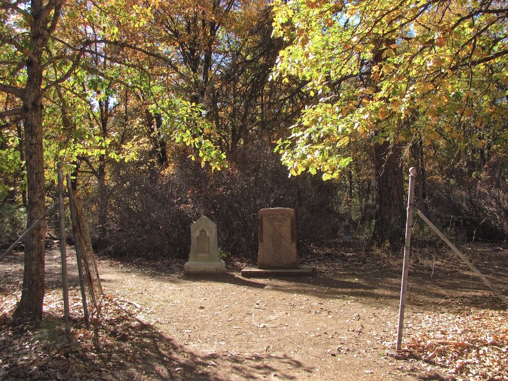
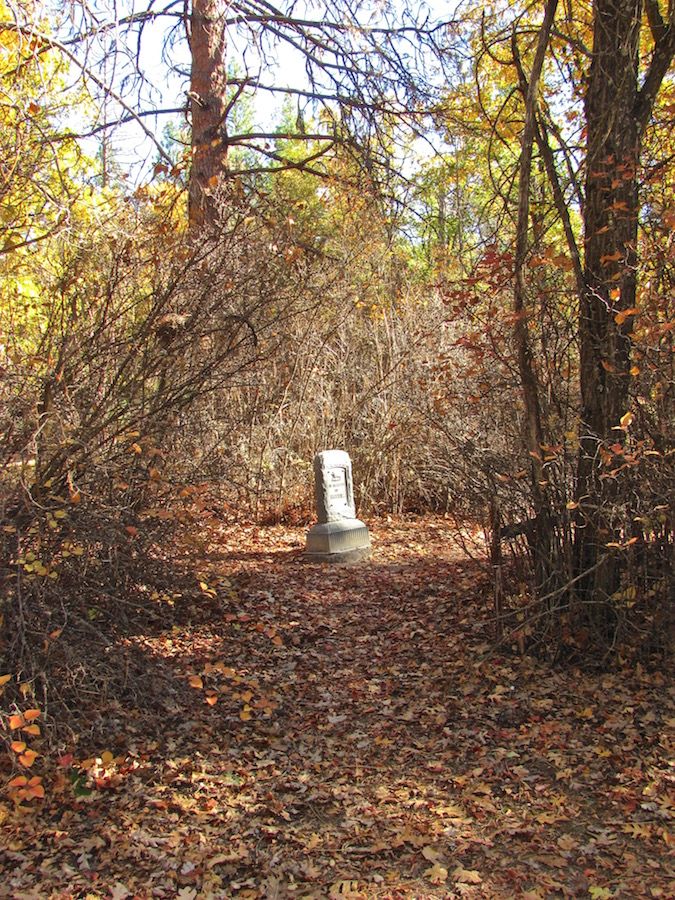
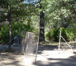
| Description | : | This Cemetery is located in the McArthur Burney Falls State Park. Past the chain link fence entrance is a marker with the names of the people buried in this cemetery called Burney Falls Cemetery, on the state park map it is shown as Pioneer Cemetery. |
frequently asked questions (FAQ):
-
Where is Burney Falls Cemetery?
Burney Falls Cemetery is located at Burney, Shasta County ,California ,USA.
-
Burney Falls Cemetery cemetery's updated grave count on graveviews.com?
6 memorials
-
Where are the coordinates of the Burney Falls Cemetery?
Latitude: 41.0228400
Longitude: -121.6456300


Nearby Cemetories:
1. Cayton Cemetery
Cayton, Shasta County, USA
Coordinate: 41.0319700, -121.6320800
2. Goose Valley Indian Burial Grounds
Burney, Shasta County, USA
Coordinate: 40.9503800, -121.7459000
3. Dana Cemetery
Glenburn, Shasta County, USA
Coordinate: 41.1234896, -121.5788626
4. Burney Cemetery
Burney, Shasta County, USA
Coordinate: 40.8837100, -121.6566600
5. Burney District Cemetery
Burney, Shasta County, USA
Coordinate: 40.8801600, -121.6526200
6. Snooks Cemetery
Burney, Shasta County, USA
Coordinate: 40.8788900, -121.6649800
7. Winters Cemetery
Fall River Mills, Shasta County, USA
Coordinate: 40.9932700, -121.4460300
8. Eastman Lake Cemetery
Eastman Place, Shasta County, USA
Coordinate: 41.1160600, -121.4783200
9. Fall River Cemetery
Fall River Mills, Shasta County, USA
Coordinate: 41.0133300, -121.4333100
10. Pine Grove Cemetery
McArthur, Shasta County, USA
Coordinate: 41.0558014, -121.3835983
11. Big Bend Indian Cemetery
Big Bend, Shasta County, USA
Coordinate: 41.0345700, -121.9298500
12. Cove Cemetery
Shasta County, USA
Coordinate: 40.9034100, -121.9386200
13. Day Cemetery
Day, Modoc County, USA
Coordinate: 41.2093320, -121.3733430
14. Halcumb Cemetery
Montgomery Creek, Shasta County, USA
Coordinate: 40.8213997, -121.9308014
15. Brown Cemetery
Hat Creek, Shasta County, USA
Coordinate: 40.7532900, -121.4798200
16. Wilcox Family Cemetery
Shasta County, USA
Coordinate: 40.7447100, -121.4716700
17. Hillside Cemetery
Bieber, Lassen County, USA
Coordinate: 41.0811005, -121.1936035
18. Lookout Cemetery
Lookout, Modoc County, USA
Coordinate: 41.2039570, -121.1581060
19. Mountain View Cemetery
Bieber, Lassen County, USA
Coordinate: 41.1328011, -121.1205978
20. Fern Cemetery
Shasta County, USA
Coordinate: 40.6473600, -121.8861500
21. McCloud Cemetery
McCloud, Siskiyou County, USA
Coordinate: 41.2327860, -122.1357720
22. Fender Cemetery
Redding, Shasta County, USA
Coordinate: 40.7167320, -122.0352859
23. Whitmore Evangelical Cemetery
Shasta County, USA
Coordinate: 40.6235580, -121.8566580
24. Josephine Cemetery
Whitmore, Shasta County, USA
Coordinate: 40.6326828, -121.9151993