
| Memorials | : | 3 |
| Location | : | Shasta County, USA |
| Coordinate | : | 40.6473600, -121.8861500 |
frequently asked questions (FAQ):
-
Where is Fern Cemetery?
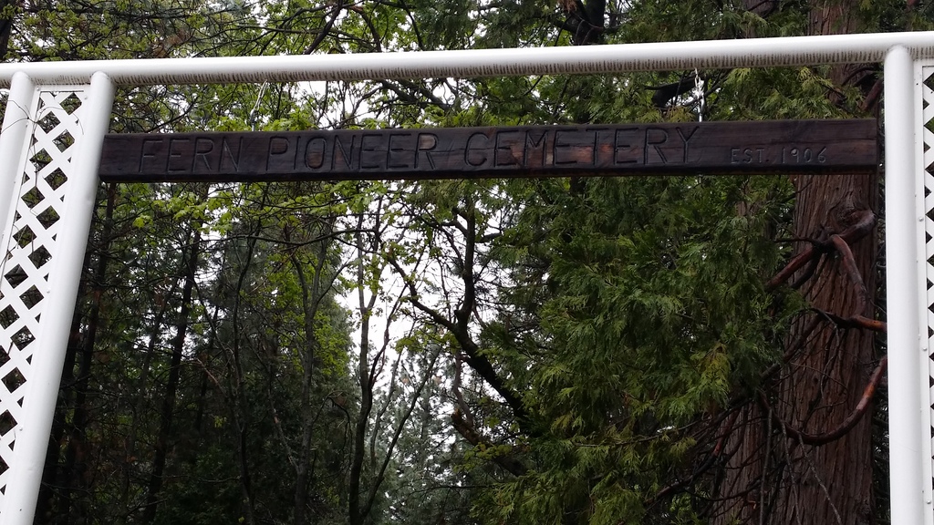
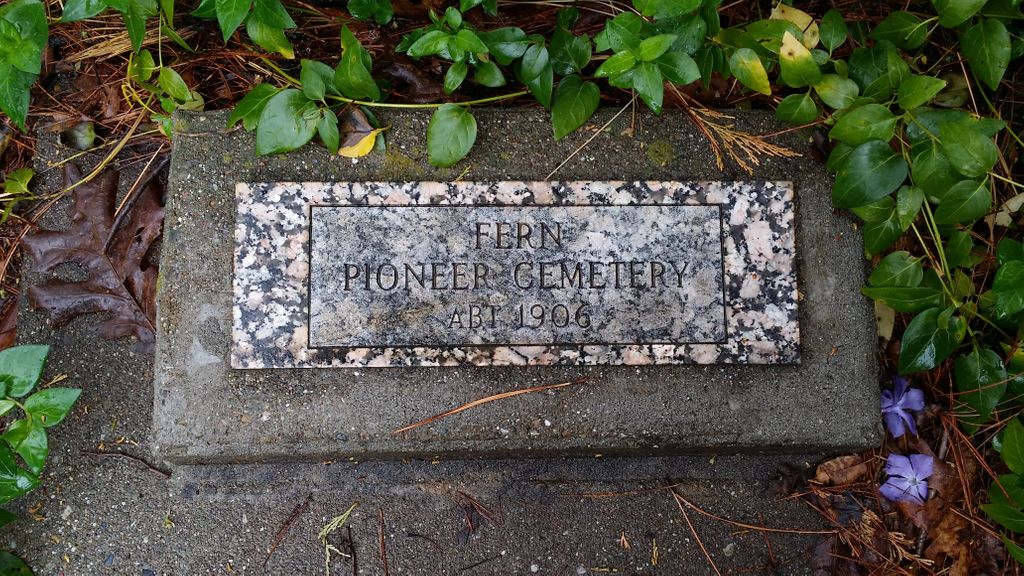
Fern Cemetery is located at Shasta County ,California ,USA.
-
Fern Cemetery cemetery's updated grave count on graveviews.com?
3 memorials
-
Where are the coordinates of the Fern Cemetery?
Latitude: 40.6473600
Longitude: -121.8861500
Nearby Cemetories:
1. Josephine Cemetery
Whitmore, Shasta County, USA
Coordinate: 40.6326828, -121.9151993
2. Tuttle Gulch Cemetery
Cottonwood, Shasta County, USA
Coordinate: 40.6326828, -121.9151993
3. Whitmore Evangelical Cemetery
Shasta County, USA
Coordinate: 40.6235580, -121.8566580
4. Oak Run Cemetery
Oak Run, Shasta County, USA
Coordinate: 40.6882324, -122.0308685
5. Fender Cemetery
Redding, Shasta County, USA
Coordinate: 40.7167320, -122.0352859
6. Ogburn Inwood Cemetery
Shingletown, Shasta County, USA
Coordinate: 40.5092100, -121.9622000
7. Original Plateau Cemetery
Shasta County, USA
Coordinate: 40.5020100, -121.8248200
8. Mountain Home Cemetery
Shasta County, USA
Coordinate: 40.5342700, -121.7218200
9. Plateau Cemetery
Shasta County, USA
Coordinate: 40.4840460, -121.8254480
10. Klotz Family Cemetery
Shingletown, Shasta County, USA
Coordinate: 40.4784760, -121.8553840
11. Hunt Cemetery
Shasta County, USA
Coordinate: 40.6236200, -122.1116300
12. Halcumb Cemetery
Montgomery Creek, Shasta County, USA
Coordinate: 40.8213997, -121.9308014
13. Herrick Family Cemetery
Shasta County, USA
Coordinate: 40.4450200, -121.8679300
14. Manton Cemetery
Manton, Tehama County, USA
Coordinate: 40.4342310, -121.8638310
15. Fuller Cemetery
Shasta County, USA
Coordinate: 40.4536700, -121.7208300
16. Millville IOOF Cemetery
Millville, Shasta County, USA
Coordinate: 40.5539017, -122.1663971
17. Beck Cemetery
Shasta County, USA
Coordinate: 40.5487400, -122.1720900
18. Millville Masonic Cemetery
Millville, Shasta County, USA
Coordinate: 40.5555000, -122.1842804
19. Junior Family Cemetery
Tehama County, USA
Coordinate: 40.3990010, -121.8673330
20. Lanes Valley Cemetery
Paynes Creek, Tehama County, USA
Coordinate: 40.3998400, -121.9762400
21. Cove Cemetery
Shasta County, USA
Coordinate: 40.9034100, -121.9386200
22. Snooks Cemetery
Burney, Shasta County, USA
Coordinate: 40.8788900, -121.6649800
23. Haggard Family Ranch Cemetery
Palo Cedro, Shasta County, USA
Coordinate: 40.5105600, -122.2227800
24. Burney District Cemetery
Burney, Shasta County, USA
Coordinate: 40.8801600, -121.6526200