
| Memorials | : | 1 |
| Location | : | Heavener, Le Flore County, USA |
| Coordinate | : | 34.8878640, -94.5019330 |
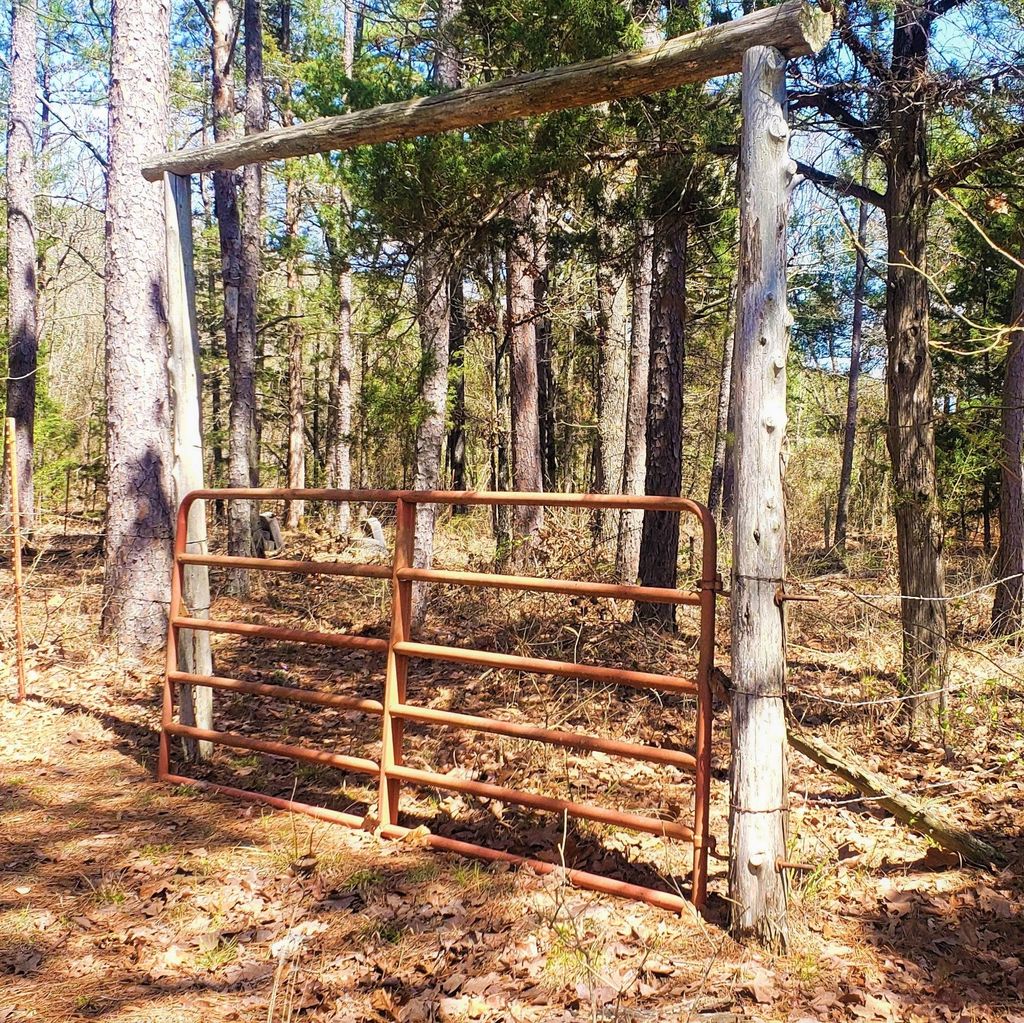
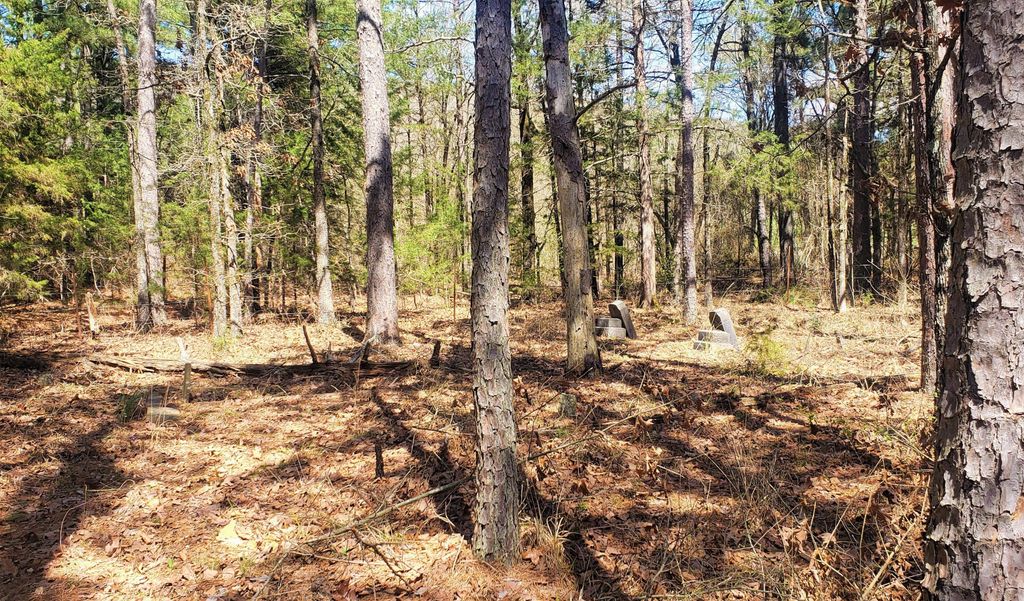
| Description | : | The cemetery is located in the Forrester Community east of Heavener, Oklahoma. It is not easy to find and difficult to access. Follow Oklahoma State Hwy 128 east from Heavener about 5 miles. Turn left onto Sugar Creek Lane (Co Rd D1475) and continue for 2 miles. Turn left (north) onto Co Rd D1463 and continue for .2 of a mile until the road intersects with Sugar Creek Place. Turn left and continue about 250 yards. Pull off to the right onto a clearing just past a dense group of trees. The Cemetery is about 30... Read More |
frequently asked questions (FAQ):
-
Where is Burns Cemetery?
Burns Cemetery is located at Heavener, Le Flore County ,Oklahoma , 74937USA.
-
Burns Cemetery cemetery's updated grave count on graveviews.com?
1 memorials
-
Where are the coordinates of the Burns Cemetery?
Latitude: 34.8878640
Longitude: -94.5019330
Nearby Cemetories:
1. Loving Cemetery
Hontubby, Le Flore County, USA
Coordinate: 34.8616982, -94.4997025
2. Blevins Family Cemetery
Heavener, Le Flore County, USA
Coordinate: 34.8615300, -94.5007200
3. Davenport Cemetery
Coaldale, Scott County, USA
Coordinate: 34.8752900, -94.4494500
4. Coaldale Cemetery
Coaldale, Scott County, USA
Coordinate: 34.8910500, -94.4432140
5. Hontubby Cemetery
Hontubby, Le Flore County, USA
Coordinate: 34.8543900, -94.5643400
6. Black Cemetery
Scott County, USA
Coordinate: 34.8917007, -94.4191971
7. Weeks Cemetery
Scott County, USA
Coordinate: 34.8806000, -94.4067001
8. Oakdale Cemetery
Heavener, Le Flore County, USA
Coordinate: 34.8839970, -94.6058610
9. Memorial Park Cemetery
Heavener, Le Flore County, USA
Coordinate: 34.9067001, -94.6044006
10. Hill Cemetery
Heavener, Le Flore County, USA
Coordinate: 34.8871994, -94.6102982
11. Dunlap Grave Site
Heavener, Le Flore County, USA
Coordinate: 34.8843300, -94.6131000
12. Gipson Cemetery
Bates, Scott County, USA
Coordinate: 34.8969002, -94.3869019
13. Sliger Cemetery
Scott County, USA
Coordinate: 34.8974991, -94.3811035
14. Monroe Cemetery
Monroe, Le Flore County, USA
Coordinate: 34.9892046, -94.5217620
15. Griffith Family Cemetery
Monroe, Le Flore County, USA
Coordinate: 34.9940000, -94.5061000
16. Mount Pleasant Cemetery
Le Flore County, USA
Coordinate: 34.8953900, -94.6347700
17. Morris Cemetery
Le Flore County, USA
Coordinate: 34.9521700, -94.6165000
18. Flemmichubbe Cemetery
Howe, Le Flore County, USA
Coordinate: 34.9746800, -94.5941800
19. Ison Burial Site
Hodgen, Le Flore County, USA
Coordinate: 34.8416834, -94.6311068
20. West Harmony Cemetery
Sebastian County, USA
Coordinate: 34.9848900, -94.4224680
21. Big Creek Cemetery
Le Flore County, USA
Coordinate: 34.7709800, -94.5009400
22. Perry Cemetery
Le Flore County, USA
Coordinate: 34.8426500, -94.6340800
23. Springhill Cemetery
Monroe, Le Flore County, USA
Coordinate: 34.9851100, -94.5834500
24. Haw Creek Cemetery
Black Fork, Scott County, USA
Coordinate: 34.7994003, -94.4049988