| Memorials | : | 0 |
| Location | : | Monroe, Le Flore County, USA |
| Coordinate | : | 34.9940000, -94.5061000 |
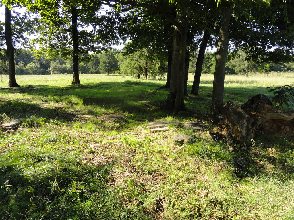
| Description | : | GPS 34 degrees 59.644N 94 degrees 30.367W From HWY 259,turn onto HWY 83. Just prior to Sugar Loaf Creek, make a right turn to first road and turn on 13990. The cemetery is on private property. One must ask the owner then enter an iron gate on the right. The cemetery is in a grove of trees. Tombstones are all down and broken. |
frequently asked questions (FAQ):
-
Where is Griffith Family Cemetery?
Griffith Family Cemetery is located at Private farm near Sugar Loaf Creek on road 13990 Monroe, Le Flore County ,Oklahoma ,USA.
-
Griffith Family Cemetery cemetery's updated grave count on graveviews.com?
0 memorials
-
Where are the coordinates of the Griffith Family Cemetery?
Latitude: 34.9940000
Longitude: -94.5061000
Nearby Cemetories:
1. Monroe Cemetery
Monroe, Le Flore County, USA
Coordinate: 34.9892046, -94.5217620
2. Vaughn Memorial Cemetery
Gilmore, Le Flore County, USA
Coordinate: 35.0370200, -94.5220800
3. Springhill Cemetery
Monroe, Le Flore County, USA
Coordinate: 34.9851100, -94.5834500
4. West Harmony Cemetery
Sebastian County, USA
Coordinate: 34.9848900, -94.4224680
5. Leatherwood Cemetery
West Hartford, Sebastian County, USA
Coordinate: 34.9975696, -94.4170723
6. Flemmichubbe Cemetery
Howe, Le Flore County, USA
Coordinate: 34.9746800, -94.5941800
7. Jackson-Red Yard Cemetery
Hartford, Sebastian County, USA
Coordinate: 35.0233100, -94.4175700
8. Morris Cemetery
Le Flore County, USA
Coordinate: 34.9521700, -94.6165000
9. Hall Cemetery
Poteau, Le Flore County, USA
Coordinate: 35.0950012, -94.4993973
10. Unity Cemetery
Hartford, Sebastian County, USA
Coordinate: 34.9981155, -94.3787155
11. Burns Cemetery
Heavener, Le Flore County, USA
Coordinate: 34.8878640, -94.5019330
12. Pleasant Valley Cemetery
Sebastian County, USA
Coordinate: 35.0842018, -94.4328003
13. Howe Cemetery
Howe, Le Flore County, USA
Coordinate: 34.9493500, -94.6318000
14. Oakland Cemetery
Poteau, Le Flore County, USA
Coordinate: 35.0410995, -94.6307983
15. Begum Cemetery
Sebastian County, USA
Coordinate: 35.0853004, -94.4257965
16. Coaldale Cemetery
Coaldale, Scott County, USA
Coordinate: 34.8910500, -94.4432140
17. Memorial Park Cemetery
Heavener, Le Flore County, USA
Coordinate: 34.9067001, -94.6044006
18. Hartford Memorial Park
Hartford, Sebastian County, USA
Coordinate: 35.0275002, -94.3666992
19. Clark Cemetery
Midland, Sebastian County, USA
Coordinate: 35.0746994, -94.3957977
20. Black Cemetery
Scott County, USA
Coordinate: 34.8917007, -94.4191971
21. Cedar Grove Cemetery
Poteau, Le Flore County, USA
Coordinate: 35.0457993, -94.6464005
22. Davenport Cemetery
Coaldale, Scott County, USA
Coordinate: 34.8752900, -94.4494500
23. Slaytonville Cemetery
Slaytonville, Sebastian County, USA
Coordinate: 35.1114970, -94.4414220
24. Le Flore County Rural Cemetery
Howe, Le Flore County, USA
Coordinate: 34.9435060, -94.6524670

