
| Memorials | : | 0 |
| Location | : | Cherokee, Colbert County, USA |
| Coordinate | : | 34.6171150, -88.0555130 |
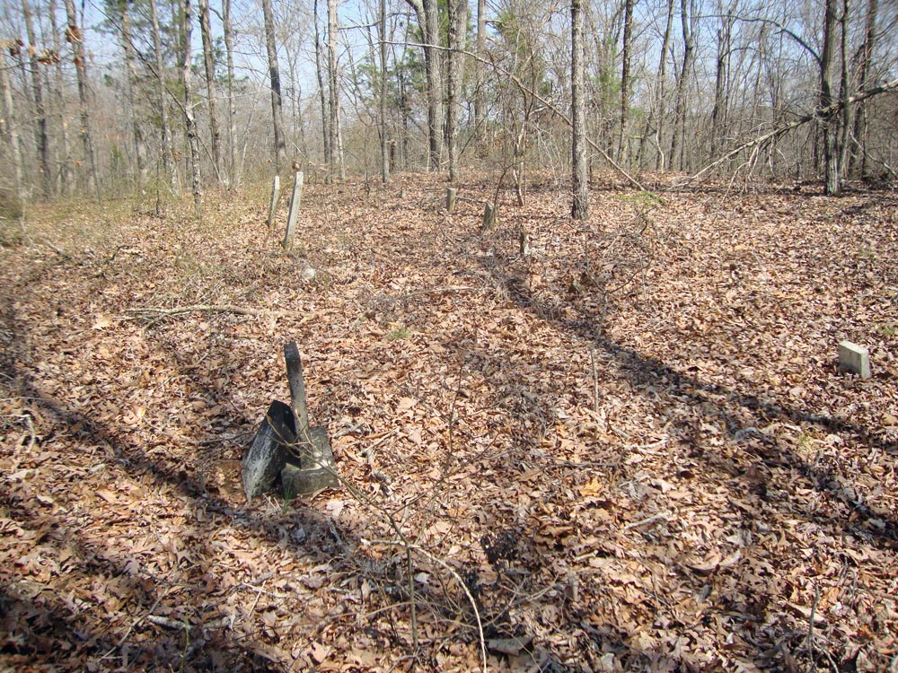
| Description | : | This Cemetery is also known as ISRAEL BURNS FAMILY CEMETERY! There's only four identified graves in this cemetery, and those are of the Israel Burns family. There's several rocks which probably indicate burials, but there's no names on any of the stones. The following was graciously contributed by Dorothy Higginbottom Russell of Cherokee, Colbert County, Alabama: Location is SE4 NE4, Sec 24m T5S, R15W. From US72, take Colbert Co 21 south to the junction with Colbert Co 12 (which is also White Pike Road). Follow Colbert Co 12 to the point where the main TVA power line crosses the road. ... Read More |
frequently asked questions (FAQ):
-
Where is Burns Family Cemetery?
Burns Family Cemetery is located at Cherokee, Colbert County ,Alabama ,USA.
-
Burns Family Cemetery cemetery's updated grave count on graveviews.com?
0 memorials
-
Where are the coordinates of the Burns Family Cemetery?
Latitude: 34.6171150
Longitude: -88.0555130
Nearby Cemetories:
1. Sally Burns Cemetery
Cherokee, Colbert County, USA
Coordinate: 34.6019630, -88.0661930
2. Mynot Cemetery
Cherokee, Colbert County, USA
Coordinate: 34.6467018, -88.0492020
3. Finley Cemetery
Maud, Colbert County, USA
Coordinate: 34.6389008, -88.1053009
4. Maud Burns Cemetery
Colbert County, USA
Coordinate: 34.6409721, -88.1110535
5. Russell Cemetery
Maud, Colbert County, USA
Coordinate: 34.5956001, -88.1331024
6. Perry Bolton Cemetery
Pleasant Site, Franklin County, USA
Coordinate: 34.5490630, -88.0387140
7. Bolton Cemetery
Belgreen, Franklin County, USA
Coordinate: 34.5489006, -88.0391998
8. Johnson Cemetery
Colbert County, USA
Coordinate: 34.6713982, -88.1119003
9. Pleasant Site Cemetery
Red Bay, Franklin County, USA
Coordinate: 34.5433006, -88.0669022
10. Lower Pleasant Site Cemetery
Franklin County, USA
Coordinate: 34.5443993, -88.0843964
11. James Cemetery
Franklin County, USA
Coordinate: 34.5527992, -88.1147003
12. Cumberland Presbyterian Cemetery
Allsboro, Colbert County, USA
Coordinate: 34.6837500, -88.1109000
13. Carter Branch Cemetery
Tishomingo, Tishomingo County, USA
Coordinate: 34.6657982, -88.1363983
14. Forest Grove Cemetery
Mingo, Tishomingo County, USA
Coordinate: 34.6152992, -88.1624985
15. Allsboro Cemetery
Colbert County, USA
Coordinate: 34.6936989, -88.1112976
16. Martin Cemetery
Tishomingo County, USA
Coordinate: 34.6660995, -88.1483002
17. Mount Zion Cemetery
Colbert County, USA
Coordinate: 34.6961670, -87.9908610
18. Old Union Cemetery
Belmont, Tishomingo County, USA
Coordinate: 34.5696983, -88.1667023
19. Rickard Cemetery
Cherokee, Colbert County, USA
Coordinate: 34.7143850, -88.0115590
20. Mount Pleasant Cemetery
Cherokee, Colbert County, USA
Coordinate: 34.7141991, -88.0102997
21. Alsobrook Cemetery
Malone, Colbert County, USA
Coordinate: 34.7167015, -88.1106033
22. Blue Lick Cemetery
Franklin County, USA
Coordinate: 34.5341988, -87.9666977
23. Paradise Cemetery
Tishomingo County, USA
Coordinate: 34.6514015, -88.1844025
24. McCollough Cemetery
Colbert County, USA
Coordinate: 34.6361008, -87.9160995