
| Memorials | : | 0 |
| Location | : | Cherokee, Colbert County, USA |
| Coordinate | : | 34.6019630, -88.0661930 |
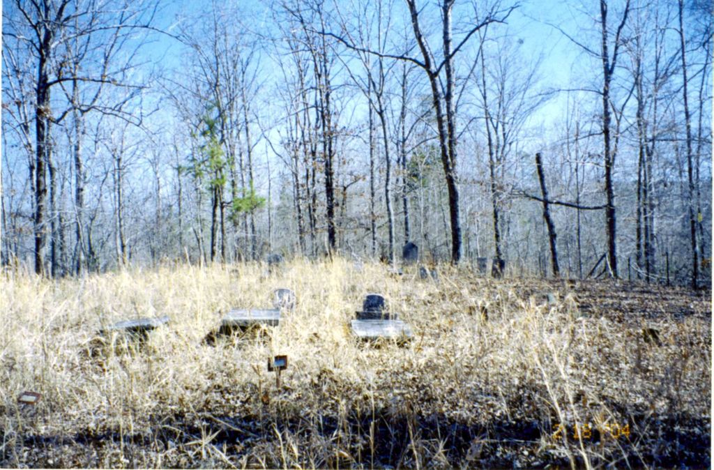
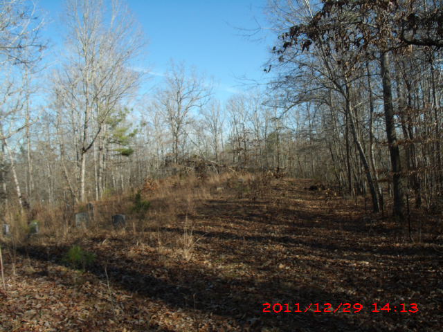
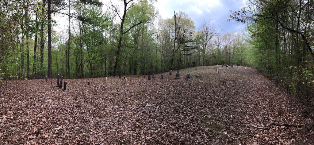
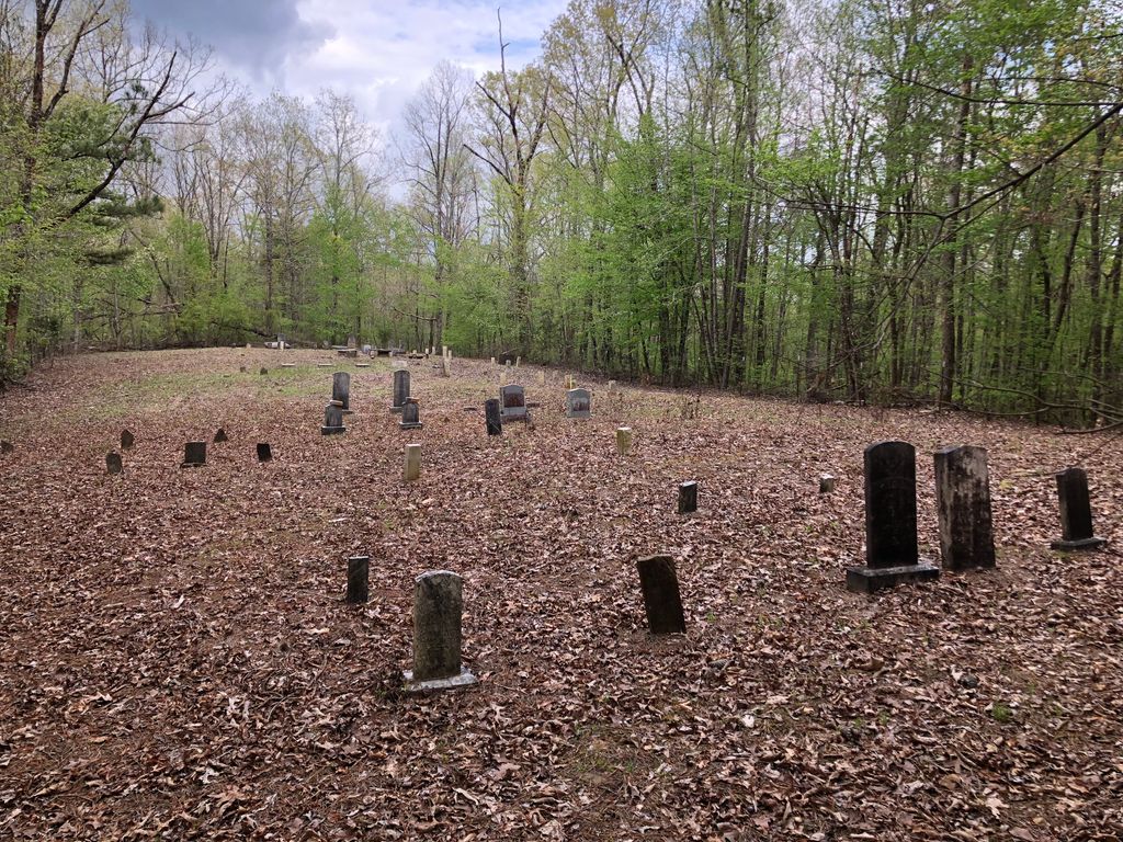
| Description | : | This Cemetery is locally known as the 'Moore Cemetery'. It was named the 'Sally Burns Cemetery' by the folks doing the WPA cemetery surveys in the 1930's. There is NO SIGN on Sally Burns Road indicating that a cemetery is present. The location is south of White Pike (County Road 12). If you go north over the Rock Creek Bridge, toward White Pike Road, you've gone too far. The cemetery is in a fenced off, cleared area about two city blocks as you walk through the woods. There is no place off the road to park... Read More |
frequently asked questions (FAQ):
-
Where is Sally Burns Cemetery?
Sally Burns Cemetery is located at Cherokee, Colbert County ,Alabama ,USA.
-
Sally Burns Cemetery cemetery's updated grave count on graveviews.com?
0 memorials
-
Where are the coordinates of the Sally Burns Cemetery?
Latitude: 34.6019630
Longitude: -88.0661930
Nearby Cemetories:
1. Burns Family Cemetery
Cherokee, Colbert County, USA
Coordinate: 34.6171150, -88.0555130
2. Mynot Cemetery
Cherokee, Colbert County, USA
Coordinate: 34.6467018, -88.0492020
3. Finley Cemetery
Maud, Colbert County, USA
Coordinate: 34.6389008, -88.1053009
4. Maud Burns Cemetery
Colbert County, USA
Coordinate: 34.6409721, -88.1110535
5. Russell Cemetery
Maud, Colbert County, USA
Coordinate: 34.5956001, -88.1331024
6. Bolton Cemetery
Belgreen, Franklin County, USA
Coordinate: 34.5489006, -88.0391998
7. Perry Bolton Cemetery
Pleasant Site, Franklin County, USA
Coordinate: 34.5490630, -88.0387140
8. Pleasant Site Cemetery
Red Bay, Franklin County, USA
Coordinate: 34.5433006, -88.0669022
9. Lower Pleasant Site Cemetery
Franklin County, USA
Coordinate: 34.5443993, -88.0843964
10. James Cemetery
Franklin County, USA
Coordinate: 34.5527992, -88.1147003
11. Johnson Cemetery
Colbert County, USA
Coordinate: 34.6713982, -88.1119003
12. Forest Grove Cemetery
Mingo, Tishomingo County, USA
Coordinate: 34.6152992, -88.1624985
13. Carter Branch Cemetery
Tishomingo, Tishomingo County, USA
Coordinate: 34.6657982, -88.1363983
14. Old Union Cemetery
Belmont, Tishomingo County, USA
Coordinate: 34.5696983, -88.1667023
15. Cumberland Presbyterian Cemetery
Allsboro, Colbert County, USA
Coordinate: 34.6837500, -88.1109000
16. Martin Cemetery
Tishomingo County, USA
Coordinate: 34.6660995, -88.1483002
17. Allsboro Cemetery
Colbert County, USA
Coordinate: 34.6936989, -88.1112976
18. Blue Lick Cemetery
Franklin County, USA
Coordinate: 34.5341988, -87.9666977
19. Paradise Cemetery
Tishomingo County, USA
Coordinate: 34.6514015, -88.1844025
20. Mount Zion Cemetery
Colbert County, USA
Coordinate: 34.6961670, -87.9908610
21. Mann Cemetery
Belmont, Tishomingo County, USA
Coordinate: 34.5191994, -88.1650009
22. Prospect Cemetery
Belmont, Tishomingo County, USA
Coordinate: 34.5193730, -88.1652740
23. Bonds Cemetery
Dempsey, Franklin County, USA
Coordinate: 34.5320000, -87.9520000
24. Highland Baptist Church Cemetery
Tishomingo, Tishomingo County, USA
Coordinate: 34.6192017, -88.2082977