
| Memorials | : | 0 |
| Location | : | Herdland Township, Clay County, USA |
| Coordinate | : | 42.9235992, -95.0907974 |
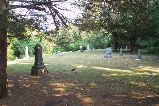
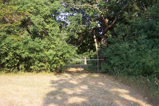
| Description | : | It comprises the burials for the old community that used to exist there, the Burr Oak Community which was located in Herland Township. It is Located in Section 34 of Herdland Township, Clay County, Iowa, intersection of 500th St and 250th Ave. Latitude: 42.924ºN Longitude: 95.091ºW. Attached is a picture to make it easier for people to find the cemetery. It is hidden in the woods and in the picture is in the top left hand side of section 34 in herland township. |
frequently asked questions (FAQ):
-
Where is Burr Oak Cemetery?
Burr Oak Cemetery is located at RR2 Herdland Township, Clay County ,Iowa ,USA.
-
Burr Oak Cemetery cemetery's updated grave count on graveviews.com?
0 memorials
-
Where are the coordinates of the Burr Oak Cemetery?
Latitude: 42.9235992
Longitude: -95.0907974
Nearby Cemetories:
1. Osborn Cemetery
Webb, Clay County, USA
Coordinate: 42.9346918, -95.0608244
2. Saint Josephs Cemetery
Sioux Rapids, Buena Vista County, USA
Coordinate: 42.8883018, -95.1324997
3. Fanny Fern Cemetery
Clay County, USA
Coordinate: 42.9530983, -95.1607971
4. Lone Tree Cemetery
Sioux Rapids, Buena Vista County, USA
Coordinate: 42.8819008, -95.1492004
5. Liberty Cemetery
Greenville, Clay County, USA
Coordinate: 42.9897003, -95.1417007
6. Poland Township Cemetery
Marathon, Buena Vista County, USA
Coordinate: 42.8610992, -94.9916992
7. Douglas Township Cemetery
Clay County, USA
Coordinate: 42.9255981, -95.2450027
8. Rosehill Cemetery
Clay County, USA
Coordinate: 43.0368996, -95.0919037
9. Barnes Township Cemetery
Linn Grove, Buena Vista County, USA
Coordinate: 42.8880997, -95.2397003
10. Garfield Township Cemetery
Webb, Clay County, USA
Coordinate: 42.9538994, -94.9392014
11. Little Sioux Valley Cemetery
Rembrandt, Buena Vista County, USA
Coordinate: 42.8375015, -95.2074966
12. Zion Methodist Cemetery
Clay County, USA
Coordinate: 42.9808006, -95.2497025
13. Smith Cemetery
Albert City, Buena Vista County, USA
Coordinate: 42.8142014, -94.9925003
14. Lincoln Cemetery
Rossie, Clay County, USA
Coordinate: 43.0111008, -95.2313995
15. Garton Family Cemetery
Marathon, Buena Vista County, USA
Coordinate: 42.8297000, -94.9334500
16. Logan Township Cemetery
Clay County, USA
Coordinate: 43.0489006, -94.9747009
17. Swan Lake Cemetery
Laurens, Pocahontas County, USA
Coordinate: 42.8511009, -94.8925018
18. Fairfield Cemetery
Albert City, Buena Vista County, USA
Coordinate: 42.7783012, -94.9692001
19. Willow Creek Cemetery
Royal, Clay County, USA
Coordinate: 43.0214005, -95.2885971
20. Swedish Lutheran Cemetery
Royal, Clay County, USA
Coordinate: 43.0683000, -95.2350000
21. Lincoln Township Cemetery
Buena Vista County, USA
Coordinate: 42.7413000, -95.1282000
22. Oakland Cemetery
Peterson, Clay County, USA
Coordinate: 42.9281006, -95.3432999
23. Calvary Cemetery
Silver Lake Township, Palo Alto County, USA
Coordinate: 43.0386009, -94.8613968
24. Calvary Cemetery
Laurens, Pocahontas County, USA
Coordinate: 42.8403015, -94.8368988