
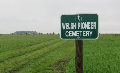
| Memorials | : | 113 |
| Location | : | Clay County, USA |
| Coordinate | : | 42.9255981, -95.2450027 |
frequently asked questions (FAQ):
-
Where is Douglas Township Cemetery?
Douglas Township Cemetery is located at Clay County ,Iowa ,USA.
-
Douglas Township Cemetery cemetery's updated grave count on graveviews.com?
113 memorials
-
Where are the coordinates of the Douglas Township Cemetery?
Latitude: 42.9255981
Longitude: -95.2450027
Nearby Cemetories:
1. Barnes Township Cemetery
Linn Grove, Buena Vista County, USA
Coordinate: 42.8880997, -95.2397003
2. Zion Methodist Cemetery
Clay County, USA
Coordinate: 42.9808006, -95.2497025
3. Fanny Fern Cemetery
Clay County, USA
Coordinate: 42.9530983, -95.1607971
4. Oakland Cemetery
Peterson, Clay County, USA
Coordinate: 42.9281006, -95.3432999
5. Lone Tree Cemetery
Sioux Rapids, Buena Vista County, USA
Coordinate: 42.8819008, -95.1492004
6. Lincoln Cemetery
Rossie, Clay County, USA
Coordinate: 43.0111008, -95.2313995
7. Saint Josephs Cemetery
Sioux Rapids, Buena Vista County, USA
Coordinate: 42.8883018, -95.1324997
8. Little Sioux Valley Cemetery
Rembrandt, Buena Vista County, USA
Coordinate: 42.8375015, -95.2074966
9. Liberty Cemetery
Greenville, Clay County, USA
Coordinate: 42.9897003, -95.1417007
10. Willow Creek Cemetery
Royal, Clay County, USA
Coordinate: 43.0214005, -95.2885971
11. Saint Johannes Cemetery
Brooke Township, Buena Vista County, USA
Coordinate: 42.8662758, -95.3669968
12. Burr Oak Cemetery
Herdland Township, Clay County, USA
Coordinate: 42.9235992, -95.0907974
13. Hannibal H Waterman Cemetery
O'Brien County, USA
Coordinate: 42.9375530, -95.4170760
14. Clay Center Cemetery
Royal, Clay County, USA
Coordinate: 43.0410995, -95.3272018
15. Plainview Cemetery
Alta, Buena Vista County, USA
Coordinate: 42.8087100, -95.3280200
16. Osborn Cemetery
Webb, Clay County, USA
Coordinate: 42.9346918, -95.0608244
17. Swedish Lutheran Cemetery
Royal, Clay County, USA
Coordinate: 43.0683000, -95.2350000
18. Fred Feldman Grave
Waterman Township, O'Brien County, USA
Coordinate: 42.9178590, -95.4433340
19. Immanuel Lutheran Church Cemetery
Aurelia, Cherokee County, USA
Coordinate: 42.8165000, -95.3885000
20. Rosehill Cemetery
Clay County, USA
Coordinate: 43.0368996, -95.0919037
21. Elk Cemetery
Elk Township, Buena Vista County, USA
Coordinate: 42.7641983, -95.3094025
22. TriMello Cemetery
Royal, Clay County, USA
Coordinate: 43.0682983, -95.3728027
23. Haight Family Farm Cemetery
Aurelia, Cherokee County, USA
Coordinate: 42.7778400, -95.3781060
24. Waterman Cemetery
Sutherland, O'Brien County, USA
Coordinate: 42.9664001, -95.4847031