
| Memorials | : | 6 |
| Location | : | Franklin County, USA |
| Coordinate | : | 37.1237000, -79.8236100 |
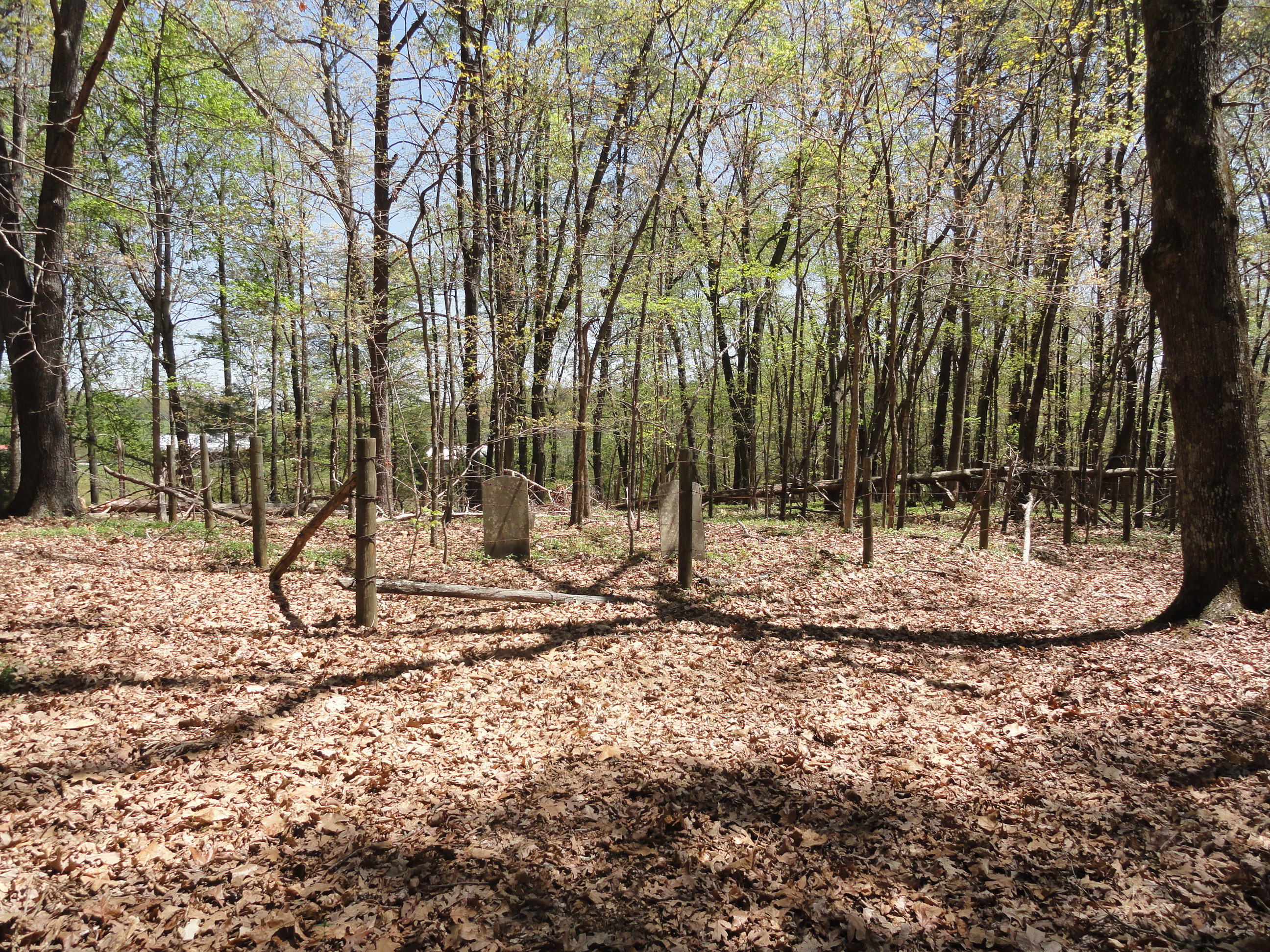
| Description | : | Cemetery located on Poteet Rd. on right, about .3 of mile from Landmark Road, near Burnt Chimney, Wirtz, Virginia. There are at least 8 graves marked with field stones. Cemetery enclosed in barbed wire fence, with fallen trees inside the cemetery. *Listed as Cabiness Cemetery in Cemetery Records of Franklin County, Virginia, compiled by The Franklin County Historical Society. On tombstones names are spelled as Cabaniss. |
frequently asked questions (FAQ):
-
Where is Cabiness Cemetery?
Cabiness Cemetery is located at Franklin County ,Virginia ,USA.
-
Cabiness Cemetery cemetery's updated grave count on graveviews.com?
6 memorials
-
Where are the coordinates of the Cabiness Cemetery?
Latitude: 37.1237000
Longitude: -79.8236100
Nearby Cemetories:
1. Ozzie Cemetery
Burnt Chimney, Franklin County, USA
Coordinate: 37.1227989, -79.8283005
2. Bailey-Sink Cemetery
Franklin County, USA
Coordinate: 37.1240400, -79.8365600
3. Harper Cemetery
Burnt Chimney, Franklin County, USA
Coordinate: 37.1122290, -79.8241890
4. Oak Hill Cemetery
Boones Mill, Franklin County, USA
Coordinate: 37.1290550, -79.8491400
5. Burwell Cemetery
Burnt Chimney, Franklin County, USA
Coordinate: 37.1184900, -79.7896100
6. Booth Cemetery
Franklin County, USA
Coordinate: 37.1181000, -79.7895500
7. Altice Farm Cemetery
Franklin County, USA
Coordinate: 37.1471500, -79.8015300
8. Crook Cemetery
Burnt Chimney, Franklin County, USA
Coordinate: 37.0966970, -79.7984650
9. Red Valley United Methodist Church Cemetery
Boones Mill, Franklin County, USA
Coordinate: 37.1381890, -79.8624620
10. Old Liberty Cemetery
Burnt Chimney, Franklin County, USA
Coordinate: 37.0871949, -79.8263603
11. Bailey Cemetery
Franklin County, USA
Coordinate: 37.1244011, -79.8722000
12. Starkey-Stover Cemetery
Boones Mill, Franklin County, USA
Coordinate: 37.1238228, -79.8794947
13. Chambers-Perdue Cemetery
Burnt Chimney, Franklin County, USA
Coordinate: 37.0782400, -79.8162300
14. Bonbrook Baptist Church Cemetery
Boones Mill, Franklin County, USA
Coordinate: 37.1022710, -79.8756380
15. Chestnut Grove Cemetery
Franklin County, USA
Coordinate: 37.0964012, -79.7722015
16. Bowman #4
Boones Mill, Franklin County, USA
Coordinate: 37.0982000, -79.8764700
17. Jefferson Family Cemetery
Burnt Chimney, Franklin County, USA
Coordinate: 37.0923450, -79.7751400
18. Reed Family Cemetery
Hardy, Bedford County, USA
Coordinate: 37.1736830, -79.8033120
19. Plunkett Cemetery
Boones Mill, Franklin County, USA
Coordinate: 37.1519012, -79.8794022
20. Basham Cemetery
Franklin County, USA
Coordinate: 37.1747017, -79.8000031
21. Barton Cemetery
Franklin County, USA
Coordinate: 37.1768900, -79.8067000
22. Basham Cemetery
Franklin County, USA
Coordinate: 37.1767500, -79.7997700
23. Booth Lovelace Plantation
Franklin County, USA
Coordinate: 37.1721500, -79.8673400
24. Robertson Cemetery
Burnt Chimney, Franklin County, USA
Coordinate: 37.1126970, -79.7411150