
| Memorials | : | 12 |
| Location | : | Burnt Chimney, Franklin County, USA |
| Coordinate | : | 37.0782400, -79.8162300 |
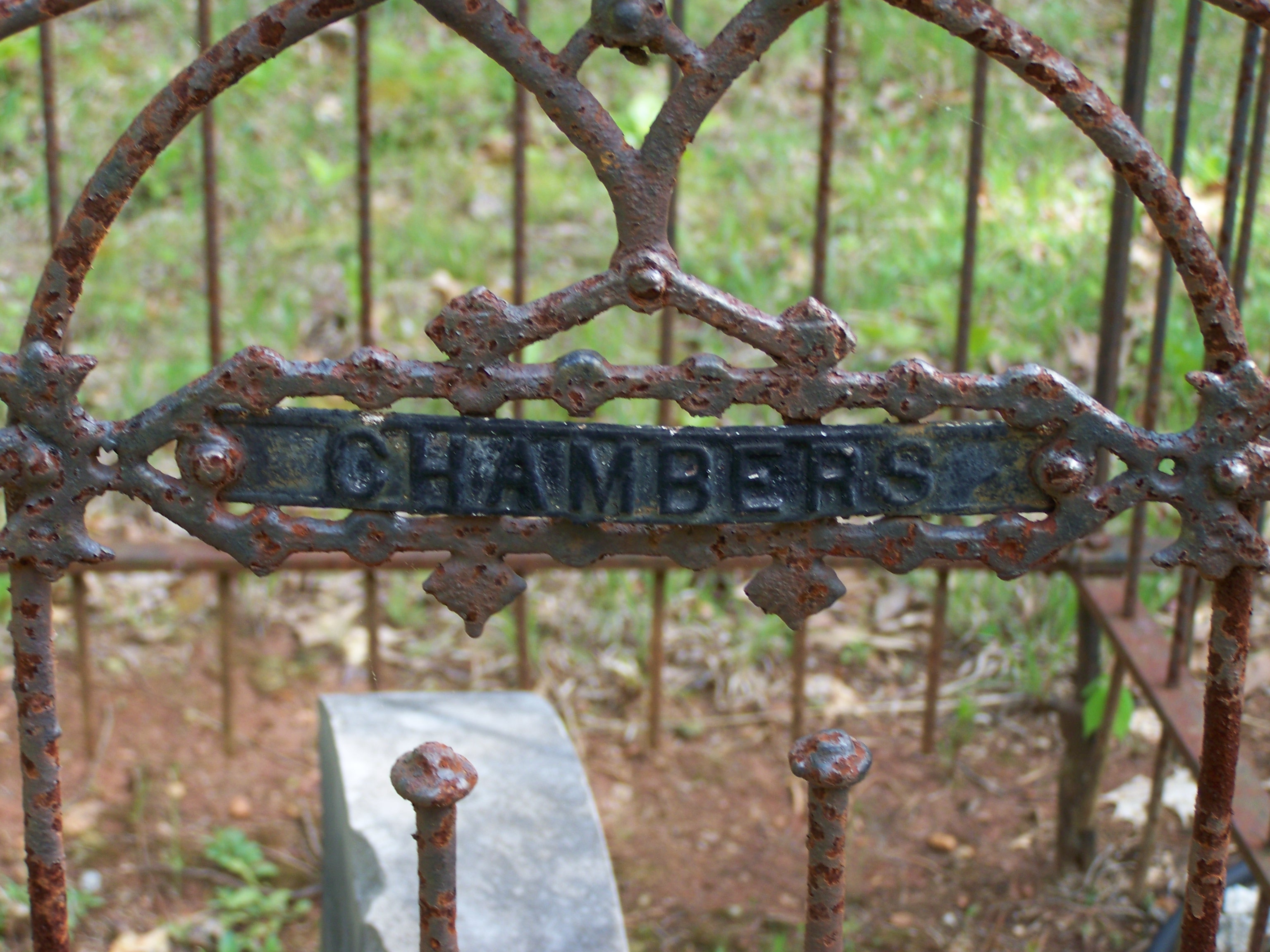
| Description | : | The Chambers-Perdue Cemetery is located off Booker T. Washington Highway (VA #122) southwest of the Burnt Chimney intersection 0.8 miles south of the Wirtz Road (VA #697) junction. Enter Dee Dee Lane (there are two Dee Dee Lanes adjacent to each other. This is the one on the south at 5172 BTW Hwy.) Follow the dirt road a short distance (~1/8 mile) past the derelict house and on perhaps 1/4 mile more to cemetery in clearing. There are actually two cemeteries (Perdue & Chambers) back-to-back surrounded by wrought iron fences. |
frequently asked questions (FAQ):
-
Where is Chambers-Perdue Cemetery?
Chambers-Perdue Cemetery is located at Burnt Chimney, Franklin County ,Virginia ,USA.
-
Chambers-Perdue Cemetery cemetery's updated grave count on graveviews.com?
12 memorials
-
Where are the coordinates of the Chambers-Perdue Cemetery?
Latitude: 37.0782400
Longitude: -79.8162300


Nearby Cemetories:
1. Old Liberty Cemetery
Burnt Chimney, Franklin County, USA
Coordinate: 37.0871949, -79.8263603
2. Crook Cemetery
Burnt Chimney, Franklin County, USA
Coordinate: 37.0966970, -79.7984650
3. Harper Cemetery
Burnt Chimney, Franklin County, USA
Coordinate: 37.1122290, -79.8241890
4. Jefferson Family Cemetery
Burnt Chimney, Franklin County, USA
Coordinate: 37.0923450, -79.7751400
5. Chestnut Grove Cemetery
Franklin County, USA
Coordinate: 37.0964012, -79.7722015
6. Booth Cemetery
Franklin County, USA
Coordinate: 37.1181000, -79.7895500
7. Burwell Cemetery
Burnt Chimney, Franklin County, USA
Coordinate: 37.1184900, -79.7896100
8. Ozzie Cemetery
Burnt Chimney, Franklin County, USA
Coordinate: 37.1227989, -79.8283005
9. Cabiness Cemetery
Franklin County, USA
Coordinate: 37.1237000, -79.8236100
10. Bailey-Sink Cemetery
Franklin County, USA
Coordinate: 37.1240400, -79.8365600
11. Bowman #4
Boones Mill, Franklin County, USA
Coordinate: 37.0982000, -79.8764700
12. Bonbrook Baptist Church Cemetery
Boones Mill, Franklin County, USA
Coordinate: 37.1022710, -79.8756380
13. Oak Hill Cemetery
Boones Mill, Franklin County, USA
Coordinate: 37.1290550, -79.8491400
14. Bailey Cemetery
Franklin County, USA
Coordinate: 37.1244011, -79.8722000
15. Starkey-Stover Cemetery
Boones Mill, Franklin County, USA
Coordinate: 37.1238228, -79.8794947
16. Robertson Cemetery
Burnt Chimney, Franklin County, USA
Coordinate: 37.1126970, -79.7411150
17. Altice Farm Cemetery
Franklin County, USA
Coordinate: 37.1471500, -79.8015300
18. Red Valley United Methodist Church Cemetery
Boones Mill, Franklin County, USA
Coordinate: 37.1381890, -79.8624620
19. Chitwood Cemetery
Franklin County, USA
Coordinate: 37.0088997, -79.7818985
20. Halesford Baptist Church Cemetery
Burnt Chimney, Franklin County, USA
Coordinate: 37.1214800, -79.7381000
21. Burroughs Family Cemetery
Franklin County, USA
Coordinate: 37.1203308, -79.7315292
22. Arrington Cemetery
Franklin County, USA
Coordinate: 37.0097008, -79.7568970
23. Forbes-Hodges Cemetery
Boones Mill, Franklin County, USA
Coordinate: 37.1207119, -79.9081643
24. Plunkett Cemetery
Boones Mill, Franklin County, USA
Coordinate: 37.1519012, -79.8794022