
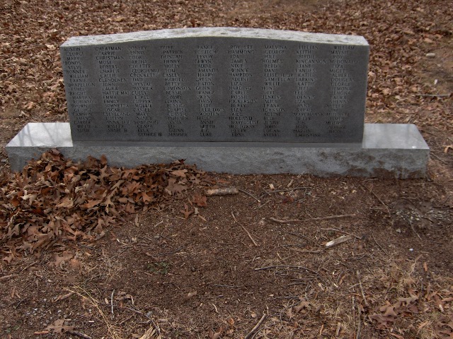
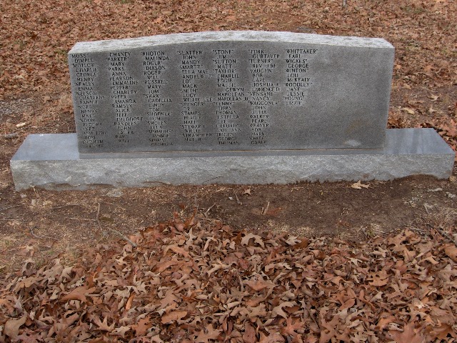
| Memorials | : | 669 |
| Location | : | Coffee County, USA |
| Coordinate | : | 35.3656006, -86.1841965 |
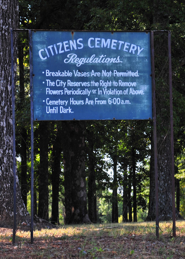
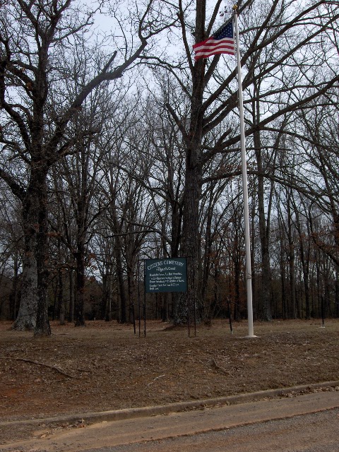
| Description | : | Citizens Cemetery - (Community Marker) This land began to be used as a cemetery for the Black community in the 1870's but the State of Tennessee took the land as part of the area became Camp Peay, a World War I training base. In 1940 the US Government took the land which became part of Camp Forrest, a World War II training base and burials ceased. The cemetery includes a score of persons who were refugees from the Great Flood of the Mississippi and Ohio Rivers of 1937 who were relocated to Camp Peay. The cemetery was later abandoned and... Read More |
frequently asked questions (FAQ):
-
Where is Camp Forrest Cemetery?
Camp Forrest Cemetery is located at Coffee County ,Tennessee ,USA.
-
Camp Forrest Cemetery cemetery's updated grave count on graveviews.com?
669 memorials
-
Where are the coordinates of the Camp Forrest Cemetery?
Latitude: 35.3656006
Longitude: -86.1841965
Nearby Cemetories:
1. Carroll Cemetery
Coffee County, USA
Coordinate: 35.4202995, -86.1671982
2. Davis Cemetery
Coffee County, USA
Coordinate: 35.4174995, -86.2283020
3. Gault Cemetery
Franklin County, USA
Coordinate: 35.3256203, -86.2465301
4. Spring Creek Cemetery
Estill Springs, Franklin County, USA
Coordinate: 35.3185997, -86.1292038
5. Neel Chapel Cemetery
Coffee County, USA
Coordinate: 35.4319000, -86.1900024
6. Brown Cemetery
Franklin County, USA
Coordinate: 35.3058014, -86.2363968
7. Blanton Cemetery
Coffee County, USA
Coordinate: 35.4418983, -86.1697006
8. Neel Cemetery
Coffee County, USA
Coordinate: 35.4441986, -86.1892014
9. Spring Creek Cemetery
Estill Springs, Franklin County, USA
Coordinate: 35.3060989, -86.1156006
10. Shipley Cemetery
Manchester, Coffee County, USA
Coordinate: 35.4032400, -86.0950700
11. Gilbert Cemetery
Franklin County, USA
Coordinate: 35.2938995, -86.2433014
12. Mount Olivet Cemetery
Estill Springs, Franklin County, USA
Coordinate: 35.2797012, -86.1639023
13. Barton Cemetery
Coffee County, USA
Coordinate: 35.4474983, -86.2225037
14. Fletcher Cemetery
Franklin County, USA
Coordinate: 35.2757988, -86.1727982
15. Simpson Cemetery
Estill Springs, Franklin County, USA
Coordinate: 35.2821999, -86.1406021
16. Lusk Cemetery
Coffee County, USA
Coordinate: 35.4444008, -86.1288986
17. Williams Cemetery
Moore County, USA
Coordinate: 35.3382988, -86.2913971
18. Huffar Cemetery
Coffee County, USA
Coordinate: 35.3807983, -86.0702972
19. New Awalt Cemetery
Estill Springs, Franklin County, USA
Coordinate: 35.2694000, -86.1841700
20. Chastain Cemetery
Franklin County, USA
Coordinate: 35.2789001, -86.2418976
21. Turkey Creek Cemetery
Moore County, USA
Coordinate: 35.3072014, -86.2818985
22. Estill Springs Cemetery
Estill Springs, Franklin County, USA
Coordinate: 35.2764015, -86.1299973
23. Brandon Cemetery
Coffee County, USA
Coordinate: 35.4618988, -86.2157974
24. Jabel Ray Home Place Cemetery
Moore County, USA
Coordinate: 35.3516045, -86.3062744