
| Memorials | : | 0 |
| Location | : | Estill Springs, Franklin County, USA |
| Coordinate | : | 35.3185997, -86.1292038 |
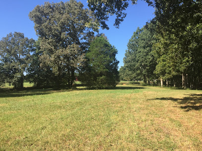
| Description | : | Spring Creek Cemetery is on high ground just north of the intersection of Spring Creek Road and Matlock Lane, Estill Springs, Tennessee, in a heavily wooded and overgrown area (as of 2019), on land owned by Larry and Diane Matlock who live at the east end of Matlock Lane. The cemetery is next to the southern boundary of Arnold Air Force Base. The Matlocks say Spring Creek Church used to stand in an open area that is between Spring Creek Road and the cemetery, but the church burned down many years ago. The cemetery includes a small but prominent... Read More |
frequently asked questions (FAQ):
-
Where is Spring Creek Cemetery?
Spring Creek Cemetery is located at Spring Creek Road Estill Springs, Franklin County ,Tennessee ,USA.
-
Spring Creek Cemetery cemetery's updated grave count on graveviews.com?
0 memorials
-
Where are the coordinates of the Spring Creek Cemetery?
Latitude: 35.3185997
Longitude: -86.1292038
Nearby Cemetories:
1. Spring Creek Cemetery
Estill Springs, Franklin County, USA
Coordinate: 35.3060989, -86.1156006
2. Old Grays Mill Cemetery
Estill Springs, Franklin County, USA
Coordinate: 35.2872009, -86.1057968
3. Simpson Cemetery
Estill Springs, Franklin County, USA
Coordinate: 35.2821999, -86.1406021
4. Old Bethpage Cemetery
Estill Springs, Franklin County, USA
Coordinate: 35.2827988, -86.1132965
5. Estill Springs Cemetery
Estill Springs, Franklin County, USA
Coordinate: 35.2764015, -86.1299973
6. Bethpage Cemetery
Estill Springs, Franklin County, USA
Coordinate: 35.2775002, -86.1108017
7. Mount Olivet Cemetery
Estill Springs, Franklin County, USA
Coordinate: 35.2797012, -86.1639023
8. Gossage Cemetery
Estill Springs, Franklin County, USA
Coordinate: 35.2742004, -86.1042023
9. Elder Cemetery
Franklin County, USA
Coordinate: 35.3088989, -86.0697021
10. Fletcher Cemetery
Franklin County, USA
Coordinate: 35.2757988, -86.1727982
11. Duncan Cemetery
Franklin County, USA
Coordinate: 35.2621994, -86.1393967
12. Paynes Cemetery
Estill Springs, Franklin County, USA
Coordinate: 35.2778015, -86.0742035
13. Clemmons Cemetery
Franklin County, USA
Coordinate: 35.2566986, -86.1386032
14. Duncans Stagecoach Cemetery
Franklin County, USA
Coordinate: 35.2757988, -86.0730972
15. Corn Cemetery
Franklin County, USA
Coordinate: 35.2564011, -86.1074982
16. Camp Forrest Cemetery
Coffee County, USA
Coordinate: 35.3656006, -86.1841965
17. Elk River Primitive Baptist Church Cemetery
Capitol Hill, Franklin County, USA
Coordinate: 35.2928589, -86.0541508
18. New Awalt Cemetery
Estill Springs, Franklin County, USA
Coordinate: 35.2694000, -86.1841700
19. Duncan Cemetery
Franklin County, USA
Coordinate: 35.2818985, -86.0563965
20. Hunt Cemetery
Estill Springs, Franklin County, USA
Coordinate: 35.2531013, -86.1616974
21. Huffar Cemetery
Coffee County, USA
Coordinate: 35.3807983, -86.0702972
22. Acklen Cemetery
Franklin County, USA
Coordinate: 35.2352982, -86.1369019
23. Finney Cemetery
Franklin County, USA
Coordinate: 35.2703018, -86.0428009
24. Asia Cemetery
Estill Springs, Franklin County, USA
Coordinate: 35.2392006, -86.0864029