| Memorials | : | 0 |
| Location | : | Salisbury, Litchfield County, USA |
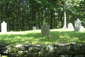
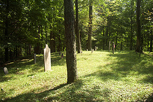
| Description | : | According to Historical collections relating to the town of Salisbury, the inscriptions for this cemetery were taken in 1898 from stones standing in a small yard a few rods east of the Under Mountain Road, about a quarter of a mile north of Sage's Ravine highway bridge. This yard is also partly in Sheffield, Massachusetts. The cemetery was photographed in 2004 by Michelle & Rocco Valenzano. |
frequently asked questions (FAQ):
-
Where is Candee-Sage Cemetery?
Candee-Sage Cemetery is located at No GPS information available Add GPSUnder Mountain Road (Rt. 41) Salisbury, Litchfield County ,Connecticut , 06068USA.
-
Candee-Sage Cemetery cemetery's updated grave count on graveviews.com?
0 memorials
Nearby Cemetories:
1. Bakersville Cemetery
Bakersville, Litchfield County, USA
Coordinate: 41.7270000, -73.4820200
2. Alder City Cemetery
Kent, Litchfield County, USA
Coordinate: 41.6756700, -73.4793000
3. Bulls Bridge Cemetery
Kent, Litchfield County, USA
Coordinate: 41.6929800, -73.5013500
4. Congregational Church Cemetery
Kent, Litchfield County, USA
Coordinate: 41.7844009, -73.4633026
5. Flanders Cemetery
Kent, Litchfield County, USA
Coordinate: 41.5566400, -73.3095120
6. Good Hill Cemetery
Kent, Litchfield County, USA
Coordinate: 41.5649000, -73.3142470
7. Kent Hollow Cemetery
Kent, Litchfield County, USA
Coordinate: 41.5659485, -73.3193207
8. Kent School Cemetery
Kent, Litchfield County, USA
Coordinate: 41.5471611, -73.2876282
9. Morehouse Family Cemetery
Kent, Litchfield County, USA
Coordinate: 41.5643997, -73.2639008
10. Parcells Family Cemetery
Kent, Litchfield County, USA
Coordinate: 41.5300590, -73.3005130
11. Sacred Heart Cemetery
Kent, Litchfield County, USA
Coordinate: 41.5624886, -73.3115082
12. Saint Andrew's Cemetery
Kent, Litchfield County, USA
Coordinate: 41.5645676, -73.3193207
13. Saint Joseph Chapel Cemetery
Kent, Litchfield County, USA
Coordinate: 41.7270000, -73.4820200
14. Saint Michaels Chapel Cemetery
Kent, Litchfield County, USA
Coordinate: 41.6756700, -73.4793000
15. Schaghticoke Tribal Burial Ground
Kent, Litchfield County, USA
Coordinate: 41.6929800, -73.5013500
16. Skiff Mountain Cemetery
Kent, Litchfield County, USA
Coordinate: 41.7844009, -73.4633026
17. Christ Church Columbarium
Roxbury, Litchfield County, USA
Coordinate: 41.5566400, -73.3095120
18. Great Oak Cemetery
Roxbury, Litchfield County, USA
Coordinate: 41.5649000, -73.3142470
19. North Cemetery
Roxbury, Litchfield County, USA
Coordinate: 41.5659485, -73.3193207
20. Old Cemetery
Roxbury, Litchfield County, USA
Coordinate: 41.5471611, -73.2876282
21. Old Levenworth Cemetery
Roxbury, Litchfield County, USA
Coordinate: 41.5643997, -73.2639008
22. Old South Cemetery
Roxbury, Litchfield County, USA
Coordinate: 41.5300590, -73.3005130
23. Roxbury Center Cemetery
Roxbury, Litchfield County, USA
Coordinate: 41.5624886, -73.3115082
24. Saint Patrick Cemetery
Roxbury, Litchfield County, USA
Coordinate: 41.5645676, -73.3193207


