
| Memorials | : | 0 |
| Location | : | Haywood County, USA |
| Coordinate | : | 35.6030360, -89.0963250 |
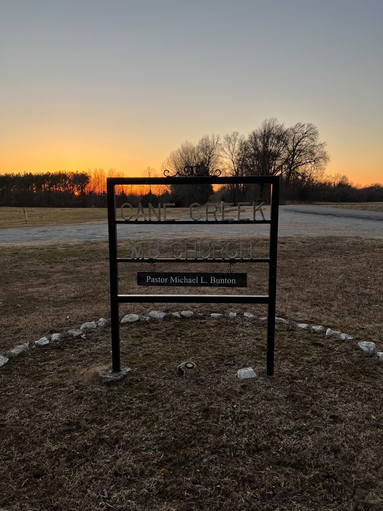
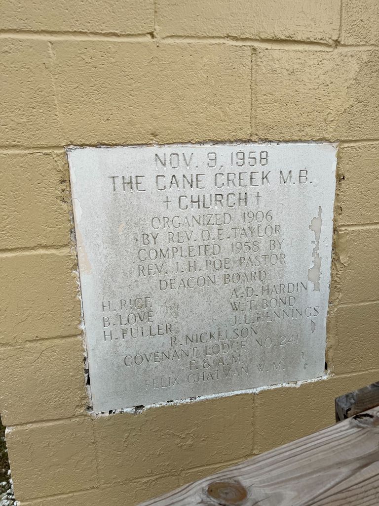
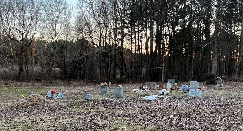
| Description | : | Directions: Located on the southwest side of Cane Creek Road about 1.8 miles north of its juncture with U.S. Highway 70 (at the Interstate Highway 40 interchange) (from JKT Smith book). Located behind the Cane Creek MB Church on the southwest side of Cane Creek Road, as it makes a hard left turn (westerly) about 1.8 miles north of its juncture with U.S. Highway 70 (near the Interstate Highway 40 interchange) |
frequently asked questions (FAQ):
-
Where is Cane Creek MB Church Cemetery?
Cane Creek MB Church Cemetery is located at Haywood County ,Tennessee ,USA.
-
Cane Creek MB Church Cemetery cemetery's updated grave count on graveviews.com?
0 memorials
-
Where are the coordinates of the Cane Creek MB Church Cemetery?
Latitude: 35.6030360
Longitude: -89.0963250
Nearby Cemetories:
1. Drake Cemetery
Willow Grove, Haywood County, USA
Coordinate: 35.5848040, -89.1135900
2. Powell Cemetery
Wellwood, Haywood County, USA
Coordinate: 35.6249100, -89.1085960
3. Hawkins-Hess Cemetery
Madison County, USA
Coordinate: 35.5950012, -89.0550003
4. Standley Family Cemetery
Willow Grove, Haywood County, USA
Coordinate: 35.5995100, -89.1431710
5. Fort Burial Ground
Madison County, USA
Coordinate: 35.5835133, -89.0543076
6. Woodland Cemetery
Woodland, Haywood County, USA
Coordinate: 35.5628320, -89.0955120
7. Union Grove Cemetery
Woodland, Haywood County, USA
Coordinate: 35.5684830, -89.1216130
8. Chapman Family Cemetery
Huntersville, Madison County, USA
Coordinate: 35.5887640, -89.0443390
9. Chestnut Grove Cemetery
Brownsville, Haywood County, USA
Coordinate: 35.5952988, -89.1532974
10. Forrest Cemetery
Madison County, USA
Coordinate: 35.5583200, -89.0751000
11. Brown Creek Cemetery
Woodland, Haywood County, USA
Coordinate: 35.5550000, -89.1008300
12. Ingram Cemetery
Denmark, Madison County, USA
Coordinate: 35.6126430, -89.0379870
13. Currie Cemetery
Woodland, Haywood County, USA
Coordinate: 35.5583000, -89.1200027
14. Currie-Clarke Cemetery
Woodland, Haywood County, USA
Coordinate: 35.5519870, -89.1083400
15. Johnson Grove Church Cemetery
Denmark, Madison County, USA
Coordinate: 35.6153070, -89.0334440
16. Providence Cemetery
Providence, Madison County, USA
Coordinate: 35.6497340, -89.0665320
17. Forrest Family Cemetery
Woodland, Haywood County, USA
Coordinate: 35.5513992, -89.0753021
18. Castellaw Cemetery
Holly Grove, Haywood County, USA
Coordinate: 35.6445500, -89.1425390
19. Saint John Baptist Church Cemetery #2
Denmark, Madison County, USA
Coordinate: 35.5730570, -89.0374420
20. Castellaw Family Cemetery
Holly Grove, Haywood County, USA
Coordinate: 35.6463000, -89.1415000
21. Cobb Cemetery
Brownsville, Haywood County, USA
Coordinate: 35.6311940, -89.1590840
22. Zion Baptist Church Cemetery
Willow Grove, Haywood County, USA
Coordinate: 35.6139790, -89.1672680
23. Holly Grove Church Cemetery
Holly Grove, Haywood County, USA
Coordinate: 35.6552048, -89.1298065
24. Zion Baptist Church Cemetery
Haywood County, USA
Coordinate: 35.6131490, -89.1677140