
| Memorials | : | 0 |
| Location | : | Sunshine, Rutherford County, USA |
| Coordinate | : | 35.4082600, -81.8350400 |
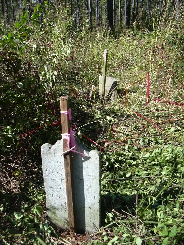
| Description | : | This cemetery is located about 500 feet off the south side of SR1007, Andrew's Mill Road, about 1.7 miles west oif the Washburn Store crossroads. It is on a high hill surrounded by large trees. It is also known as the "Carson-Cansler Cemetery" so it is assumed that members of the Carson family are also buried here. There is evidence of many graves in the cemetery but only one inscribed marker, John Cansler. John's wife, Barbara, had a legible marker at one time, but can no longer be read. It has been moved to the old Cansler/Carson home place. To... Read More |
frequently asked questions (FAQ):
-
Where is Cansler Cemetery?
Cansler Cemetery is located at Sunshine, Rutherford County ,North Carolina ,USA.
-
Cansler Cemetery cemetery's updated grave count on graveviews.com?
0 memorials
-
Where are the coordinates of the Cansler Cemetery?
Latitude: 35.4082600
Longitude: -81.8350400
Nearby Cemetories:
1. Robertson Creek Freewill Baptist Cemetery
Bostic, Rutherford County, USA
Coordinate: 35.3937840, -81.8465540
2. New Vernon Baptist Cemetery
Bostic, Rutherford County, USA
Coordinate: 35.3958320, -81.8497430
3. Hollifield Family Cemetery
Bostic, Rutherford County, USA
Coordinate: 35.4203956, -81.8117291
4. Wilson Baptist Cemetery
Forest City, Rutherford County, USA
Coordinate: 35.4257164, -81.8531723
5. Mount Lebanon Cemetery
Rutherford County, USA
Coordinate: 35.4319000, -81.8414001
6. Duggar Freeman Cemetery
Rutherford County, USA
Coordinate: 35.4247780, -81.8585810
7. Mountain View Baptist Church Cemetery
Bostic, Rutherford County, USA
Coordinate: 35.4227630, -81.8080460
8. Sunshine United Methodist Church Cemetery
Bostic, Rutherford County, USA
Coordinate: 35.4286930, -81.8132680
9. Salem United Methodist Church Cemetery
Washburn, Rutherford County, USA
Coordinate: 35.4000015, -81.7985992
10. Cherry Mountain Freewill Baptist Cemetery
Washburn, Rutherford County, USA
Coordinate: 35.3929060, -81.7902790
11. Green-Davis-Melton Cemetery
Rutherford County, USA
Coordinate: 35.3782930, -81.7928500
12. Smith Grove Baptist Cemetery
Forest City, Rutherford County, USA
Coordinate: 35.3740660, -81.8730180
13. Cedar Grove United Methodist Church Cemetery
Rutherford County, USA
Coordinate: 35.4506110, -81.8097540
14. Sandy Level Baptist Cemetery
Bostic, Rutherford County, USA
Coordinate: 35.4591400, -81.8520440
15. Walls Baptist Church Cemetery
Bostic, Rutherford County, USA
Coordinate: 35.3843141, -81.7757392
16. Wells Family Cemetery
Bostic, Rutherford County, USA
Coordinate: 35.3832400, -81.7757300
17. Mount Vernon Baptist Church Cemetery
Forest City, Rutherford County, USA
Coordinate: 35.4114270, -81.9060870
18. Mount Harmony Baptist Church Cemetery
Bostic, Rutherford County, USA
Coordinate: 35.4588380, -81.7996940
19. Bostic Baptist Cemetery
Bostic, Rutherford County, USA
Coordinate: 35.3489370, -81.8371580
20. Corinth Baptist Church Cemetery
Ellenboro, Rutherford County, USA
Coordinate: 35.3563900, -81.7971670
21. Ross Hill Baptist Church Cemetery
Bostic, Rutherford County, USA
Coordinate: 35.4575280, -81.7922220
22. Concord Baptist Church Cemetery
Bostic, Rutherford County, USA
Coordinate: 35.3482000, -81.8227690
23. Brittain Cemetery
Rutherfordton, Rutherford County, USA
Coordinate: 35.4530983, -81.8861008
24. Mount Hebron United Methodist Church Cemetery
Forest City, Rutherford County, USA
Coordinate: 35.4128070, -81.9121850