
| Memorials | : | 0 |
| Location | : | Montgomery, Montgomery County, USA |
| Coordinate | : | 32.1411560, -86.1782800 |
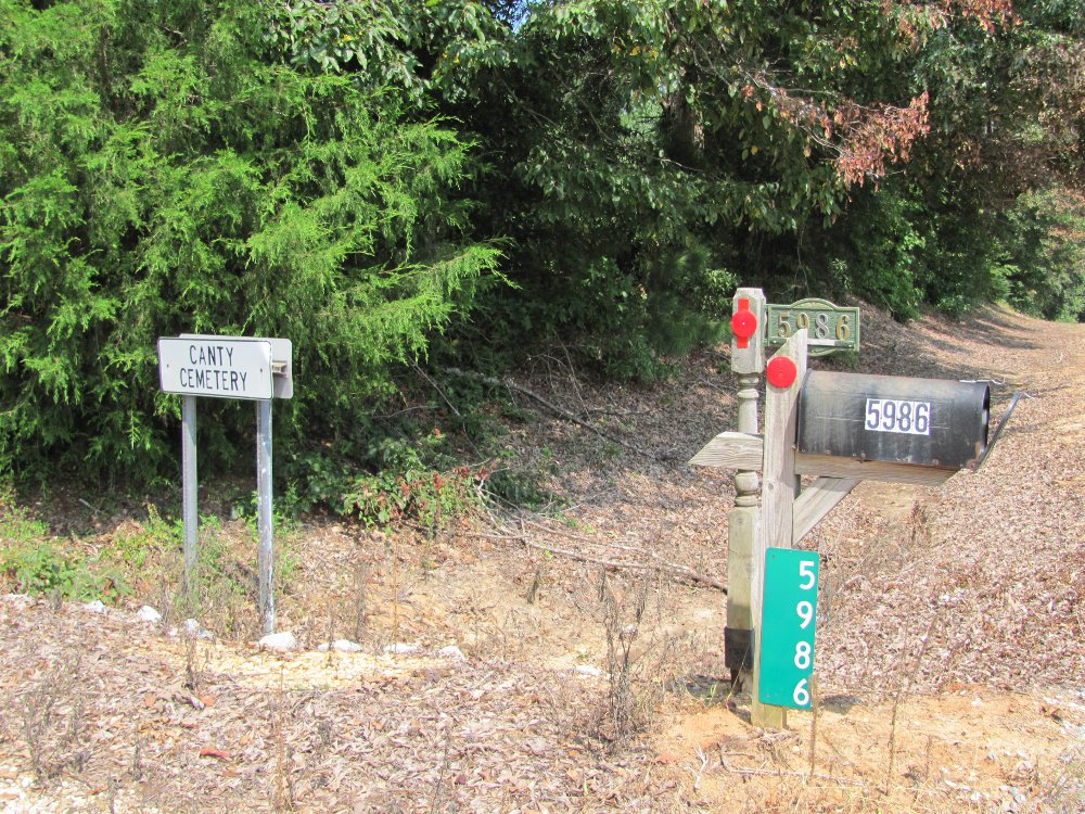
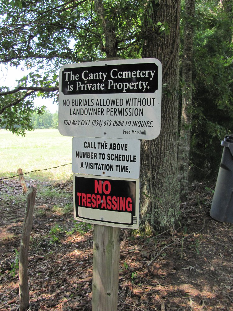
| Description | : | Cantey Cemetery is located on the Mt. Zion Road 14.7 miles south of the southern bypass Montgomery, AL. From the southern bypass go south on Woodley Road 12 miles to a fork. Bear right on Mt. Zion Road. Cantey cemetery is on the right, behind the house at 5986 Mt. Zion Road. It is well maintained and surrounded by woods. The cemetery was in front of the Cantey home. |
frequently asked questions (FAQ):
-
Where is Canty Cemetery?
Canty Cemetery is located at Montgomery, Montgomery County ,Alabama ,USA.
-
Canty Cemetery cemetery's updated grave count on graveviews.com?
0 memorials
-
Where are the coordinates of the Canty Cemetery?
Latitude: 32.1411560
Longitude: -86.1782800
Nearby Cemetories:
1. Orme Cemetery
Montgomery County, USA
Coordinate: 32.1267014, -86.1917038
2. Mount Zion Baptist Cemetery
Ramer, Montgomery County, USA
Coordinate: 32.1702110, -86.1757950
3. Mount Zion Road Cemetery
Ramer, Montgomery County, USA
Coordinate: 32.1704880, -86.1773560
4. Bethany Cemetery
Lowndes County, USA
Coordinate: 32.1721992, -86.1652985
5. New Providence Missionary Baptist Church Cemetery
Ramer, Montgomery County, USA
Coordinate: 32.1482400, -86.1394000
6. Calvary Baptist Church Cemetery
Montgomery, Montgomery County, USA
Coordinate: 32.1585000, -86.2169300
7. Chesser Cemetery
Montgomery County, USA
Coordinate: 32.1035995, -86.1947021
8. Pilgrim Missionary Baptist Church Cemetery
Ramer, Montgomery County, USA
Coordinate: 32.1127500, -86.1342000
9. Elizabeth Cemetery
Ramer, Montgomery County, USA
Coordinate: 32.0928020, -86.1555570
10. Underwood Cemetery
Montgomery County, USA
Coordinate: 32.1488991, -86.2455978
11. Norman Urquhart Cemetery
Ramer, Montgomery County, USA
Coordinate: 32.1003350, -86.1275550
12. Jackson Cemetery
Montgomery County, USA
Coordinate: 32.1300011, -86.2474976
13. Elizabeth Missionary Baptist Church Cemetery
Mathews, Montgomery County, USA
Coordinate: 32.1464630, -86.1001640
14. Hickory Chapel Cemetery
Ramer, Montgomery County, USA
Coordinate: 32.0793210, -86.1441730
15. Jericho Cemetery
Snowdoun, Montgomery County, USA
Coordinate: 32.1885910, -86.2422700
16. Carter Hill Cemetery
Montgomery, Montgomery County, USA
Coordinate: 32.1926350, -86.1151910
17. Sprague Cemetery
Montgomery County, USA
Coordinate: 32.1293983, -86.2743988
18. Bell Cemetery
Montgomery County, USA
Coordinate: 32.1032982, -86.2771988
19. Weeping Mary Cemetery
Ramer, Montgomery County, USA
Coordinate: 32.0514440, -86.2123780
20. Ramer Cemetery
Ramer, Montgomery County, USA
Coordinate: 32.0524260, -86.2186410
21. Frazer-McLeod Cemetery
Pine Level, Montgomery County, USA
Coordinate: 32.0714560, -86.0959480
22. Spring Hill Baptist Church Cemetery
Montgomery County, USA
Coordinate: 32.0787810, -86.0869330
23. Sand Creek Cemetery
Montgomery County, USA
Coordinate: 32.1122500, -86.0656180
24. Sharpe Cemetery
Snowdoun, Montgomery County, USA
Coordinate: 32.1591988, -86.2956009