
| Memorials | : | 0 |
| Location | : | Montgomery County, USA |
| Coordinate | : | 32.1122500, -86.0656180 |
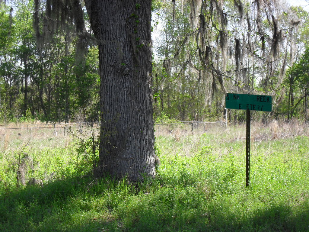
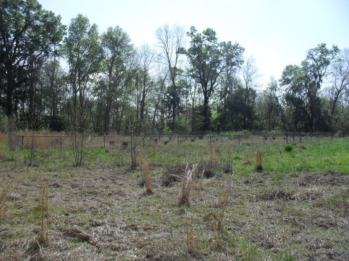
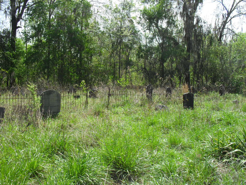
| Description | : | This cemetery is very old and located off of Barnes Road right behind Sandy Creek Flea Market. When you turn onto the road, keep straight. The cemetery is in a clearing no more than a hundred feet on the left hand side. There are at least 25 and possibly more graves that are unmarked and illegible. The Montgomery County Department of Transportation shows only Sandy Creek Cemetery on this road which dead ends. It is my conclusion based on the GPS coordinates that this cemetery and Possum Trot are the same and at some point people began... Read More |
frequently asked questions (FAQ):
-
Where is Sand Creek Cemetery?
Sand Creek Cemetery is located at Montgomery County ,Alabama , 36069USA.
-
Sand Creek Cemetery cemetery's updated grave count on graveviews.com?
0 memorials
-
Where are the coordinates of the Sand Creek Cemetery?
Latitude: 32.1122500
Longitude: -86.0656180
Nearby Cemetories:
1. Warrior Hill Baptist Church Cemetery
Pine Level, Montgomery County, USA
Coordinate: 32.0778660, -86.0624530
2. Spring Hill Baptist Church Cemetery
Montgomery County, USA
Coordinate: 32.0787810, -86.0869330
3. Pine Level United Methodist Church Cemetery
Pine Level, Montgomery County, USA
Coordinate: 32.0706558, -86.0571442
4. Elizabeth Missionary Baptist Church Cemetery
Mathews, Montgomery County, USA
Coordinate: 32.1464630, -86.1001640
5. Pine Level Baptist Church Cemetery
Pine Level, Montgomery County, USA
Coordinate: 32.0663757, -86.0613251
6. Mount Zion AME Church Cemetery
Pine Level, Montgomery County, USA
Coordinate: 32.0660460, -86.0543472
7. Frazer-McLeod Cemetery
Pine Level, Montgomery County, USA
Coordinate: 32.0714560, -86.0959480
8. Briar Hill Baptist Church Cemetery
Mathews, Montgomery County, USA
Coordinate: 32.1655900, -86.0595300
9. Norman Urquhart Cemetery
Ramer, Montgomery County, USA
Coordinate: 32.1003350, -86.1275550
10. Pilgrim Missionary Baptist Church Cemetery
Ramer, Montgomery County, USA
Coordinate: 32.1127500, -86.1342000
11. Bethesda Cemetery
Montgomery County, USA
Coordinate: 32.0792007, -85.9991989
12. New Providence Missionary Baptist Church Cemetery
Ramer, Montgomery County, USA
Coordinate: 32.1482400, -86.1394000
13. Hickory Chapel Cemetery
Ramer, Montgomery County, USA
Coordinate: 32.0793210, -86.1441730
14. Elizabeth Cemetery
Ramer, Montgomery County, USA
Coordinate: 32.0928020, -86.1555570
15. Edwards Cemetery
Union Springs, Bullock County, USA
Coordinate: 32.0744000, -85.9792000
16. Old Salem Cemetery
Bullock County, USA
Coordinate: 32.0611000, -85.9793000
17. Old Mount Pleasant Missionary Baptist Church Cemet
Pine Level, Montgomery County, USA
Coordinate: 32.0265800, -86.0313800
18. Carter Hill Cemetery
Montgomery, Montgomery County, USA
Coordinate: 32.1926350, -86.1151910
19. Hills Chapel Cemetery
Grady, Montgomery County, USA
Coordinate: 32.0349998, -86.1268997
20. Old Hopewell Church Cemetery
Fitzpatrick, Bullock County, USA
Coordinate: 32.1703410, -85.9787040
21. Seek and Follow AME Zion Church Cemetery
Grady, Montgomery County, USA
Coordinate: 32.0336960, -86.1268190
22. Community Baptist Church Cemetery
Montgomery County, USA
Coordinate: 32.0189020, -86.0799020
23. Panhandle Cemetery
Montgomery County, USA
Coordinate: 32.2075005, -86.0492020
24. Bozeman - Hill Cemetery
Montgomery County, USA
Coordinate: 32.0318910, -86.1286730